|
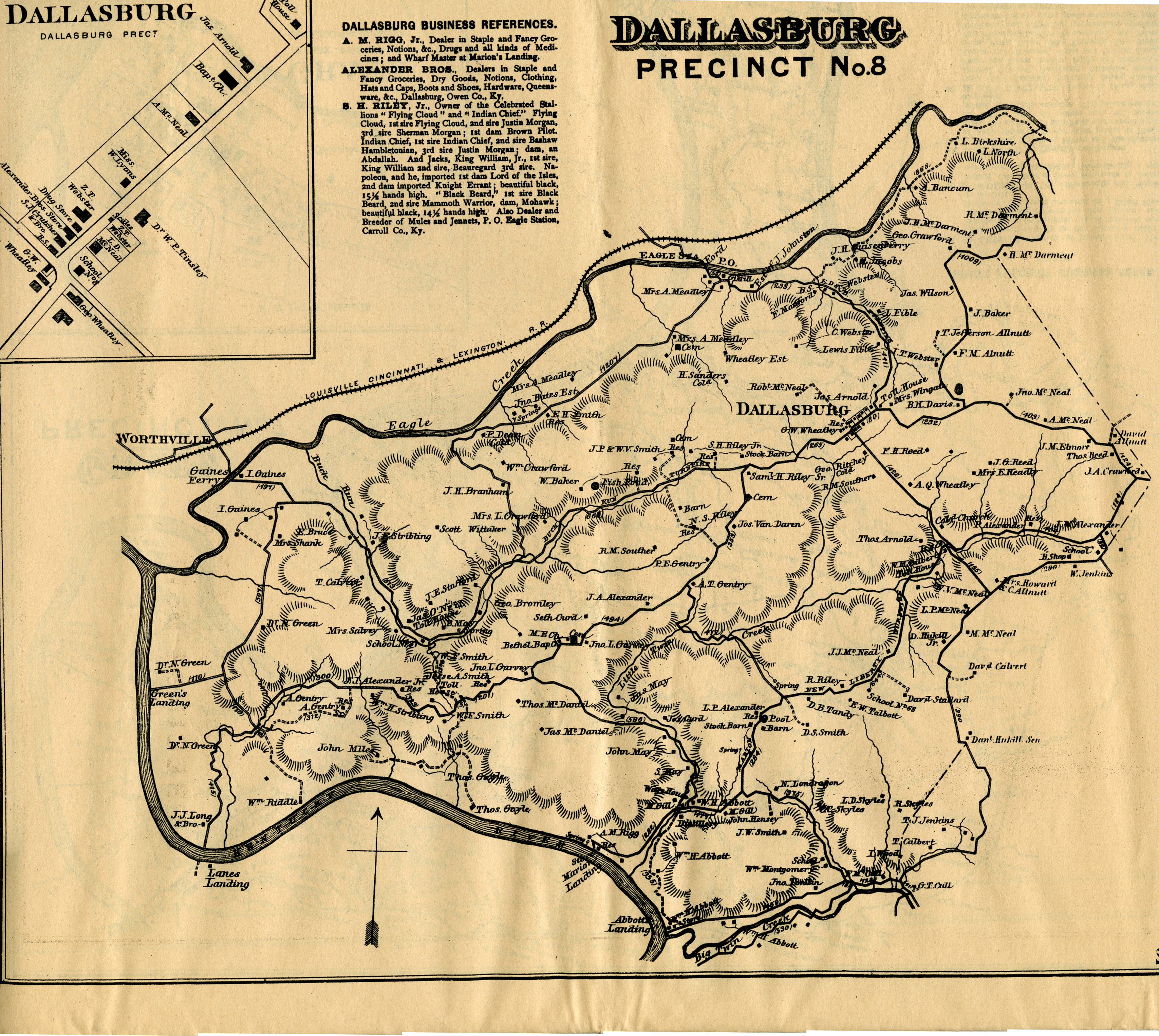
Map of
Dallasburg from the 1883 Atlas. Contributed By: Ernie and
Georgia Stamper
1883
J. D. Lake Maps of Carroll County
US
Atlas, Carroll County - 1895 map
Historic
Panoramic Maps
Carroll County Zip Codes
CARROLLTON 41008

CARROLLTON 41045
EAGLE STATION 41083
ENGLISH 41008
GHENT 41045
PRESTONVILLE 41008
SANDERS 41083
WORTHVILLE 41098
Kentucky Genealogy Resources:
 Kentucky Historical Society
Filson Club Historical Society in Louisville
The Kentucky Museum
Kentucky Historical Maps
Origin of Kentucky County Names
Geographic Names from Geological Survey Topo Maps
Electronic Guide to Kentucky Place Names
Kentucky Atlas and Gazetteer: Maps, History, General Information
Kentucky Highway Historical Markers
Kentucky Civil War Battles
Map of Kentucky Civil War Battles
RootsWeb: Kentucky Military Records
RootsWeb: Kentucky Revolutionary War Info
History of Ships Named Kentucky
Kentucky Genealogical Society
Kentucky Census Records Online
Vital Statistics (Records of Kentucky Deaths, Marriages and Divorces)
What's a Kentucky Colonel?
Kentucky's State Symbols
University of Louisville
University of Kentucky
Carroll
County Migrations
Cyndi's
List
|

