The Hanshaw Trail
The West Trail

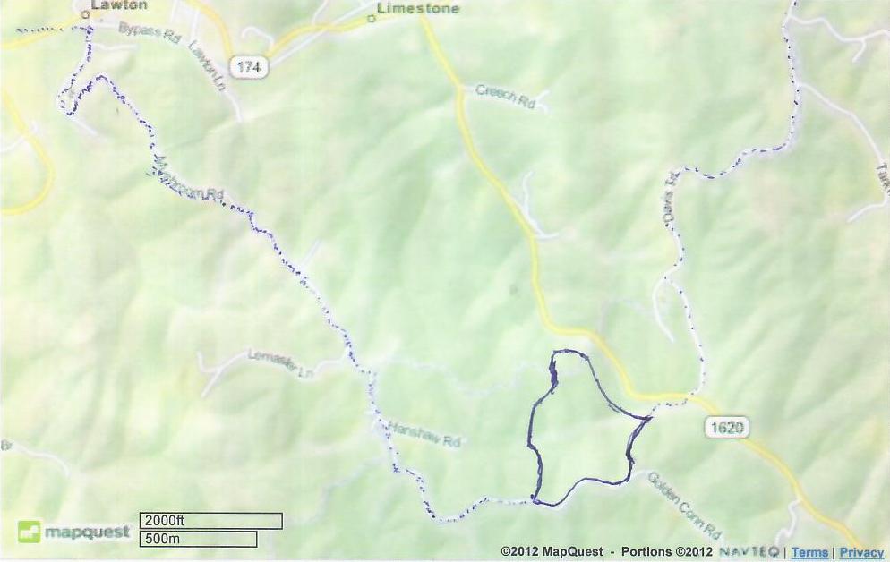
This map shows the locaton of the Hanshaw property relative to Lawton and Limestone.
Access to the property is a branch off the existing Tick Ridge Trail, down a partially paved road named Davis Trail to Rt. 1620.
The trail follows Rt 1620 northwest for about 150 feet, and then it follows an unpaved private road for about 200 feet until it enters
the actual Hanshaw property. No part of the Hanshaw property fronts directly on Rt 1620. The total property area is about 100 acres.
Western egress from the Hanshaw property is onto Hanshaw Rd. (unpaved). Hanshaw Rd. eventually becomes Mushroon Rd. (paved) which ends
at Rt 174 in Lawton, next to the old Raybourn Store. Just before it intersects with Rt 174, Mushroom Rd. crosses the bed of the
old C&O railroad right of way.

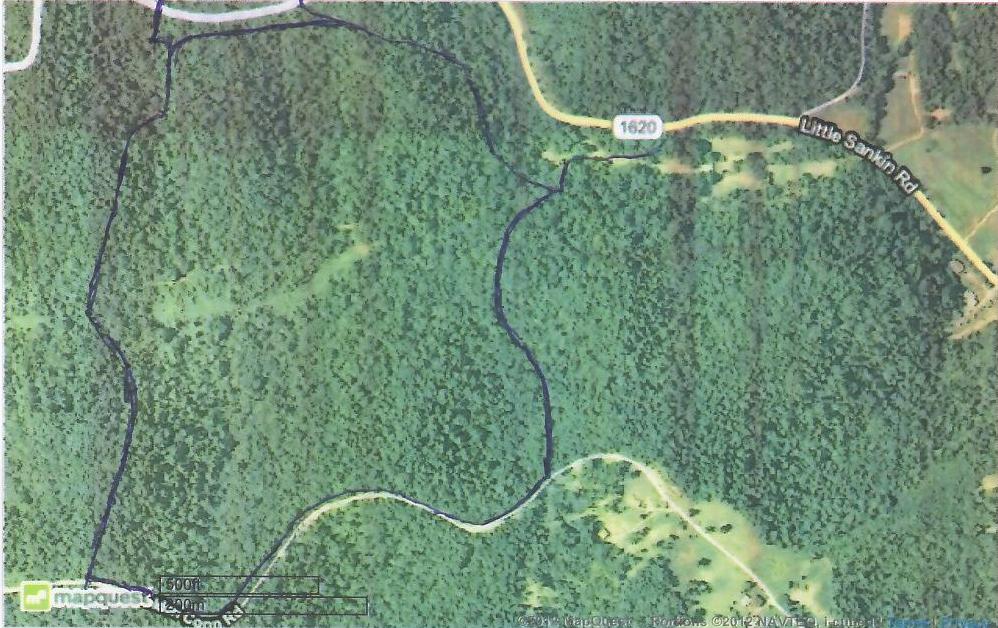
This is an aerial photo of the Hanshaw property area.

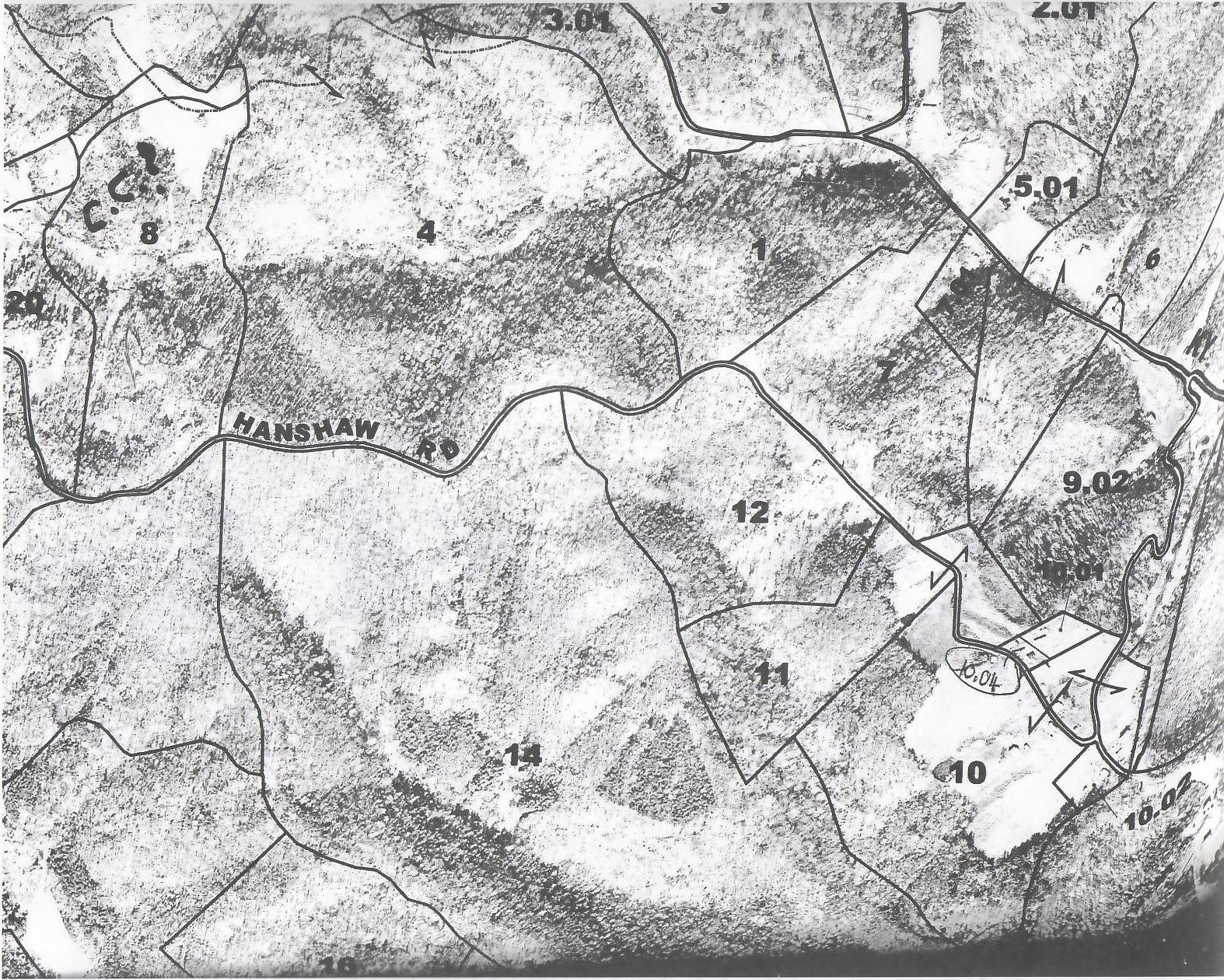
This is the PVA map for the Hanshaw property (parcel "4"). The dotted line indicates that the northermost portion of the property is in Carter County,
while the bulk of it is in Elliott County.
Davis Trail Rd. is the "hockey stick" in the upper right corner which intersects with Rt. 1620. Rt 1620 has moderate traffic (about like Ben's Run Rd.).
The squigly line just west of the Davis Trail Rd./Rt 1620 intersection approximates the route of the private access road to the Hanshaw property.
There are a number of homes on a continuation of Hanshaw Rd. named Golden Conn Rd. near its intersection with Rt. 1620 (on the extreme right).
There are very few residences in the immediate area of the Hanshaw property.

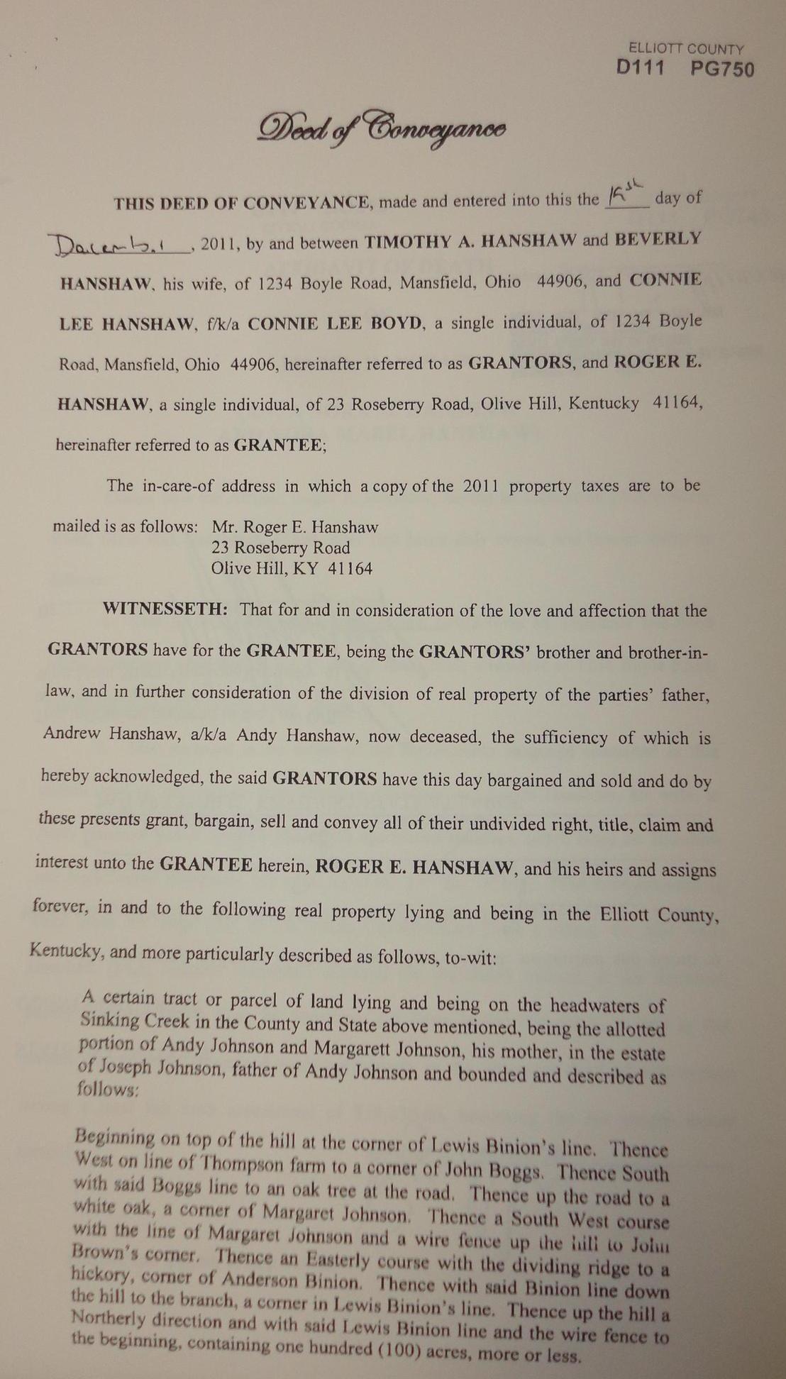
First page of the deed to the Hanshaw property
Coming from Olive Hill, the existing trail turns left here on its way to the Tark Hill area.
This intersection is the starting point of the Hanshaw Trail.
This is about 1.8 miles from the Olive Hill Depot.