The Hanshaw Trails
The Southeast Trail

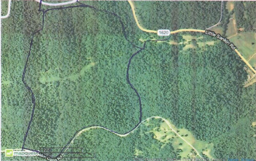
This is an aerial photo of the Hanshaw property area.
The Southeast Trail runs along the Southeastern quadrant of the Hanshaw property.
I will be adding it to this map shortly.
Looking south on Hanshaw Rd. at the entrance to the Southeast trail
The Southeast trail is marked by double blue tape ribbons on trees on the right of the trail
The upper portion of the Southeast trail descends at a gentle slope through a moderately timbered area of the property.
At this point the Southeast trail makes a turn to the right. Look for the blue tape markings on the right.
This is where the Southeast trail makes its steepest descent. This is a VERY hazardous gradient and should only be attempted
by a very experienced rider and horse.
I did clear a path past the obstruction, so it is much more open than it appears in the photo.
Passage is between the log on the left and the branches on the right.
Once you have completed the descent, the trail becomes a "walk in the park", and very pleasant.
This is the lower end of the Southeast trail. It intersects with the East trail at the foot of that trail's steepest grade.
It's difficult to see in this photo, but there is a single blue tape ribbon with a double blue tape ribbon below it
on the tree straight ahead. Again, the East trail in marked with single blue ribbons, while the
Southeast trail is marked with double blue tape ribbons.