
						                                         240

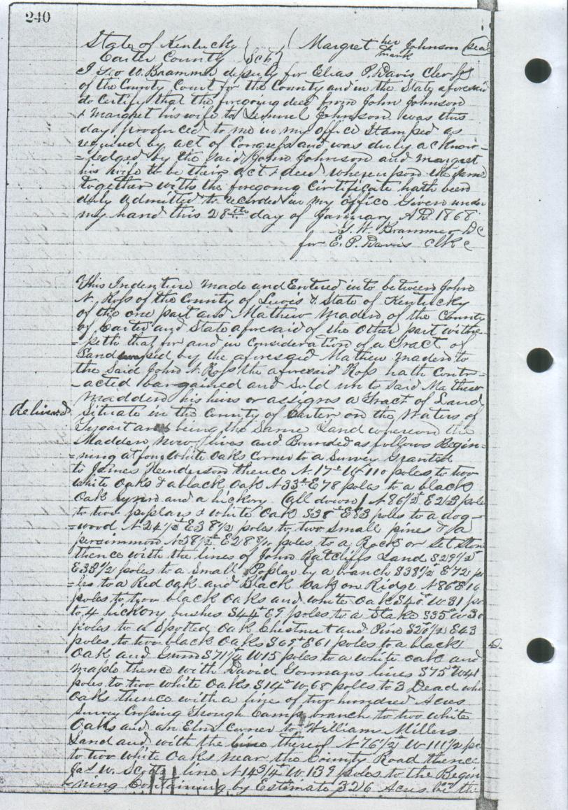
This indenture made and entered into between John N. Ross of the County of Lewis
& State of Kentucky of the one part and Matthew Maden of the County of Carter and
State aforesaid of the other part witnesseth that for and in consideration of a tract
of land ???ed by the aforesaid Mathew Maden to the said John N. Ross, the aforesaid Ross
hath contracted, bargained and sold unto said Mathew Madden, his heirs or assigns a
tract of land situated in the County of Carter on the waters of Tygart and being the
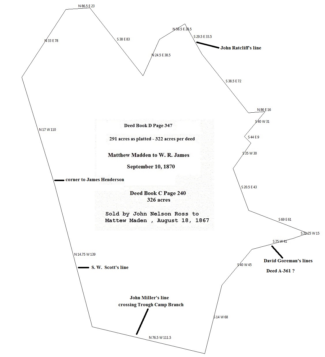
same land whereon the Madden now lives and bounded as follows: Beginning at four white
oaks corner to a survey granted to James Henderson, thence N 17 W 110 poles to two white
oaks & a black oak N 33 E 78 poles to a black oak ???? and a hickory (all down)
N 86 1/2 E 23 poles to two poplars & white oak S 38 E 83 poles to a dogwood
N 24 1/2 E 38 1/2 poles to two small pines & a persimmon N 58 1/2 E 28 8/16 poles to a
rock or set stone(?) thence with the lines of John Ratcliffs land S 29 1/2 E 33 1/2
poles to a small poplar by a branch, S 38 1/2 E 72 poles to a red oak and black oak on
ridge, N 86 E 16 poles to two black oaks and white oak, S 20? E 43 poles to two black oaks
S 69 E 61 poles to a black oak and gum, S 71 1/4 W 15 poles to a white oak and maple thence
with David Gorman's lines S 75 W 41 poles to two white oaks S 14 W 68 poles to 3 dead white
oaks, thence with a line of two hundred acres survey crossing Trough Camp Branch to two white
oaks and an elm corner to William Millers land and with the lines thereof N 76 1/2 W 111 1/2
poles to two white oaks near the County Road, thence S. W. Scotts lines N 14 3/4 W 139 poles
to the begining, by estimate 326 acres ?? the
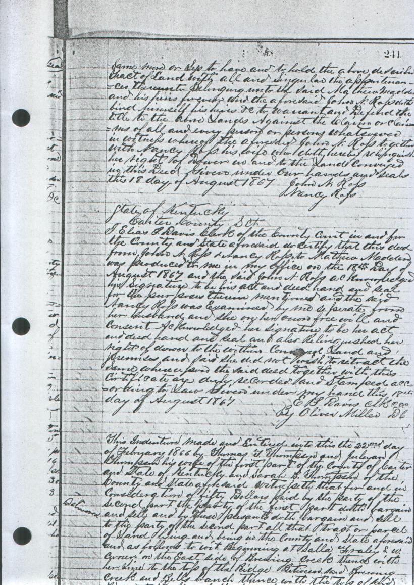
The ambiguous call "thense with the line of 200 acres cross through Camp Branch to 2 white oaks
and an elm corner corner to William Miller's land" was interpolated to be a call of "S 40 W 45 poles".
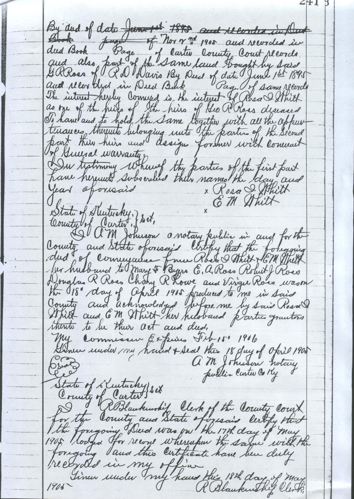
241 same ??? or sess(?) to have and to hold the above described tract of land with all and singular appurtenances therunto belonging unto the said Mathew Madden and his heirs forever, and the aforesaid John N. Ross doth bind himself, his heirs & to warrant and defend the title to the above lands against the claim or claims of all and every person or persons whatsoever in witness thereof the aforesaid John N. Ross together with Nancy Ross, his wife, who doth hereby relinquishes her right of dower in and to the lands conveyed in this deed, given under our hands and seals this 18 day of August 1867. John N. Ross Nancy Ross State of Kentucky Carter County I, Elias P. Davis, Clerk of the County Court in and for the County and State aforesaid do certify that this deed from John N. Ross & Nancy Ross to Mathew Madden was produced to me in my office on the 18th day of August 1867 and the said John N. Ross acknowledged his signature to be his act and deed hand and seal for the purpose herein mentoned and the said Nancy Ross was examined by me seperate from her husband and she on her own free will and consent acknowledged her signature to be her act and deed hand and seal and also relinquished her right of dower to the within conveyed land and premises and said she did not wish to retract the same ????? the said deed together with this certificate are duly recorded and stamped according to law, given under my hand this 18th day of August 1867. E. P. Davis, Clk By Oliver Miller, DCThe western boundary call of "N 17 W 110" corresponds to that same call in Deed Book B Page 283.
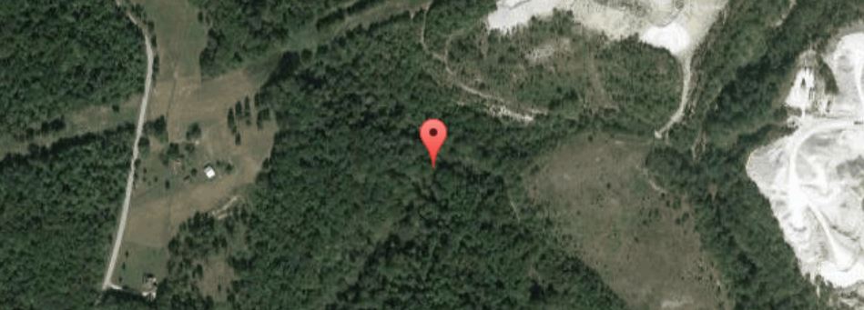
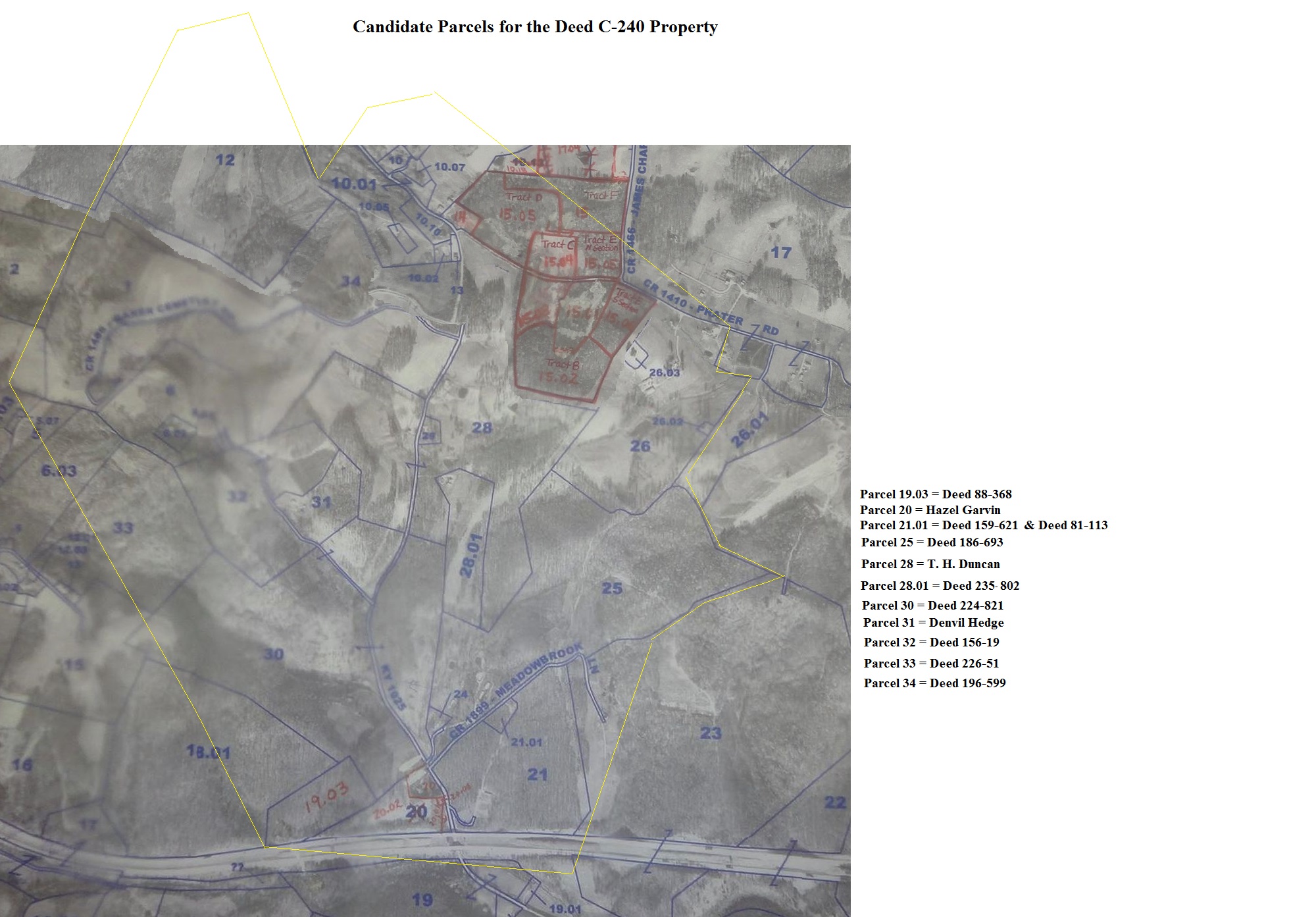
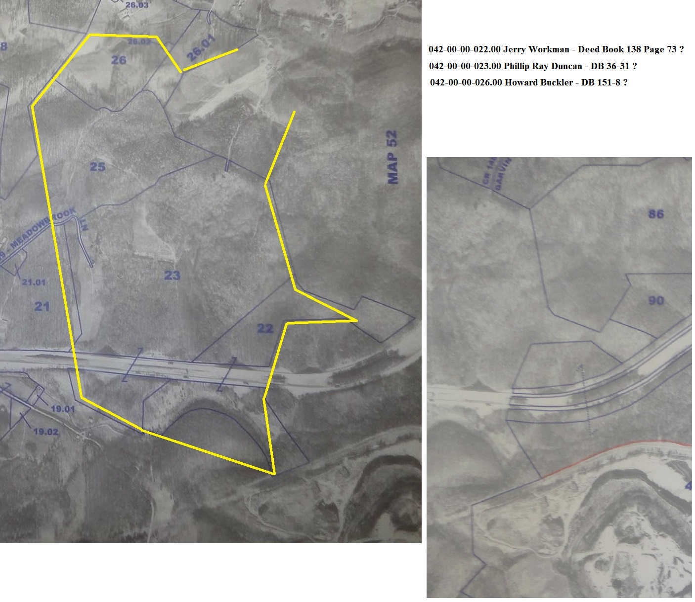
The location of Trough Camp Branch, below Interstate 64, north of Rt 60, East of West Carter Dr. near Olive Hill
