
										Page 128

				Record of Commissioner's Deeds

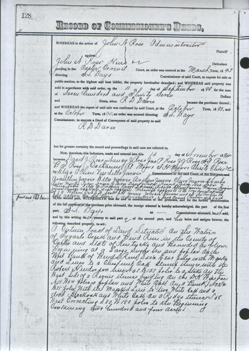
Whereas in the action of John N. Ross Administrator

John N. Ross heirs  or defendant
Pending in the Carter Circuit Court an order was entered at the March term 1893
directing S. L. Bays Commissioner of said Court, to expose for sale at public
auction, to the highest bidder, the property hereinafter described; and WHEREAS
said property was sold in accordance with said order on the 11 day of September
1893 for the sum of Seven Hundred and Thirty Seven dollars and 0 cents, when
R. D. Davis became the purchaser thereof;  ane WHEREAS the report of said sale
was confirmed by said court at the October term, 1893, and at the October term,
1894, an order was entered directing S. L. Bays Commissioner, to execute a
Deed of Conveyance of said property to said R. D. Davis but for greater certainty
the record and proceedings in said case are referred to.

Now, therefore this indenture made and entered into this 14 day of November 1894
between David J. Ross, Nancy J. Ross, John P. Ross, J. J. Ross, A. J. Ross, B. J. Ross,
Catherine A. Moore, I. H. Moore, Alice W. Cline, Elza A. Cline, Vandilla Jarvis,
Amellions Jarvis, Ettta Jarvis, Arthur Jarvis, Clara Jarvis, Charles Tabor, Martin Tabor,
Nancy J. Tabor,  David J. Tabor, Frank Tabor,  George Tabor, Berry Tabor,
Lillie W. Armane(?),  David J. Foreman(?),  Roberta Ellen Foreman, Marion Foreman(?),
James Thomas Applegate, Doris(?) Applegate, Nelson B. Applegate,  A. W. Kozee,
J. A. Watson Dec'd(?), J. W. Scott, S. B. Young, Jobien(?) Griverse(?),
and all the parties to said action by S. L. Bays Commissioner of said Court Parties
of the first part and R. D. Davis of the second part, WITNESSETH that for and in
consideration of the premises, and for the further consideration of the full payment
of the purchase price aforesaid, the receipt whereof is hereby acknowledged, the
part of the first part, S. L. Bays, as Commissioner aforesaid, has sold, and by
this writing does convey to said party of the second part, and to his heirs and
assigns forever, the following described property to-wit:

A  certain tract of land situated on the waters of Tygarts Creek and Ben's Run
in the County of Carter and State of Kentucky and bounded as follows:
Beginning at a large Sugar tree and poplar on the west bank of Ben's Run
S 40 1/2 E 240 poles with marks and lines to a chestnut oak stump thense with the
Robert Henderson line  N 65 E 125 poles to a stake on the the east side of a revine
thense  besiding(?) on the D. K. Wise tract N 15 W 54 poles to a poplar and a white oak
on a bank(?) N 33 1/2 E 35 poles   with the marked line to two white oaks and a dead
black oak on an ridge  thense S 68 West connecting S 80 W 180 poles to the beginning
containing two hundred and four acres.
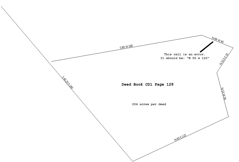
This deed has a number of issues. It is the same tract as Book H Page 20. However,
The call "S 40 E 240" on Book H Page 20 becomes "S 40.25 E 240 on this deed.
The call "N 60 E 125" on Book H Page 20 becomes "N 65 E 125" on this deed.
The call "N 15 W 50" on Book H Page 20 becomes "N 15 W 54" on this deed.
The call "N 50 W 122" on Book H Page 20 becomes "S 68 W ?" on this deed.


