
 											       619

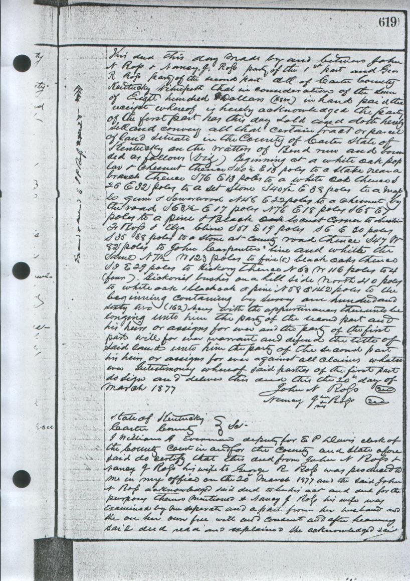
This deed this day made by and between John N. Ross & Nancy J. Ross party of
the 1st part and Geo. R. Ross party of the second part all of Carter County
Kentucky, witnesseth that in consideration of the sum of eight hundred dollars
($800) in hand paid the receipt of whereof is hereby acknowledged, the party of
the first part has this day sold and doth hereby sell and convey all that
certain tract or parcel of land situated in the County of Carter, State of
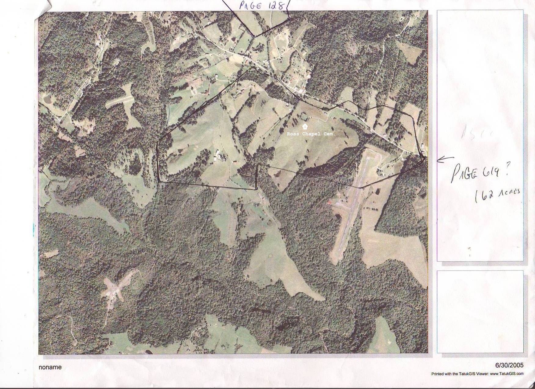
Kentucky on the waters of Ben's Run and bounded as follows, viz: Beginning at a
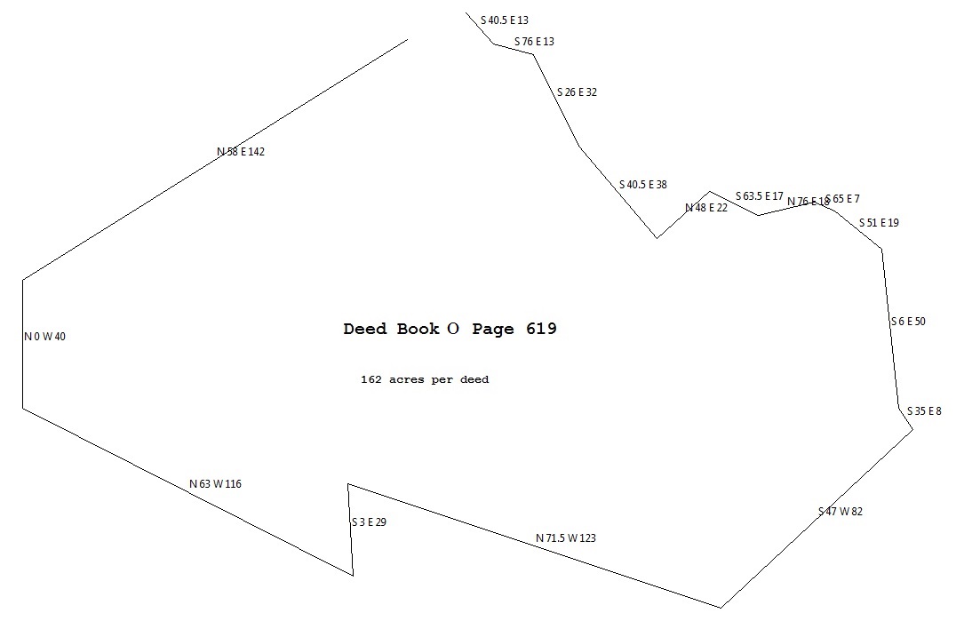
white oak poplar & chestnut, thence S 40 E 13 poles to a stake near a branch,
thence S 76 E 13 poles to a white oak, thence S 25 E 32 poles to a set stone,
S 40 1/2 E 38 poles maple, gum and sourwood N 48 E 22 poles to a chestnut by the
road S 63 1/2 e 17 poles N 76 E 18 poles S 65 E 7 poles to a pine & black locust
corner to Ruben F. Ross & Eliza Cline S 51 E 19 poles  S 6 E 50 poles  S 35 E 8
poles to a stone at county road, thence S 47 W 82 poles to John Carpenters line
and whith te same N 71 1/2 W 123 poles to five (5) black oaks, thence S 3 E 29
poles to hickory, thence N 63 W 116 poles to 4 (four) hickorie bushes on a hill
side north 40 poles to white oak & black oak & pine N 58 E 142 poles to the
beginning, containing by survey one hundred and sixty two (162) acres, with the
apputenances thereunto belonging unto him the party of the second part and his
heirs or assigns forever, and the party of the first part will forever warrant
and defend the title of said land unto him the party of the second part, his
heirs or assigns forever against all claims whatsoever, testimony whereof said
parties of the first part do sign and deliver this deed this the 20th day of
March 1877.

								John N. Ross   (seal)
  								Nancy J. Ross  (seal)
 								   (her mark)


      			(County Clerk's certification follows)

Note that the "S 6 E 50" call becomes "S 6 E 30" in Deed Book L Page 367!!!

