1753 John Patten Map
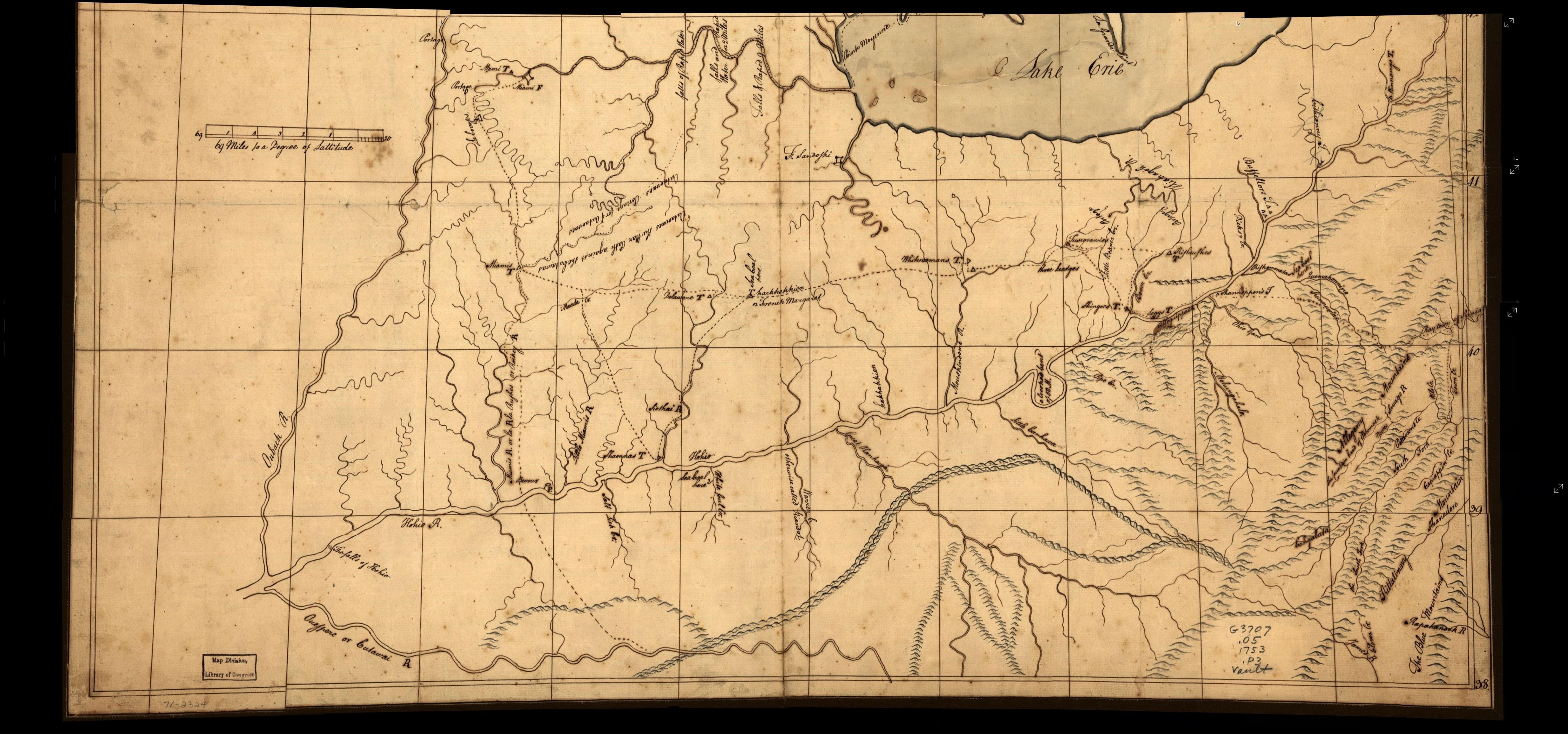
"A MAP OF THE OHIO COUNTRY" showing the places in Canada west of Niagara visited by John Patten during his
captivity by the French, 1750-1751. This is a manuscript map held by the Library of Congress and described
in Brown #16, who gives it this title. Patten was an Indian trader and one of the first to get to know the
Ohio country. His map covers the course of the Allegheny and Ohio Rivers from Pennsylvania into Indiana,
and has the first map note on "Sea Coal." This map is discussed in great detail by Eavenson"

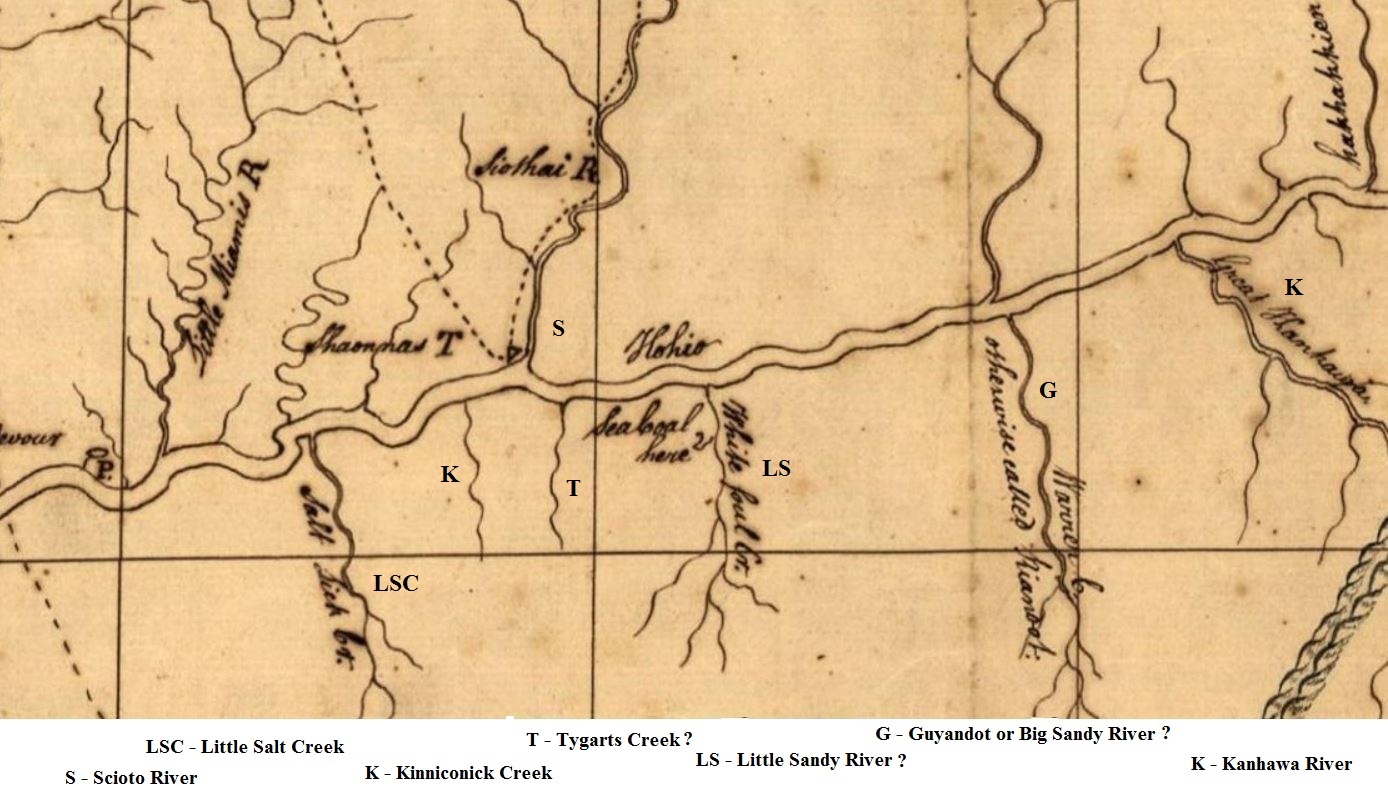
This is a blowup of the Carter County region of the main map below.
The broad wavy line is the Ohio River ("Hohio" on the map below).
The river labeled "Siothai R." is the Scioto River
From the pattern of the Ohio, I would guess that the unlabeled creeks to the right of the Scioto River
are the Little Sandy and the Big Sandy Rivers. The major river to their right appears to be the "Little Canhawa".
