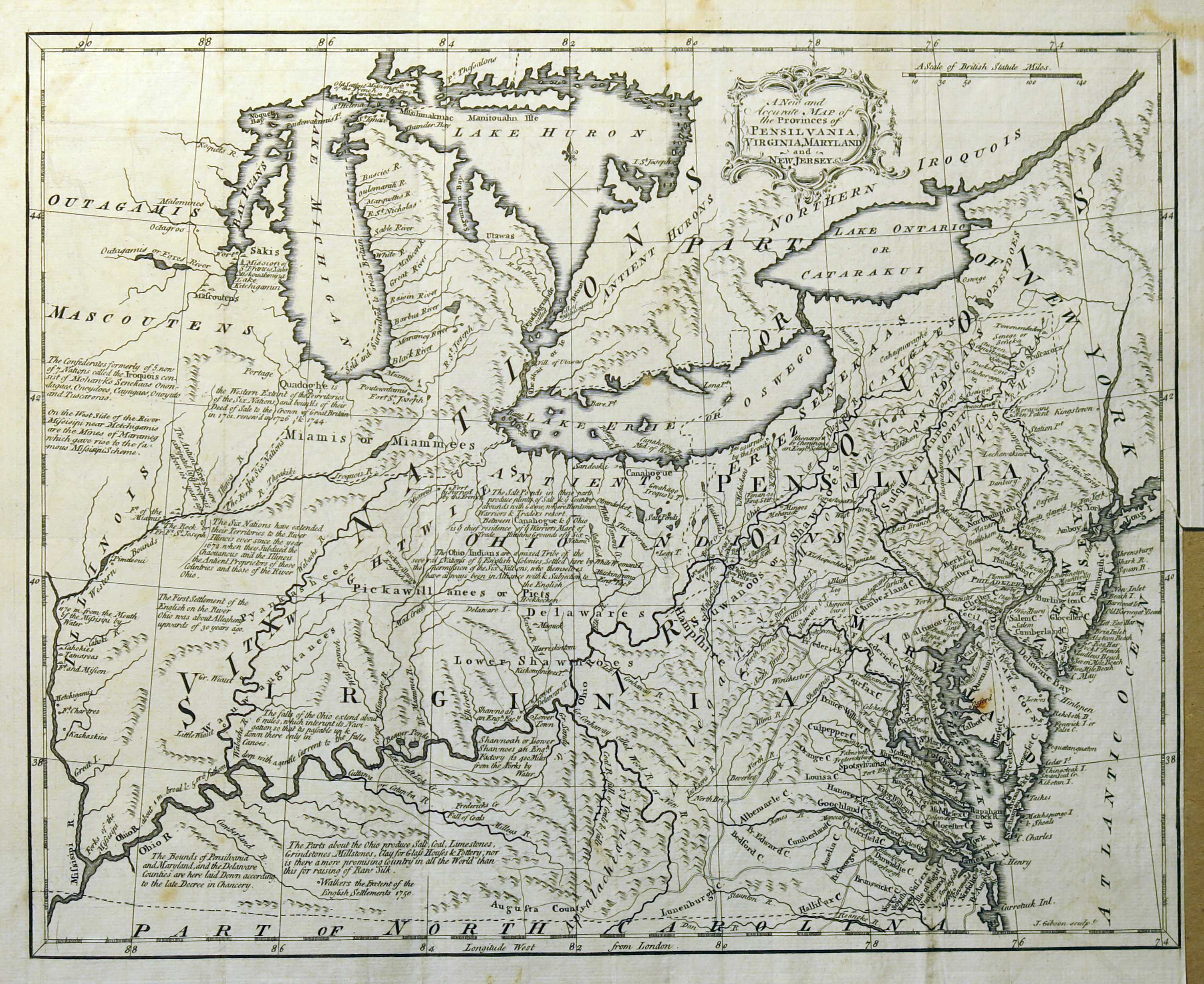
1762 J. Gibson map of "Pensilvania, Virginia, Maryland and New Jersey"

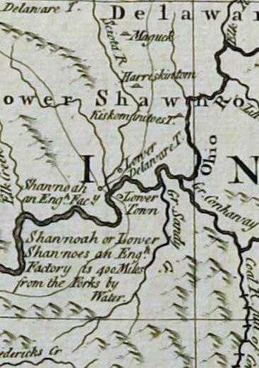
This is the area of Carter County from the full map below.
In the center of the image, the Scioto River flows south into the Ohio River.
To the right of their junction, "Gr. Sandy" is the Big Sandy River.
"Lower Delaware T." was later known as "Lower Shawnee Town", near the present location of Portsmouth, Ohio.
On the Kentucky side of the junction is "Lower Town". The curved line through "Lower Town" appears to be one of
the principle Native American trails linking central Ohio Country with the interior of Kentucky. My best guess is
that "Lower Town" was in the area of modern Garrison, Ky., and that the trail followed the "Nepernine"
(todays "Kinniconick Creek") upstream. Kinniconick is navigable by canoe for a good distance and flows through a relatively wide
flood plain that would have been an attractive trail route.
Just to the west of the juncture of the Scioto and the Ohio Rivers we see "Shannoah an Eng. Fac." marked.
On the 1784 John Filson map, this site is marked as "Old Shawne Town". On the 1812 Melish map, the community
of Alexandria is located on this site. Alexandria was located directly on the Ohio River and suffered from
frequent flooding, a generally unhealthy climate and never amounted to much. Its site was eventually
inundated by the Ohio when locks and dams were installed in the modern era to deepen the Ohio River
and make the river navigable for large vessels.
Referencing the lower portion of the map below.....
The mapping of the upper reaches of the "Gr. Sandy" and the "Low. Salt Lick Cr." to its west look somewhat improvised.
The map seems to combine the upper portion (southern) of Tygarts Creek with the lower portion (northern) of
the Big Sandy. "Low. Salt Link Cr." is obviously the Licking River. The headwaters of Tygarts Creek and
a main tributary of the Licking River (Triplett Creek) come within a few hundred yards of each other in
western Carter County. The Big Sandy is 25 miles further east, and flows from the south,
rather than from the west southwest as depicted on this map.
Triplett Creek is probably the watercourse labeled "Fredericks Cr." on this map
