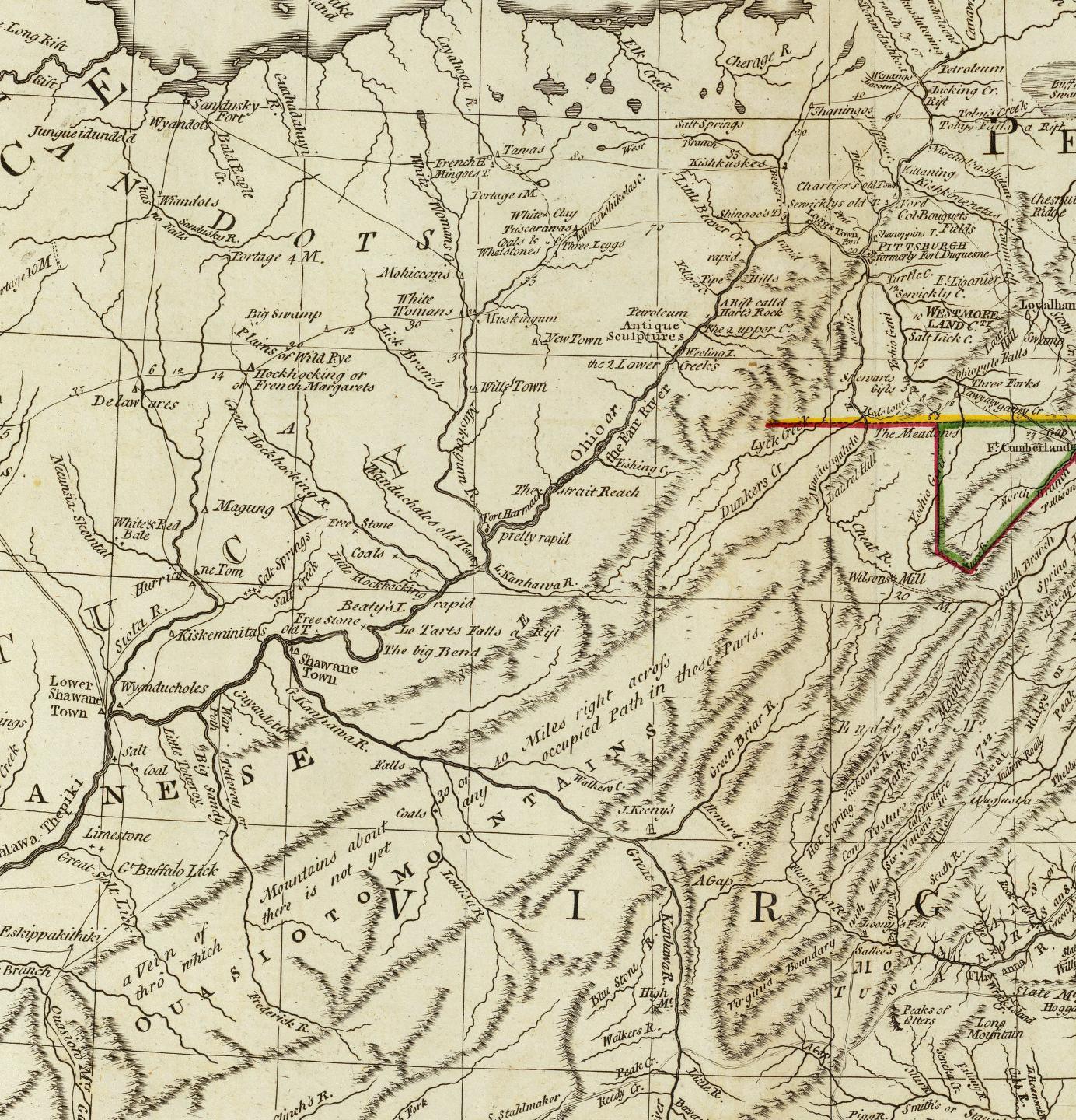
1794 Robert Laurie Map
A really superior map for its day

This is a sub-section of the full map.
Notable Features
The Little Sandy River is idntified as "The Little Totteray" (Tygarts Creek remained un-named)
"Lower Shawne Town" was a long noted community, but this map also features a village on the site of modern day Portsmouth: "Wyanducholes"
The map maker comments that there is "no occupied path through the "Ouasioto" (Appalachian) Mountains,
although this only appeared so to the white frontiersmen. Native Americans knew their way through these hills
far better than the typical Englishman knew his way from London to Edinburgh. On this map, what came to be known
as the Warriors Path is shown passing through the mountains of Kentucky and crossing the Ohio River near the Scioto River.
This is no doubt a very generalized routing of the actual trail, which more probably passed through the site
of present day Vanceburg Kentucky and ran up the Ohio River valley before crossing to follow the Scioto River northward.
The Licking River is identified as "The Great Salt Lick"
Southwest of the Great Salt Lick, the Native American cultural and economic center of Eskippakithika is shown as a trail crossroads. Sadly, today its site is little noted and will soon become over-run with commercial and residential development as metro Lexington advances toward it.
The village of "Kiskeminitas" on the east bank of the Scioto River is often noted on maps of this era.
The "Shawane Town" southeast of the point where the "Greater Kanhawah River" joins the Ohio River is found on few maps.