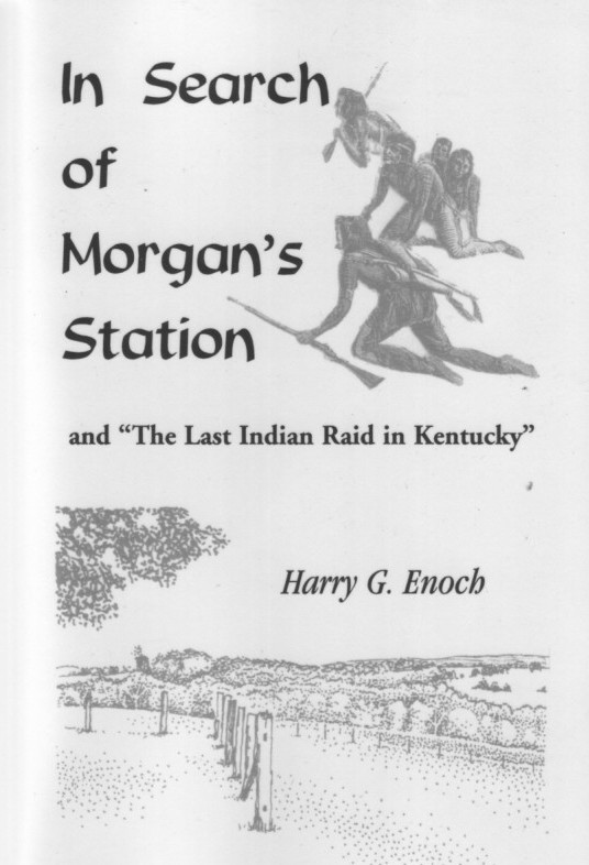
"In Search of Morgan's Station"
and the Last Indian Raid in Kentucky
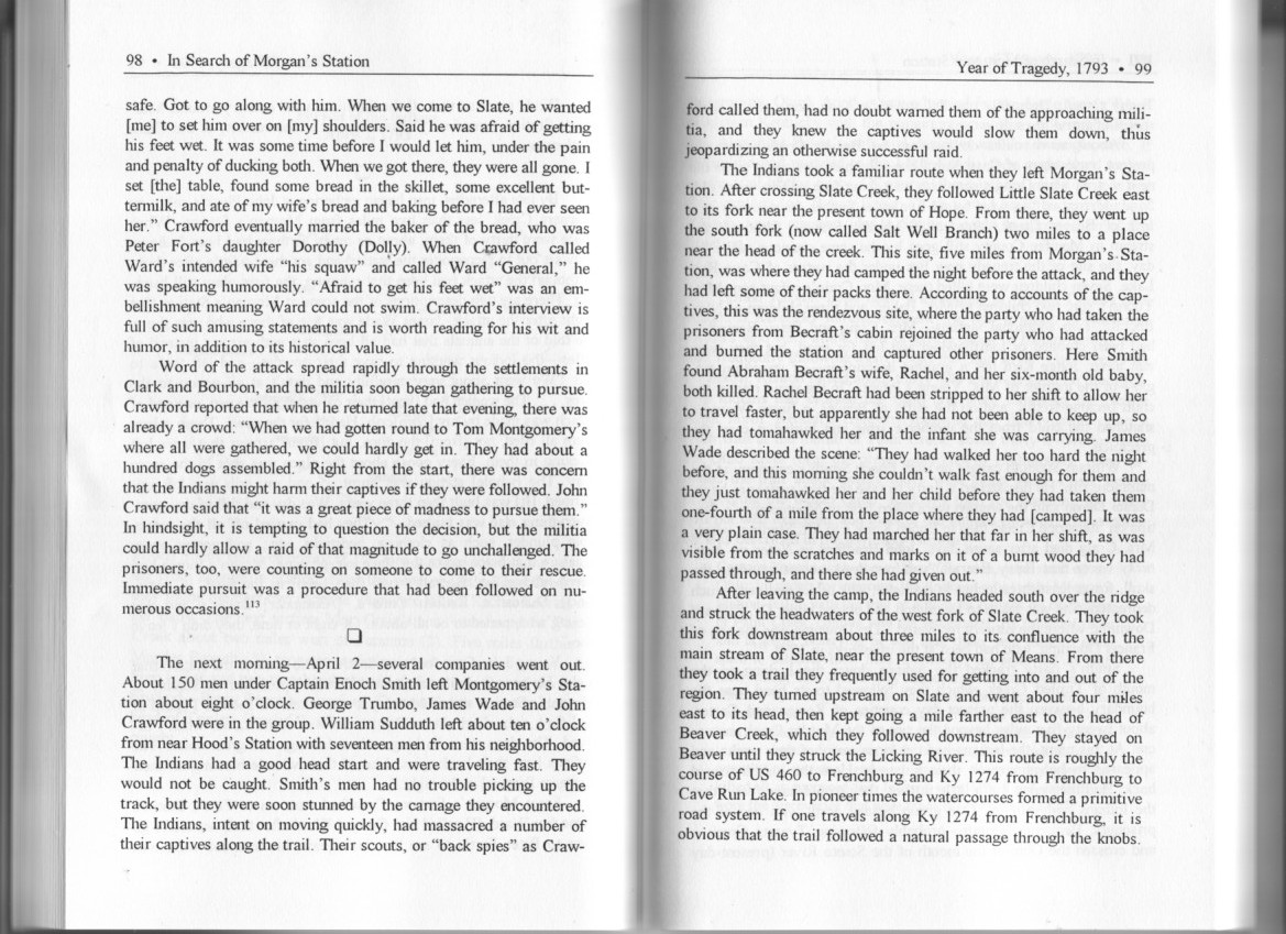
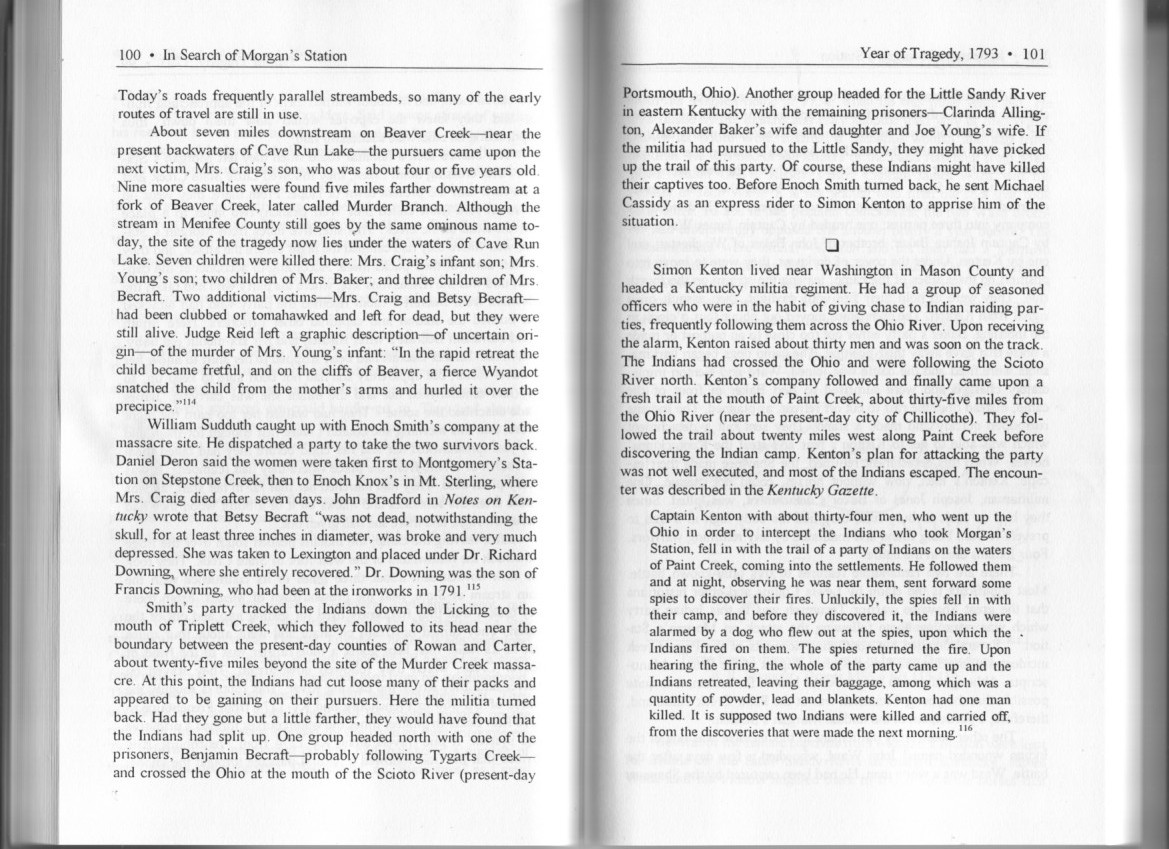
In fairness to the author, I have only posted selected pages from Mr. Enoch's book.
I highly recommend the book to anyone with an interest in local history
and those who are researching families in this part of Kentucky.
The book is well researched and annotated. Scores of early settlers are mentioned in the text.

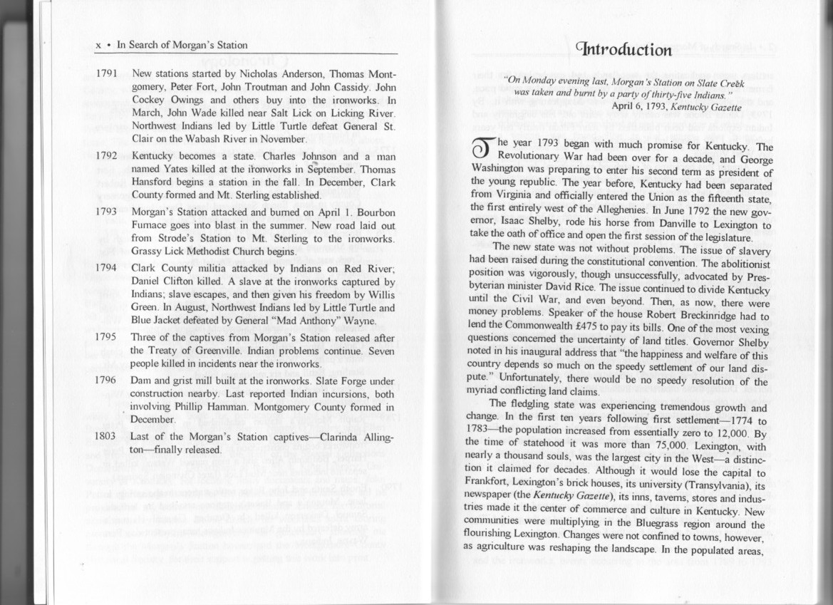
The book focuses on events in present day Montgomery and Bath Counties,
but important related events occurred in present day Carter, Menifee and Greenup Counties
The author makes a persuasive case that much of the loss of life could have been avoided
if the neighbors of the captives had not chosen to persue the Indian raiding party.
Native Americans took white captives so that they could be sold for reward to the British
or to be held as permanent members of the tribe. In similar raids, when the raiding parties
had not been pursued, loss of life was minimal on both sides.

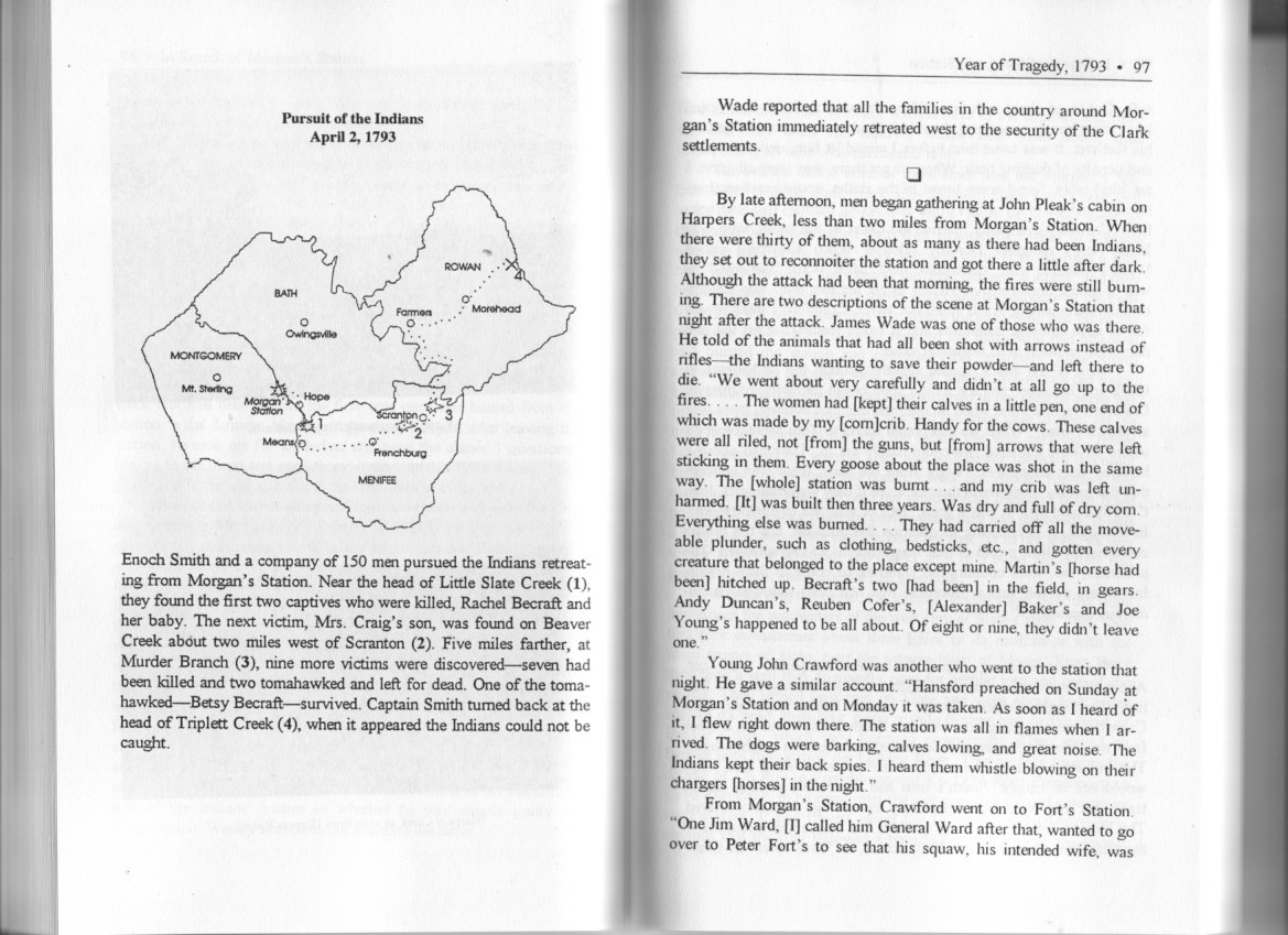
The escape route through Morehead to Tygarts Creek & the Little Sandy River
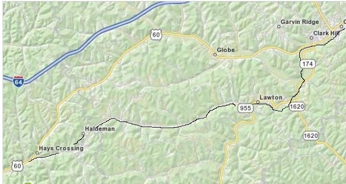
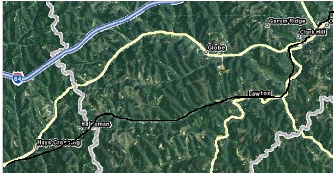
US Route 60 follows the main branch of Triplett Creek east from Morehead, Ky. through Hayes Crossing.
It is not clear from the description in the text if the old Indian trail followed
the present route of US 60 through Carter County to Olive Hill, and thence down the Tygart to the Ohio River,
or alternatively, the trail left Triplett Creek in eastern Rowan County and followed SR 174, which more
closely follows the head waters of Tygart Creek. In discussing the various possible routings,
I tried to put myself in the place of a 19th person walking over a landscape untouched
by the hand of man. Over time, the native peoples would have used their intelligence to find the safest
and fastest routing of their trails between important origins and destinations.
General principles of trail routing:
A traveler that uses a trail that passes over raised ground is subject to
delays due to mis-direction and steep climbing which would tend to sap energy and time. Trails
over raised ground often have no obvious natural landmarks to guide the traveler. There are some well
worn animal trails, but, except for American bison trails (which seldom passed over hillsides),
animal trails are not linked together in a way that would be useful to the long distance traveler.
Water is essential to human survival (and is relatively difficult to transport),
so a trail that gave regular access to a water source would be preferred.
Also, water courses generally follow the path of least resistance through hilly terraine, and over time,
creeks and rivers create wide and easily traversed (and permanent) pathways
The US60 trail routing alternative
The construction of US 60 required numerous road cuts which obviously did not exist in the early 19th century.
In early times, this routing would have involved passing over several stretches of
high ground in order to maintain the easterly direction toward Olive Hill and the Tygart Creek.
This routing would have been relatively demanding from the stand point of efficient use of time and energy.
There were several small streams which pass through this routing,
but they may not have been a reliable source of water in mid summer.
The SR 174 routing alternative
The trail could have passed through the present location of Haldeman, Soldier, Enterprise, Lawton
and thense to Olive Hill. This more southerly route covers somewhat easier terrain,
and would keep users of the trail close to a reliable water supply (the Tygart).
This is also the routing that the now abandoned C&O Railroad right of way followed.
I believe this would have been the most logical routing for the trail.
The Tygart makes a sweep through Lawton before turning northeast into the Olive Hill area.
This is not the most direct routing, but it has the distinct advantages of being easily recognized,
easily followed, over level terrain and in constant contact with a reliable water source.
It should be noted that SR1626 follows a series of open hollows/valleys from Soldier northeast to Globe
(just east of Olive Hill on US60).
This would have been a marginally more direct path to Olive Hill, but it too passes over some high ground
and does not have any notable water access.
Native Americans were no doubt familiar with this part of eastern Kentucky,
but I would propose that the main trails tended to follow easily remembered and recognizable landmarks.
The SR1626 routing would require that the traveler know when to turn north (the community of Soldier
obviously did not yet exist) and upon reaching the area of present-day community of Globe,
the traveler would need to know when to turn east to reach the Olive Hill and the Tygart,
which were still several miles distant.
Olive Hill and the Tygart
Modern day residents of Carter County may not fully appreciate the importance of the Tygart to the
Native American traveler. The Tygart passes through very hilly terrain,
so it's path is quite meandering, but the meanders seldom vary far from the creek's generally northerly direction.
Also of importance, the Tygart is the principle waterway from inner Kentucky to the Ohio between the
Little Sandy just to the east and the Licking River
to the west. The Licking has the distinct disadvantage of flowing northwest,
making it less useful to the traveler whose goal is Ohio's Scioto River
(arguably the most important river within the present day state of Ohio).
Once in the Olive Hill area, following the waters of Tygart Creek would have been the most direct route to the Ohio River.
If one stays in the bed of the creek, there are obviously no difficult climbs to act as obstacles.
The Tygart flows north north east from Olive Hill through the communities of Wolf and Iron Hill,
thence into Greenup County and on to the Ohio River, not far from the mouth of the Scioto River.
The Little Sandy River trail
As mentioned in the text, there was a second band of raiders that escaped down the Little Sandy River to
the Ohio River. There is no easy or obvious trail routing between Olive Hill and Grayson area.
There are no creeks near the present routing of US64 or US60.
They may have followed the route of the present US 60 from Olive Hill to Grayson to intercept the
Little Sandy there. This is the most direct route, but as it approaches the area of present-day Grayson,
the terrain becomes quite hilly and there are few landmarks to guide the traveler.
Without the benefit of a compass, maintaining an efficient due easterly direction would not have been easy.
Also, there are no reliable sources of water along this 15 mile routing.
That's quite a distance to carry water for a group that included women and children.
There is an alternate route to the southeast of Olive Hill following Cory Branch east southeast from its
intersection with the Tygart in Olive Hill, through the area of the communities of Mountain Top and Cory to Grahn
and the Little Sinking Creek, then east through Fultz and Leon to the Little Sandy.
This routing is somewhat less direct, but offers Cory Branch and the Little Sinking Creek as a steady water supply.
The Little Sinking Creek is easily followed and maintains an efficient easterly course once one has passed
the area of the present community of Grahn.
Perhaps unsurprisingly, this is also the routing of the old C&O railroad right of way.
Once the Little Sandy River is reached near Leon, it flows north through Grayson and Pactolus into Greenup County
and thence to the Ohio River.
Photos of most of the suggested routing of the trails (especially the ones that follow the old C&O Rairoad) may be viewed here.
