The Alanant-o-wamiowee trail
The Alanant-o-wamiowee trail
A semi-circular buffalo trail through central Kentucky
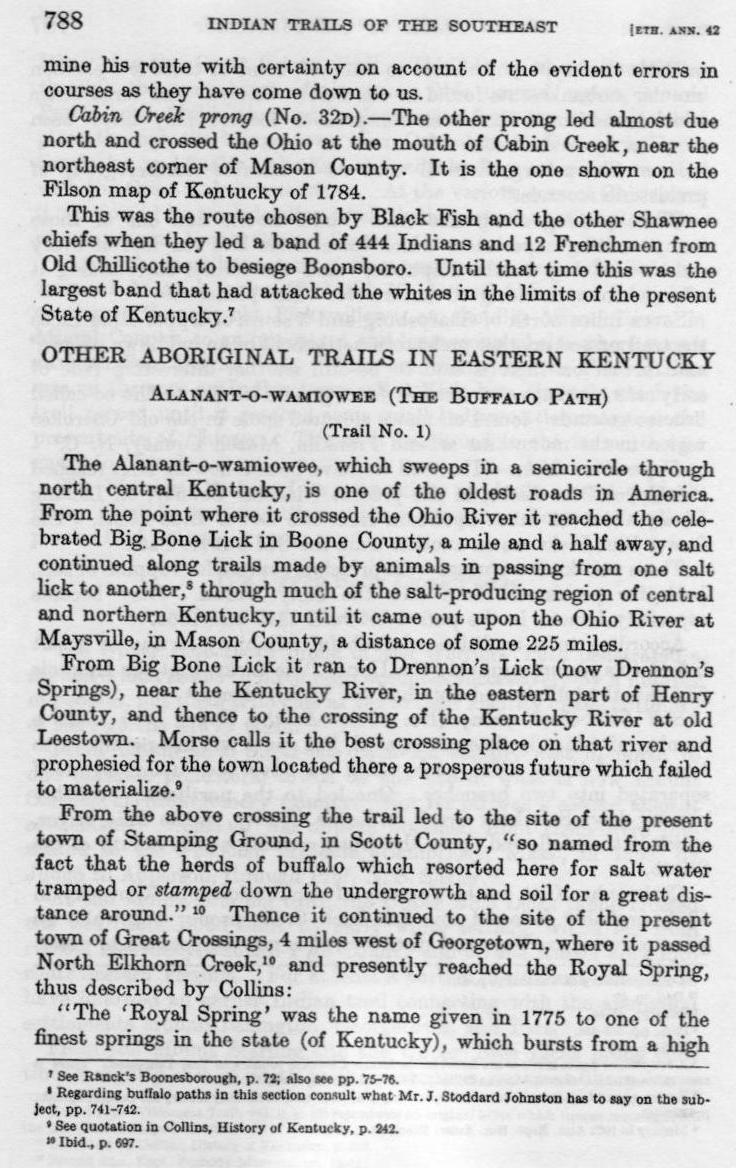
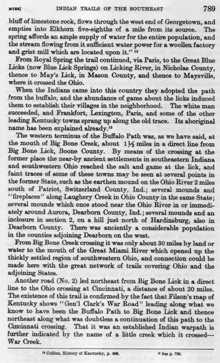
Source of this routing follows:

From: "Indian Trails of the Southeast"
By: William E. Meyer 1924-25


Research Commentary

Big Bone Lick does not appear to be located on any natural north-south travel/migration route.
There is unbroken high ground on both sides of the Ohio River from as far north as Portsmouth (Lower Shawnee town).
That implies that the resources at Big Bone Lick were discovered by chance, and that,
while it apparently became a regular stopping point for large herding animals, it should not necessarily
be considerd a waypoint on the optimal migration route between the grasslands of Indiana and central Ohio,
and the grasslands of central Kentucky to the south.

The obvious route into and out of Big Bone Lick would be along the Ohio River. Unlimited fresh water was
available, a variety of grasses, ferns and berry bushes would have grown along the rive, and predators
would have been more easily detected at a distance along the length of the river and its floodplain.

In reviewing the topography within the quandrant directly to the south of Big Bone Lick we find one or two
creek hollows that extend a short distance into the hills, but all terminate in steep climbs in
order to traverse the ridgeline of the Kentucky hills bordering the Ohio River.

In seeking a route south, and in the fullness of time, bison no doubt explored all of these hollows, especially those
to the southeast of the point on the Ohio River closest to Big Bone Lick. The top-heavy physiology of bison does not lend
itself to climbing hillsides covered with rough brush, with little or no access to water and little
plantlife for a large herds of grazing animals. Instinctively, bison would have known that
substantial creeks with well-worn floodplains would be more to their liking, even if it required walking
tangentally several miles away from the ultimate destination. It should also be considered that not all
bison travel in this region would have been from the north to the south. On would reasonable expect that a
certain percentagte of the bison population would sometimes choose to migrate the reverse
course of the Alanant-o-wamiowee trail, and therefore, the trail must be navigable in both directions.

We must also keep in mind when considering potential routes to the interior of Kentucky, that the hills
in this region would not have always looked like the well cultivated agricultural fields and open gazing pastures
that we see today. For much of history, these hills would have been covered by primordial forests which would
have tended to discourage random exploration by large animals like the bison.

Recorded history does not give us assistance in teasing out the route of the Alanant-o-wamiowee immediately
south of the Ohio River. I have found it useful to first consider the route of modern day highways that
lead in the desired direction. In Landing Creek Hollow, Kentucky Route 338 passes Big Bone Lick
just to the north. It maintains an easterly course and climbs steeply into the hills. Route 338 eventually
intersects with US Route 127/42, but these highays were engineered to maintain a direct course over the
hills, and as a result follow terraine that would be difficult for bison to negotiate.

Kite Ln. passes Big Bone Lick to the west, but it soon turns north
and suggests no obvious way to gain a southly course toward central Kentucky.

Just to the south of Landing Creek, Big Bone Creek emerges from a relatively wide hollow and flows into
the Ohio River. The creek soon forks into two tributaries, neither of which flows in a hollow that extends
into the hills for any significant distance.

A little further south, the creek in Steel Botton hollow joins the Ohio River, but is is quite small and
extends into the hills only a short distance.

To the south of Steel Bottom, Big Sugar Creek also flows into the Ohio River. This one appears to hold promise.
This is a substantial creek, and the hollow it flows from is relatively broad,
but the headwaters fork into multiple smaller creeks that flow from very narrow hollows.
Followed to the south, one of the dry hollows emerges above Glencoe, Ky.
This routing is not easy to follow from the north,
and would have been even more difficult to locate from the south.

Several miles further to the south, just past Warsaw, Ky, a very broad Craig's Creek emerges from a
hollow almost directly due south. But the headwaters are eventually lost in the hills above Sanders, Kentucky.

Next, the creek at Ghent, Ky. emerges from a hollow that extends well to the south into the hills, one fork
of which reaches to the headwaters of a south-flowing creek the emerges from the hills at Sanders, Ky.
Sanders is of interest because it lies on Eagle Creek, waterway that flows southwest
from Sanders to join the Kentucky River.

Lastly, a couple of miles south of Ghent, the Kentucky River enters the Ohio River at Carrolton.
This is about 25 miles to the southwest of Big Bone Lick, and IMHO,
is the most likely northwestern terminus on the Ohio River for Alanant-o-wamiowee trail.
Alternate routing between the Ohio River and the Kentucky River
Click here for a larger image of the map below