The Black Mountain Trail
The Black Mountain Trail
Pineville, Ky. to Harlan, Ky.
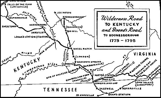
Early map of the Wilderness Road which indicates a southerly trail between Pineville and the Harlan area

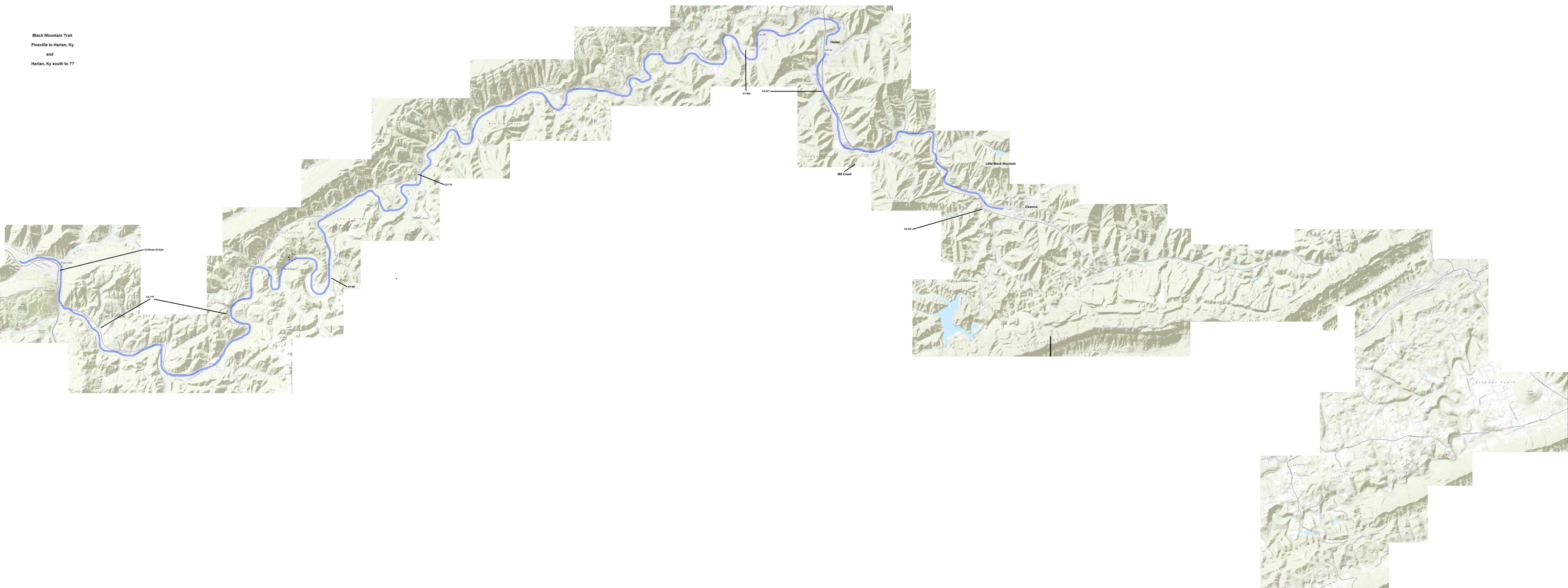
Excerpted from "Prehistoric Trails of the Upper Cumberland River Basin" By Charles Mayer Dupier, Jr. "The fact that there was such a large mound and village at the present site of Harlan, Kentucky, suggests that the place was connected to other settlements in the region. There is a dearth of information concerning prehistoric trails in the area of Harlan County, however, it is only logical that such trails existed. There is only one feasible route which would connect the Harlan site with the Warriors' Path and the townsite at Pineville. That route had to follow the Cumberland River. The topography outside the river valley is so difficult to traverse that no other logical conclusion can be drawn. As was stated earlier, it is difficult to believe that a town was located on a dead-end trail--especially one that is thirty-five miles long (the distance from Pineville to Harlan). In order to determine the route that this trail might have followed, it is necessary to find a gap across Cumberland Mountain to the south and the basin of the Powell River. The only gap in Cumberland Mountain south of central Harlan County is Cranks Gap. The trail to Cranks Gap, which would have followed a line of least resistance would be the present route of U.S. Highway 421. This road leads southeast from Harlan, through Cawood, to a point about one and one-half miles west of Mill Creek Church (on the creek of the same name). Here an old trail, which can still be seen on the topographic map for Evarts, Kentucky, leads south about two miles, through Cranks Gap (into Virginia) to Trading Creek, a tributary, to the Powell River. There are other ways out of central Harlan County, but none are so short and direct with so few obstacles. Richard Jefferies' map(45) indicates that there was a Mississippian habitation site, without a mound, located near the present site of the city of Cumberland, about fifteen miles east of Harlan, and near the headwaters of the Cumberland River. There may have been a trail which led from Harlan to this site, and perhaps beyond. That trail would have, out of topographic necessity, followed up the Poor Fork of the Cumberland River. If such a trail existed it would have had to exit the area in a southerly direction by going over Little Black Mountain (the highest point in Kentucky) and through Stone Gap into the basin of the Powell River. A state highway currently follows this route, but it is not known if that highway follows an ancient trail."
Lodging
Pine Mountain State Resort Park, Pineville, Ky.
The Olde Mill Inn Bed and Breakfast, Cumberland Gap, Ky.
Harlan County Campground, Putney, Ky.
This is another "work-in-progess". The author's suggested routing south from Harlan does not match any map. Click here for a larger image of the map below.
