Kentucky 1491
In the Time of the Original Peoples
A guide for the modern traveler who wishes to re-trace the ancient pathways
.
.
Essays and Academic Documents of Interest
"The Archaeology of Kentucky" (613 pages)
"1924-1925 Report of the American Bureau of Ethnology" (takes several minutes to load)
Very interesting, beginning at page 779. Save it to your HD for easier searching
"Pre-Columbian Map of the Mississippi?"
"Throwing Sticks"
"Mound Builders"
"Cherokee Myths"
"Aboriginal mummy with red hair"
"Shell Mounds Were Early Dakota Sioux Hopewell"
"The History of the Daniel Boone National Forest - Early Traces and Roads"
"Early Trails and Roads Through Kentucky's Wilderness" An essay from Kentucky Explorer Magazine
.
.
.
.
Documenting and Retracing the Ancient Trails of Kentucky
Employing Four Essential Principles of Trail Finding
. . .
* Linking Waypoints Recorded in the Historial Record * Directional Efficiency Toward a Known Destination * Safety and Energy Conservation * Repeatability
Best Trail Segments for Biking
Morgan's Station Trail
Route 784 to Iron Hill, then south on Rockhouse Road and Smith Branch to Rt. 60 (10 miles)
Route 801 and Route 460 through Cave Run and then along Beaver Creek to Frenchburg (15 miles)
From Grayson on Rt. 7 to Rt. 773 to EK Railroad Dr. to Grahn Rd to Sinking Creek Rd. to Grahn (10 miles)
Warrior's Path
From Vanceburg on Rt 3037 to Rt. 10 to Rt. 989 then up Toller Hollow Rd. to its end. (10 miles)
Rt. 11 from the Licking River to Interstate 64. (10 miles)
Rt. 1331 from Rt. 965 to Harpers Ridge Rd. to Morgan's Station to Spenser Rd. (5 miles)
Wagersville Rd. from Rt. 89 to Rt. 587 (10 miles)
Best Trail Segments for Hiking and Camping
Morgan's Station Trail
Route 784 to Iron Hill, then south on Rockhouse Road and Smith Branch to Rt. 60 (10 miles)
Tygarts Creek and Cave Branch trails within Carter Caves State Resort Park (8 miles)
Sheltowee Trace
In and around Cave Run Lake (4 miles)
Warrior's Path Segments on the Seltowee Trace
Rt. 646 from Rt. 11 to Kidville Rd. to Rt. 15 (5 miles)
Wagersville Rd. from Rt. 89 to Daniel Boone National Forest, then south to Grayhawk (20 miles)
Shawnee Migration Route Map
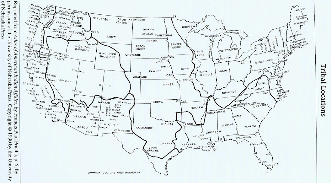
Cultural Boundaries Map
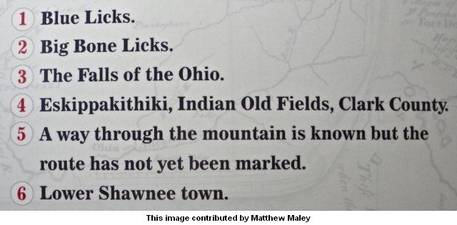
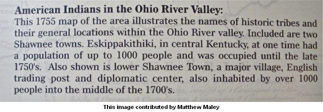
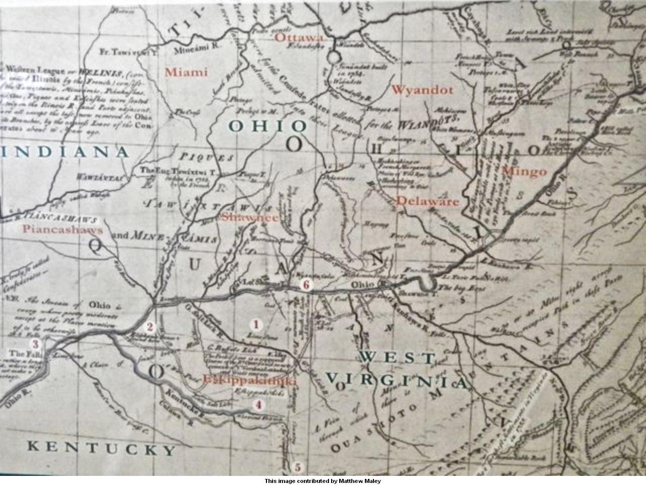
Note the trail marked as running between the area of the upper Tygarts Creek and the Little Sandy River.
I've zoomed in on that area below:
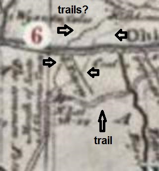
The wide horizonal double line is the Ohio River.
The Scioto River is the vertical black line in the upper left of this image.
This is confirmed by the placement of Lower Shawnee town.
The vertical black line on the right is the Big Sandy River.
There are two very faint vertical lines just to the left of the Big Sandy that seem to converge
at a point where a broadly drawn trail from the south jogs off to the east to cross
the Big Sandy and continue on to the northeast to the Ohio River near the
Kanawah River ("Kanhawa R.") in West Virginia.
At first I thought these represented the Little Sandy and Tygarts Creek, but then I noticed
that the two lines are extended across the Ohio River. This would seem to indicate that
the two faint lines represent trails, rather the courses of two streams. As documented in the
book "In Search of Morgan's Station", both Tygarts Creek and the Little Sandy River were known
to be trails from interior Kentucky to the Ohio River.
I did some searching on the internet and was able to find only one map of Native American trails
in the area of the Scioto River. None of them are to the immediate east of the Scioto.
Excerpt from "Kentucky Cherokee: People of the Cave" by Dr. Tankersley
Native American names used in our region
"Ah-wah-nee" - Native American settlement near present day Irvine, Ky.
"Ken-ta-ke" - "Place of Blue Licks" - Kentucky
"Oua-sioto" - the Appalachian Mountains of Kentucky
"Kinniconnick" Shawnee word that meant "willow bark" - Kinniconick Creek
"Nepernine" - the Licking River
"Scioto" - the Scioto River
"Prehistoric Trails of the Upper Cumberland River Basin" By Patsy Woodring
"Walking Ancient Kentucky” by J. W. Grace - updated 10/5/2014
"Prehistoric Trails of the Upper Cumberland River Basin" By Patsy Woodring
"Walking Ancient Kentucky” by J. W. Grace - updated 10/5/2014
Notable Archaeological Sites of Eastern Kentucky and Southeastern Ohio
Adena Mound near Shannon, Kentucky in Mason County
Adena Mound near Ashland, Kentucky
Adena Enclosure near Lexington, Kentucky
Bogy Hill Sun Temples, Madison County
Cleek-McCabe Site, Boone County
Feurt Mounds and Village Site, Scioto County, Ohio
Fox Farm Site, Mays Lick, Mason County
Gaitskill Mound, Mt. Sterling, Montgomery County
Gaitskill Mound Tablet, Mt. Sterling, Montgomery County
Hardin Village Site, Greenup County
Leo Petroglyph, Jackson County, Ohio
Lower Shawneetown, Greenup County
Mount Horeb Earthworks Complex, Fayette County
Mount Sterling, Montgomery County
Portsmouth Earthworks, Scioto County, Ohio
Pretty Run Creek Mounds near Winchester, Clark County
Ronald Watson Gravel Site, Boone County
Sun Temple near Lexington, Fayette County
Tremper Mound and Works, Scioto County, Ohio
Maps of Interest
Carte Nouvelle france et 13 colonies en 1710
Fort Ancient Monongahela cultures
Trails I'm working on
From: "Sharon Karns"
 To: KYBATH-L@rootsweb.com
 Subject: [KYBATH] Ky. Trails
 Date: Wed, 15 Jan 2003 22:38:06 -0800

 CUMBERLAND-OHIO FALLS TRAIL: This was an important trail during the
 pioneering period as it was the shortest and most easily traveled route
 from Nashville, Davidson Co, TN to the settlements at the Falls of the
 Ohio. It ran from Nashville to Russellville, Logan, KY; from there to
 Elizabethtown in Hardin County; to Shephardsville in Bullitt County and
 ended up in Louisville in Jefferson County. (Hathaway). The usage of
 this trail began approximately 1779 (possibly earlier). It took a branch
 west off the Wilderness Road near Logan's Station in Lincoln County,
 crossed the South Fork of the Rolling Fork River; passed thru a gap in
 the creeks and the Trace Fork of Pitman Creek in Taylor Conty. It then
 crossed the Green River at Pitman's Station in Green County, went across
 the "barrens", crossed the Barren River near McFadin's Station in Warren
 County; went southwest to the Cumberland Settlements near Nashville.
 James Robertson and his men used this rounte in driving cattle on their
 way to settle at the French Salt Lick on the Cumberland River in 1779-
 80. John Donelson, (co-founder of Nashville) was killed on this
 trail/trace in the mid 1780's.