Muhlenberg County Kentucky
Cemetery Records
Clark Cemetery
- Footstone: J.T.J.
- Footstone: O.J.
- Footstone: W.J.
- Adkerson [Atkinson], Elizabeth Carlysle. No dates. Inscription: Mother of Quintila Clark.
- Breedlove, Jesse Frank Jr. Born 1934. Died 1934.
- Breedlove, William Byrd. Born 2 Feb 1938. Died 13 Aug 1968.
- Clark, Byrd W. Born 27 May 1907. Died 27 Nov 1936.
- Clark, Isaac Goeble. Born 1899. Died 1917. Inscription: Son of Q.C. & J.C. Clark.
- Clark, James Thomas. Born 26 June 1854. Died 10 July 1855. Inscription: Son of M.B. & Q.C. Clark.
- Clark, Jeanette C. Penrod. Born 1870. Died 1957. Shared stone with Quintus Cincinus A. Clark. She married Quintes Clark, 22 Dec 1891, Muhlenberg County.
- Clark, John Q. Born 1904. Died 1965.
- Clark, Joshua B. Born 25 Dec 1848. Died 18 Oct 1853. Inscription: Son of M.B. & Q.C. Clark.
- Clark, Mary Jane. No dates. Inscription: Daughter of M.B. & Q.C. Clark.
- Clark, Matthew Beverly. Born 1814. Died 1904. Shared stone with Quintila C. Adkerson [Atkinson].
- Clark, Matthew Beverly 2nd. Born 1890. Died 1890.
- Clark, Quintila C. Adkerson [Atkinson]. Born 1822. Died 1902. Shared stone with Matthew Beverly Clark.
- Clark, Quintus Cincintus A. Born 1868. Died 1940. Shared stone with Jeanette C. Penrod. He married Jeanette Penrod, 22 Dec 1891, Muhlenberg County.
- Clark, Ruth Susan. Born 11 Aug 1895. Died 6 Feb 1972.
- Clark, Sarah W. Born 24 July 1847. Died 25 June 1855. Inscription: Daughter of M.B. & Q.C. Clark.
- Clark, William Clifton. Born 1858. Died 1895.
- Hardison, George W. Born 29 May 1862. Died 4 Oct 1891.
- Hardison, Polly. No dates. Inscription: Wife of Geo. Hardison.
- Hunt, Charles. Born 4 May 1784. Died 17 Aug 1859.
- Jones, Elizabeth. Born 1 Apr 1843. Died 20 Feb 1890.
- Jones, Eudoxie. Born 2 Mar 1850. Died 12 July 1855. Inscription: Daughter of J. & N. Jones.
- Jones, Moriah J. Born 7 Apr 1835. Died 30 June 1888.
- Jones, Nancy. No dates. Inscription: Wife of Joseph Jones, aged 73 years.
- Jones, William. Born 12 Jan 1837. Died 7 Aug 1838. Inscription: Son of J. & N. Jones.
- Kirtley, Catherine. Born 14 Nov 1800. Died 23 Sept 1828. Inscription: In memory of Catherine Kirtley, wife of Francis Kirtley.
- Stom, Margaret. Born 15 Jan 1759. Died 15 July 1830. Inscription: In memory of Margaret Stom, consort of Leonard Stom.
- Taggart, Bersheba Quin. No dates. Inscription: Daughter of Will & Edora Taggart.
- Taggart, Beverly Clark. No dates. Inscription: Son of Edora & Will Taggart.
- Taggart, Edora Clark. No dates. Inscription: Wife of Will Taggart.
- Wood, Charles R. Born 25 Dec 1855. Died 12 Apr 1896. Shared stone with Susan E. Clark Wood. He married Susan E. Clark, 22 Dec 1881, Muhlenberg County.
- Clark, Susan E. Born 4 Jan 1863. Died 24 Feb 1894. Inscription: Wife of C.R. Wood. Shared stone with Charles R. Wood. She married Charles R. Wood, 22 Dec 1881, Muhlenberg County.
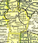
Location
GPS Coordinates: 37.13173, -86.97554.
Directions: Located 2½-3 miles east of Highway 431 on Union Ridge Road from Belton, a few hundred feet east of Clark Bridge on the north side of the road.
In April 1970, there was a large tree that had fallen into the older section of the cemetery. It was thought at that time that the gravestone for Joseph Jones would be found underneath. However, said stone has not been found.
Source: “Muhlenberg County Kentucky Cemeteries” Vol. 2. Compiled by Marain G. Hammers, 1977.
Updated June 8, 2024.