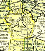
Muhlenberg County Kentucky
Local History: R
High Points in Old Rochester are Sharpened
Historic Green River Town Described By Miss Willis in Interesting Story; Her Former Home.
Rochester, Ky., Aug. 9. - Rochester, Butler county, Kentucky, now well past the hundred-year mark decides to reminisce in honor of her many children who are returning to this day's Home-Coming Celebration.
The town plots of Rochester and Skilesville, sister towns, have been drawn as they appeared in the early days within the memory of S.H. Brewer. The houses have been reproduced in water color by Miss Drusilla Corley, of the Owensboro Senior high school, for display on this occasion.
Rochester is one of twenty-one towns of this name located in twenty states. This town was named by the direct descendants of John Rochester of the family of Rochester, in England. John was the brother of Nathaniel, the founder of Rochester, New York.
Three children of Nancy Jordan Rochester and Samuel J. McDowell came to this community from near Bowling Green. These were Ann Eliza, wife of George Redding, and her brothers William and Ross McDowell. William and his mother are said to have built up the business interest of the town. A transfer of plot 62 in Rochester from James G. Pitts to Ann E. Redding, 1839, is on record at Morgantown.
H.B. Wiggin Early Settler
The records further show that in 1848 H.B. Wiggin, who came here from East Orange, New Jersey, owned the tract of land on the west side of the Russellville road. On this last stood his saw mill, about 1,000 feet upstream on Mud river, beyond the house of Jerry Bowling. This tract extended north and east, 103 acres.
The year previous Wiggin had sold to Robert Kininmonth, a native of Scotland (who came here as a superintendent of locks and damns), a tract of 360 acres bordering on Mud river.
In one of these early deeds retention is made of “one acre of land on which is buried the small daughter of said Wiggin.” This child and the daughter of E.C. Guest, each about ten years of age, were the first to be placed in the town's beautiful cemetery, the gift of Mr. Wiggin about 1852. Before this all burials were at Midway, about two miles from town.
That part of the land known to many as the “Wiggin Field” is now owned by the heirs of Judge Sam Holmes. The remainder of the land is largely in town lots.
Built on Banks of River
On the east side of the Russellville road, land extending from Green River to the Jackson farm and to the eastern extremity of the present Eugene Willis and Hays farms was owned by a man named Berry, E.C. Guest, Wm. Willis, Sr., who came here from near Harrodsburg about 1838. This land is now in town lots.
The town was first built along the bank of Green river but gradually crept back to the higher ground to escape the frequent overflows. Among the first houses in lower town was the large, square, log hotel operated by Mrs. Roberts from Russellville. This hotel burned one night and the story is told that a man who was staying there had lost for some time the power of speech. In the excitement and exertion resulting from the fire, he regained the use of his voice.
Rochester seems to have had its share of hotels. Another was built just above the site of the old one. Later the home of Daniel Reneer, just above, was remodeled and turned into a hotel. Then there was the “Lower Hotel,” at Mud river ferry, operated by the brothers Jim and John Hays. After the death of the latter, Kelly Hawes became a partner.
It was at this hotel that Harvey Stone and his family spent their first night in Rochester. The next morning Mr. Stone's younger son, aged ten, was struck by love at first sight of Mrs. Hawes' lovely little daughter, an experience that proved fatal to both.
Of the two hotels built later in the higher part of town by Daniel Smith, one is now owned by Mrs. F. Trulove and the other by David Myers. At one time these two houses, because of the names of the proprietors, were referred to by the town humorist as the Cole (Coal) House and the Wood House.
Tobacco Factories
There were four tobacco warehouses. That of the Arkenberg Tobacco Co., an Eastern concern, stood just back of the present flour mill. One owned by Wm. Willis, Sr., stood about where the residence of the last W.T. Wood now stands. That of H.B. Wiggin stood next to his store by the river, below his large two story residence at the turn of Russellville street; and that of E.C. Guest and Wm. Evans stood just above the story of K.J. and Phocian McKenney and beside the general story of Guest and Evans.
The well-built dry goods store of Mendel Bros. has been used by the firms of Bowles and Willis, Gibbs Bros., and Hays Brothers after being moved to its present location on Main Street.
Of the latter firm, J.F. Hays was at the time of his death a year ago, probably the oldest merchant in the whole Green river section, having begun business in the “Blue Front” about 1880.
In the only early residence left in lower town is the house with the long porch in front, later owned by Mrs. Oma Ewing.
In the higher section of town the oldest houses were built between 1864 and 1874. Among these are the homes of Kelley Hawes and David Poole on Russellville Street, and beyond the Methodist church those of E.C. Guest and Wm. Evans. Others are the John Chauvin house, now Mrs. Humphrey's, and the Sam Manley house. On the crest of the hill overlooking Green river for miles are the former homes of Dr. J.F. Strother, Granville Hunt (built by Zeb Fortner), and the Meachy home, now owned by the Doris heirs. Just across from the latter is the old home of Alexander Tanner, who came here in 1868 from Virginia. Back of the Strother house, on the Russellville road, stood the old Holder house which was occupied by Jim Willis and family when they came here from Perryville about the time of the Civil War.
The old academy, beyond the memory of anyone now living, stood near the present Methoidst parsonage. Early citizens have been heard to say that among the subjects taught were Latin, bontany, geometry, geology, and zoology.
Early School Teachers
Since then the old county schoolhouse which stood near the fork of the road has been used and discarded. Then came the combined grade and high school building destroyed by fire more than twenty years ago but immediately replaced by the present one.
Among the earlier teachers who are gratefully remembered is Dr. Finley, who at the age of 37 came to Rochester, in 1866, with his family of five children. Many of the young people whom he educated and inspired attribute their success in life to the influence of this cultured man. Others spoken of with admiration are Dr. C.L. Hendricks, Mr. Rhoads, Mr. Charlie Taylor of Greenville, Miss Sara Revo, Miss Morton, Mr. Nourse, W.J. Cox, and, in later years, N.T. Groves, formerly of Hawesville, D.W. Cress and Hallie Brown.
Rochester has taken great pride in her churches. The first was the Baptist “meeting-house,” a roomy square structure, which stood just opposite the present Christian church. The congregation beame scattered. Then came the old Methodist church with its tall spire. This was destroyed by fire caused by a modern lighting system. The present Methodist church stands on the same site. The old Baptist building, bought and moved across the street by the Christian congregation, was in use until about 1900, when it was discarded for the present Christian church on the same location. A new Baptist church was built about the same time, directly back of the Methodist.
The community of Rochester now includes the few families left in Skilesville, Muhlenberg county, just one mile distant across the mouth of Mud river, and those living in Ohio county directly across Green river at Lock No. 3, a community formerly known as McCrearyville.
Indian Camp on Lock Site
It is thought that the Indians once had a camp on the point where the lock is situated. The fact that a ford existed below the present dam site and that mussel shoals are near would seem to justify the belief. Further evidence has been found in the unearthing of two human skeletons and various Indian relics from the mound on the John Bowles farm near the locks.
The improvement of Green river began after adoption of an act of the legislature for that purpose in 1808. Two years later, the same year that Butler county was formed with a population of 2,018, provision was made for the opening of Mud river to navigation. Tow boats then traveled up this river a distance of 12 miles to bring down barges of a fine grade of coal from Mud River mines.
Navigation was further improved by the completion in 1834 of four locks and dams on Green and Barren rivers, according to Dr. McMustrie's “Sketches of Louisville.” The year 1838 is given in Rothert's “History of Muhlenberg County” as the time of completion of Lock No. 3. The first lockmaster was Thomas Bowles.
Supplies sent by boat from Pennsylvania down the Ohio to Louisville could then be related to Evansville, Ind., and thence to Bowling Green, a distance of about 275 miles, requiring about three and one-half days for completion of the trip from Louisville. Some of the early boats were the Ada Lyons, the Plain City, the Bracelets, the Hartford and the Lucy Wing.
Important Shipping Point
Also, spring and autumn shipments of flour, meal, wool carding, bacon, lumber, tobacco, oats, rye, peaches, and apples were sent on flat-boats to New Orleans, a distance of 1,435 miles from Louisville.
The return trip brought the year's supply of such staples as green coffee, hogsheads of brown sugar, white sugar in cubs, canned oysters, and sardines.
The imporance of Rochester as a shipping point in the early days is referred to in Collins' “History of Kentucky,” 1847:
“Rochester, the most commercial point in the county, having four tobacco warehouses, and from which 300 hogsheads of tobacco are shipped annually, is at Lock and Dam No. 3 on Green river, at the mouth of Muddy River, 12 miles from Morgantown, the county seat. It was incorporated in 1839, having a population of 228.”
Boats provided a luxurious means of travel in those days of no railroads. It was while making the trip from Louisville to Bowling Green in 1846, to attend a Sunday School convention as a delegate from the old Shelby street Methodist church, that Silas House Brewer in passing through Lock No. 3, noticed a fine head of water, fourteen feet, going to waste with no mills near. On the return trip he made up his mind to buy Skilesville acreage for his farm, three mills, residence, and other houses. He then leased the water rights for his mills for a period of thirty years.
Herbert Brewer, the oldest living native son, recalls hearing his father say that there were three houses in Skilesville at the time of his arrival. One of these was the home of George Redding, a tailor. This log house, later weatherfoarded, stood on the south side of the present Sidney Bowles home. The second was the combined store and residence of James G. Myers, which stood between the bluff and the Mud river ferry. The third was either Jesse Craig's shop on the bluff or the Wiley Brown cottage, later the home of Joseph Tucker and of Cappy Campfield.
Skilesville in 1840, according to Collins, had “one physician, two stores, and about fifteen souls. It was named after James R. Skiles, who spent a fortune in promoting the navigation of the river.” Skilesville is also listed as one of five towns in Muhlenberg county at that time. The county then had a population of 6,964.
“An election precinct was established at the house of Richard Simmons, Skilesville, in 1837,” according to Rothert's History of Muhlenberg county. “ Skilesville was not incorporated until 1876, although the town existed for more than forty years previous to that time … The Skilesville post office was established in 1840 … Since 1907 the people of the Skilesville neighborhood have received their mail either at Rochester or at Knightsburg.”
A map of the town, drawn by Jacob Luce, a pioneer citizen, was recorded in 1844 at Greenville. By the way, Collins gives Greenville, in 1870, a population of 557.
Very early a combined church and school was built. This had two stories and a very tall steeple, about seventy-five feet high. The lower floor, having neat yellow poplar desks and benches, was used for church and school. The upper floor was used by the Sons of Temperance and the Good Templars. In the church a cabinet held the leather backed hymn-books of long and short meter songs. Candles placed in front of shield-shaped tin snonces served for lights. The sermon usually lasted an hour and a half, since the minister for that circuit had sixteen different appointments and could not get around very often.
Skilesville occupied not more than forty acres and stood on two hills to escape high water. On one hill stood the tall house of Jesse Craig, built about 1860. This home burned but at once was rebuilt. The fourth generation of that family is now living on the Craig farm.
Near the Craig home, just off the road toward Greenville, stands the house built by Eden Rhoads about 1869. He was an expert carder of wool at the Brewer and Cowen mills.
Caught By Swift Current
On the other hill, beside the now partially razed Brewer home, stands the well preserved house built by Levi Cowen, who came “out west” from Queche, Vermont, to become the partner of Silas Brewer. After his death, just after the close of the War Between the States, his wife and two boys returned to the East.
Captain Gillette, also from the east, came here just after the war and lived in the Cowen house. The Gillette family took an active part in the community and the church life. They later moved to Rochester. The daughter, Mrs. T.K. Bowles, is now in her eighty-second year.
An early citizen recalls that the Ada Lyons in making a Skilesville landing during the high water was caught by a swift current which, aided by a strong wind from the east, carried her back of the town. The pilot, Mr. Jones, succeeded in nosing her back between the two hills into the river channel.
During the War Between the States, troops were encamped about the crest of the hills as you go west toward Greenville, and another, between the two hills. These were there the better part of one winter. Two officers, Captains Drinkwater and Stillwell, had an upstairs room at the Brewer home and ate at the camp. Herbert Brewer recalls:
“We had two Federal forts. One, on the point above the lock, directly opposite our home, was occupied by troops from Michigan. This held the road leading from Greenville. The other was across the Mud river ferry on a point that commanded Green river for a mile down stream. The latter was held by Wisconsin soliders.
“These forts were made of heavy green logs about fifty feet long, flitched down on two sides to make them lie close together, with port holes for the small cannon, and sand thrown up against the sides almost to the top.
Buckner Visits Rochester
“The troops occupying the fort facing down the river indulged in rifle practice firing down the river at a walnut tree about 250 feet from them that stood on the south bank of the river. Mr. Jesse Craig had a shop against the tree in questions, where he made monuments and the simpler tombstones for that part of the country. This was rather a good sized tree, say about eighteen inches in diameter, and had been scalped for the target on one side facing the fort. The guns were the Enfield and the Springfield make, I think, and the tree was very often hit.
“Quite a number of times, however, it was a clear miss; and that meant that the bullet hit the weatherboarding of the shop, going through the interior. Is it a wonder that Mr. Craig left some of the epitaphs unfinished and closed shop for the time of the fusillage?
“When the troops had all left that section, we boys took our jack knives and dug out the balls for sinkers on our fishing lines.”
Simon Bolivar Buckner, Confederate General, came to Rochester about that time to intercept some gunboats on their way to Bowling Green. His purpose was to destroy the locks. Mr. Brewer recalls that as a little lad he sat on the front steps of his home and saw the rise and fall of the drills as the greycoated men prepared to blow up the walls.
“My father went over to see whether it could be averted,” he relates, “and explained to the general that the town and region about depended upon the river for supplies and that the destruction of the locks would work a calamity; but that the stopping of the Federal gunboats could be made effective by throwing down the gates and filling the lock pits with logs. This satisfied the general.
Saw Service in War
“The gunboats came, four, I believe, not so large but covered with iron sheeting. They went back down the river and I believe found something to shoot at down about Hickman, Kentucky, and up the Cumberland river at Fort Donaldson, Tennessee, some time later.”
The date of this visit is given in Rothert's History of Muhlenberg County, pages 290-291, as September 26, 1861. He also quotes from General Duke's “History of Morgan's Cavalry.” He writes:
“General Duke, after stating that he left Morgantown on the morning of October 23, 1862, says;
“‘We crossed Mud river that night at Rochester, on a bridge constructed of three flat-boats, laid endwise, tightly bound together, and propped where the water was deep, by beams passing under the bottoms of each one and resting on the end of the next; each receiving this sort of support they mutually braced each other. A planking some five feet wide was then laid, and the horses, wagons, and artilelry were crossed without trouble. The bridge was built in about two hours. On the 24th we reached Greenville; that night a tremendous snow fell - tremendous at least for the latitude and season. After crossing Mud river there was no cause for apprehension and we moved leisurely.’”
Those from the Rochester-Skilesville neighborhood who are known to have seen service in the war are David Poole, captain; Joseph E. Willis, captain; Wm. J. Long, 1st lieutenant; Boyd Mercer, 1st lieut.; George W. Redding, musician, 11th Kentucky Volunteers.
After the war, 1868, the Green and Barren River Navigation Co. leased Green river, which up to that time had been directly controlled by the State of Kentucky. The Federal government purchased the unexpired lease of the Navigation Co. in 1888.
One night about fifty years ago, during the high stage of the river, the wall of Lock No. 3, weakened, no doubt, by the drills of General Buckner's men, gave way. A new one had been built and the locks widened.
Today few boats ply the river. Improved roads permit trucks to bring merchandise to the doors of the business houses. The young people of the town, though forced to seek employment elsewhere, are loyal to return, many of them each year, to the scenes of this peaceful river where they had lived secure in the love of one big American family.
May the old town live another hundred years!
Source: Willis, Georgia. “High Points in Old Rochester Are Sharpened.” Messenger [Owensboro, KY], 10 Aug 1941, sec. 2, p. 3.
Contributed by Mary K. Evitts Marlatt
Updated July 14, 2022