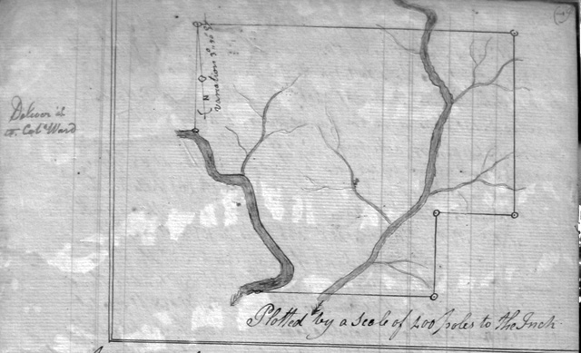
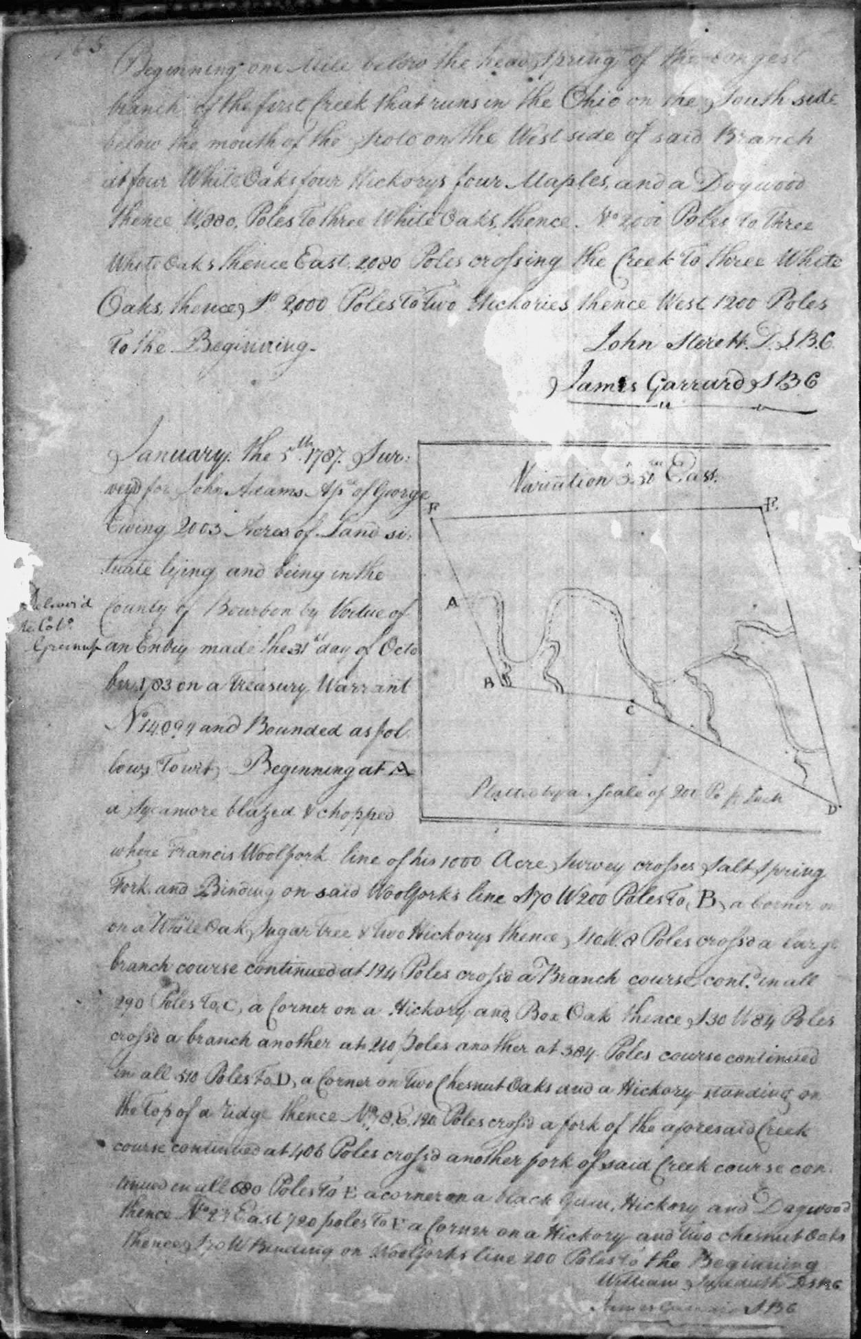
Adams, John, Assignee of Geo. Ewing
5 Jan 1787
2,003 acres
On the line of Francis Woolfork's 1,000 acre survey and crossing Salt Creek fork.
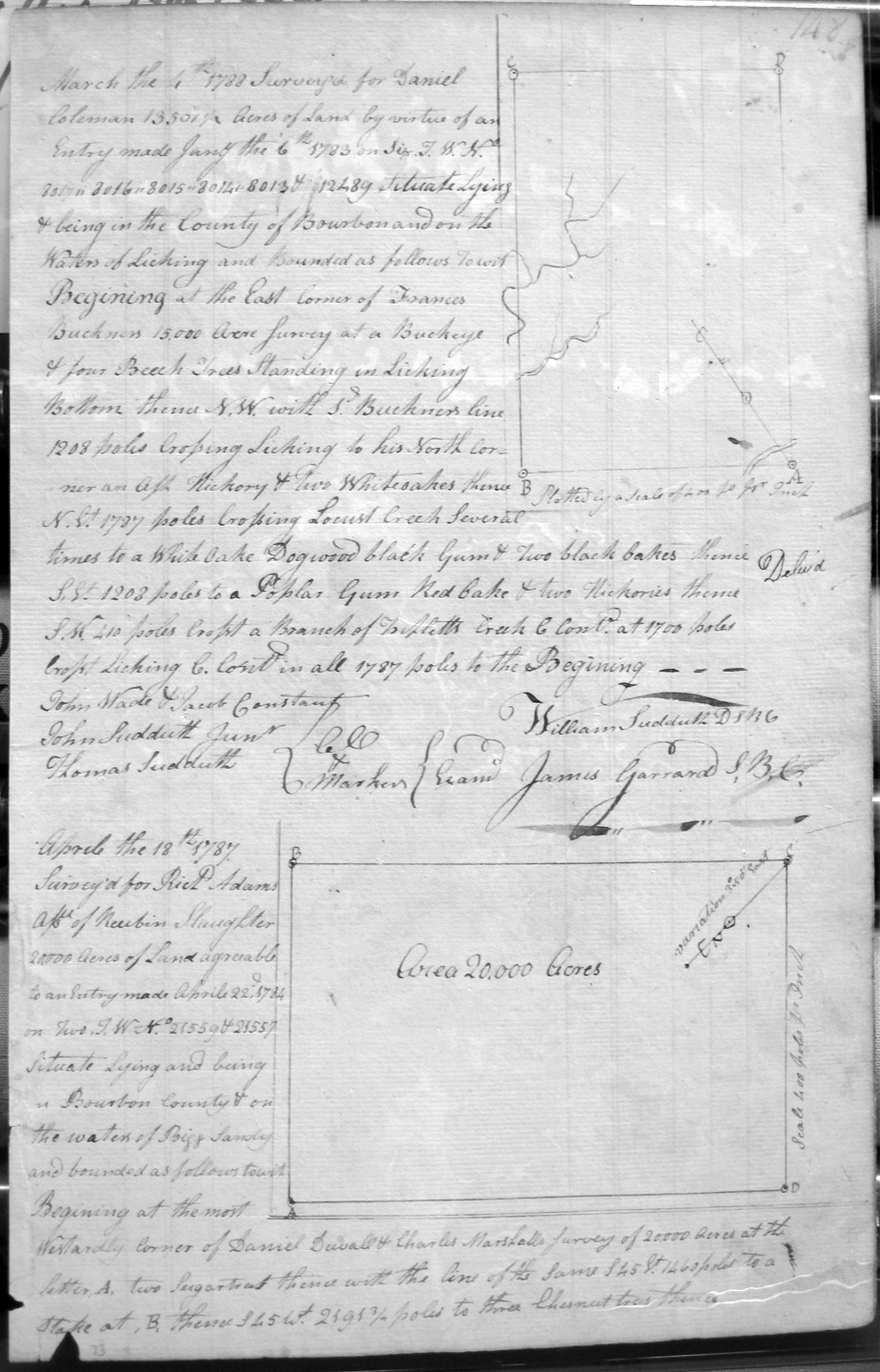
Adams, Rich'd, Assignee of Reubin Slaughter
18 Apr 1787
20,000 acres
On the waters of Bigg Sandy, at the most westerly corner of Daniel Duvall and Charles Marshall's 20,000 acre survey.
Adams, Colo. Richard
24 Apr 1789
2,000 acres
On the waters of Hinkston and bounded by Philip Drake's 1,500 acre survey, and crossing Summerset several times.
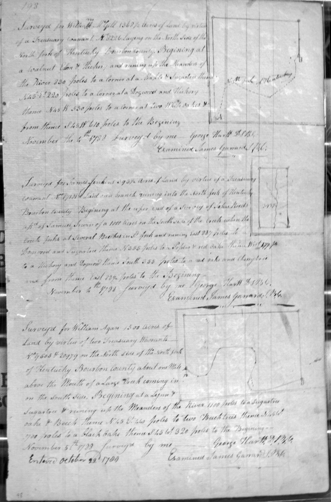
Agan, William
5 Nov 1788
1,500 acres
On the North side of the North fork of Kentucky, about a mile North of the mouth of a Large Creek coming in the South side.
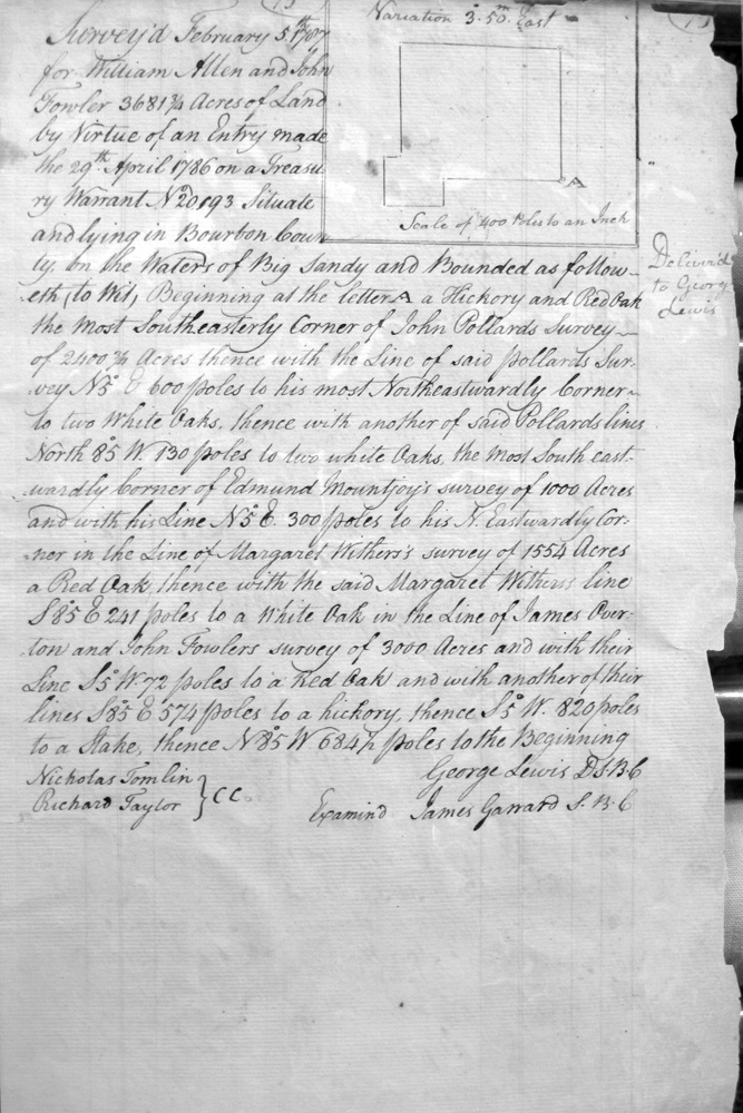
Allen, William & John Fowler
5 Feb 1787
3,681 & 3/4 acres
On the waters of Big Sandy, the most SE corner of John Pollards 2400 acre survey, NE corner of Edmund Mountjoy, Margaret Withers's survey, and James Overton & John Fowler's survey
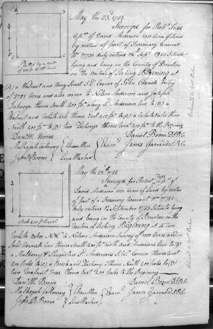
Anderson, David
23 May 1786
1,000 acres
On the waters of Licking, on the lines of Nelson Anderson's 1,000 acre survey and John O'Daniel.
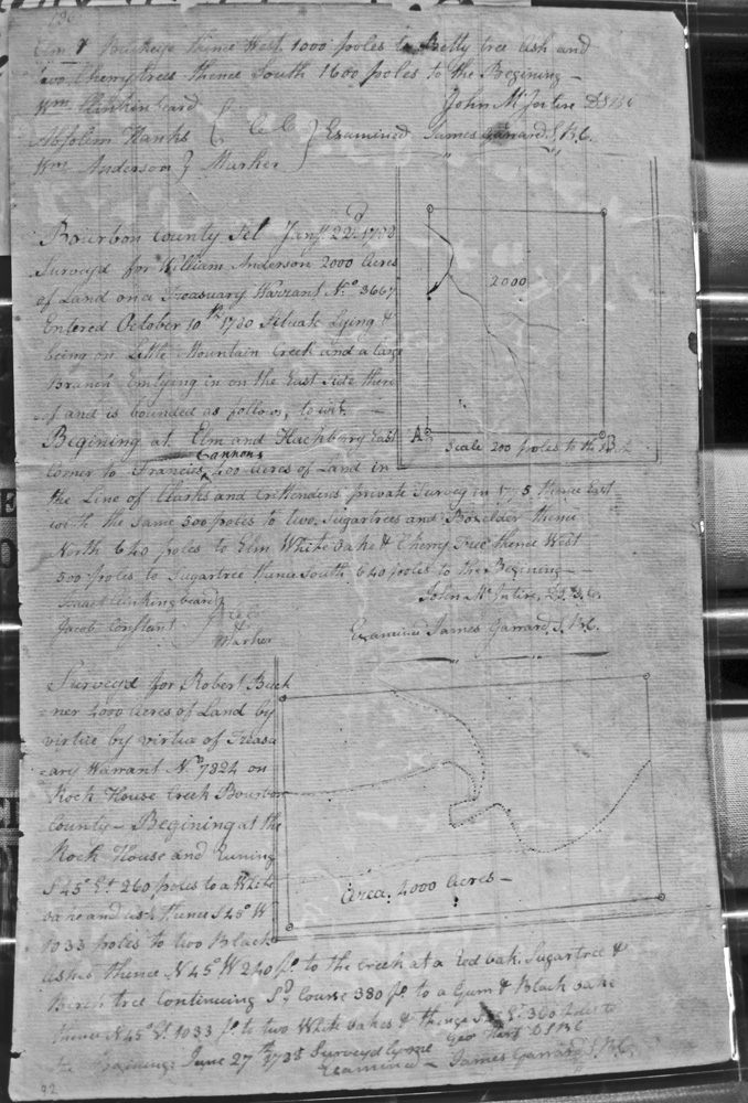
Anderson, William
22 Jan 1788
2,000 acres
On Little Mountain Creek and a large branch emptying in on the East side thereof, and on a line of Francis Cannon's 400 acres in the line of Clark's and Crittenden's private survey in 1775.
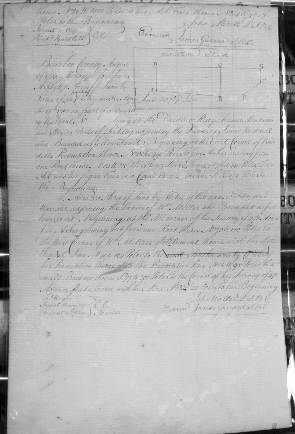
Ashby, Lewis
29 Aug 1788
800 acres
470 acres lying on the dividing ridge between Hinkson's and Stoner's forks of Licking, adjoining the lands of Isaac Ruddell, on the East corner of Ruddell's Preemption.
Also, 330 acres adjoining the lands of Wm. Miller, and on the SE corner of his 470 acres.
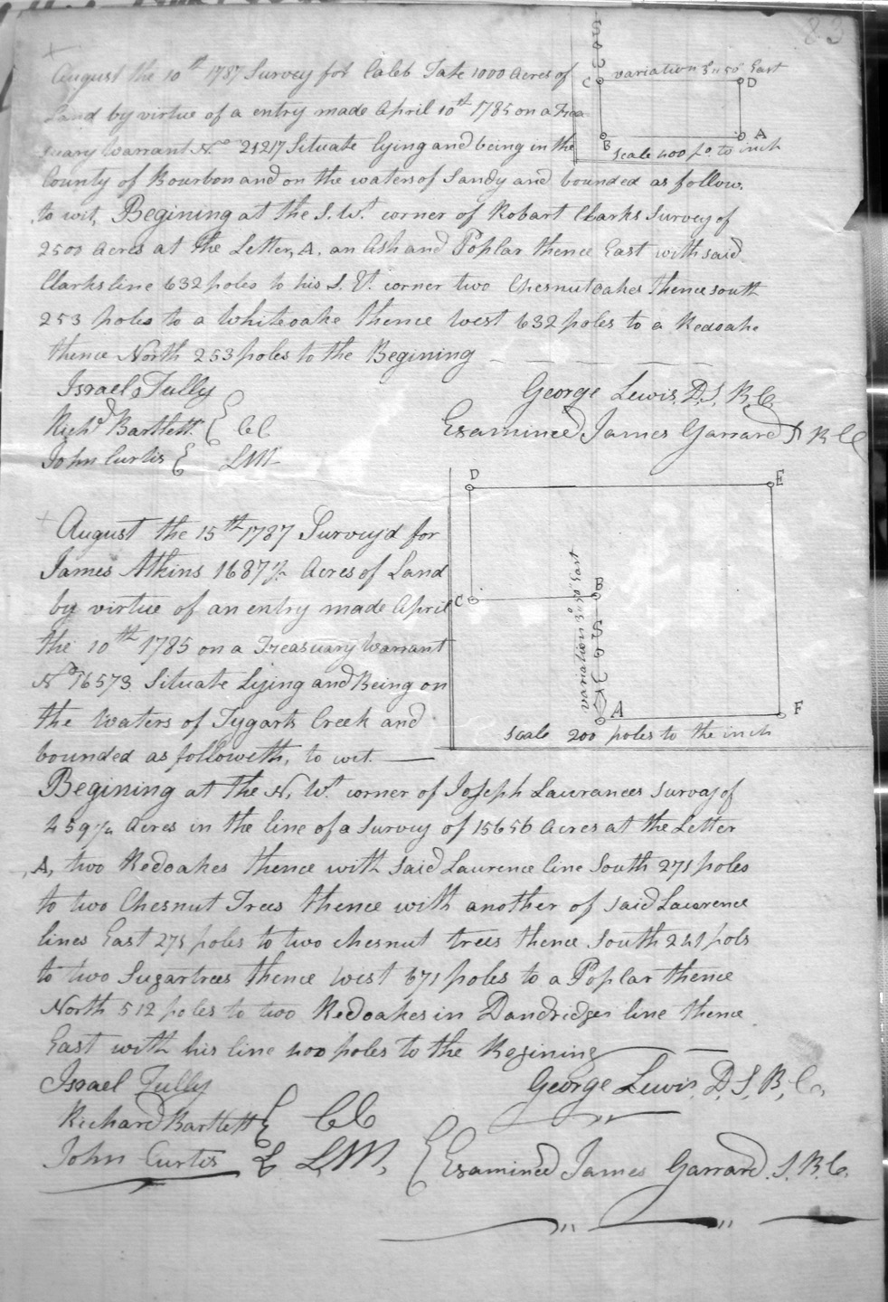
Atkins, James
15 Aug 1787
1,687 1/2 acres
On the waters of Tygart's creek, and on the NW corner of Joseph Laurance's 259 1/4 acres and on Dandridge's line.
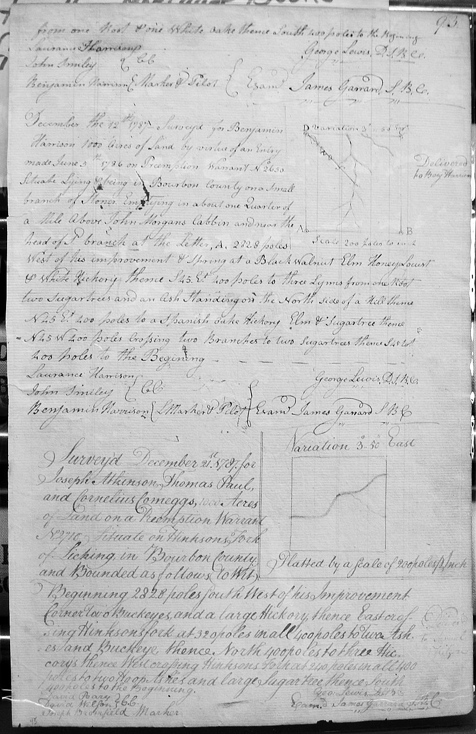
Atkinson, Joseph, Thomas Paul & Cornelius Comeggs
21 Dec 1787
1,000 acres
On Hinkson's Fork of Licking west of his improvement,
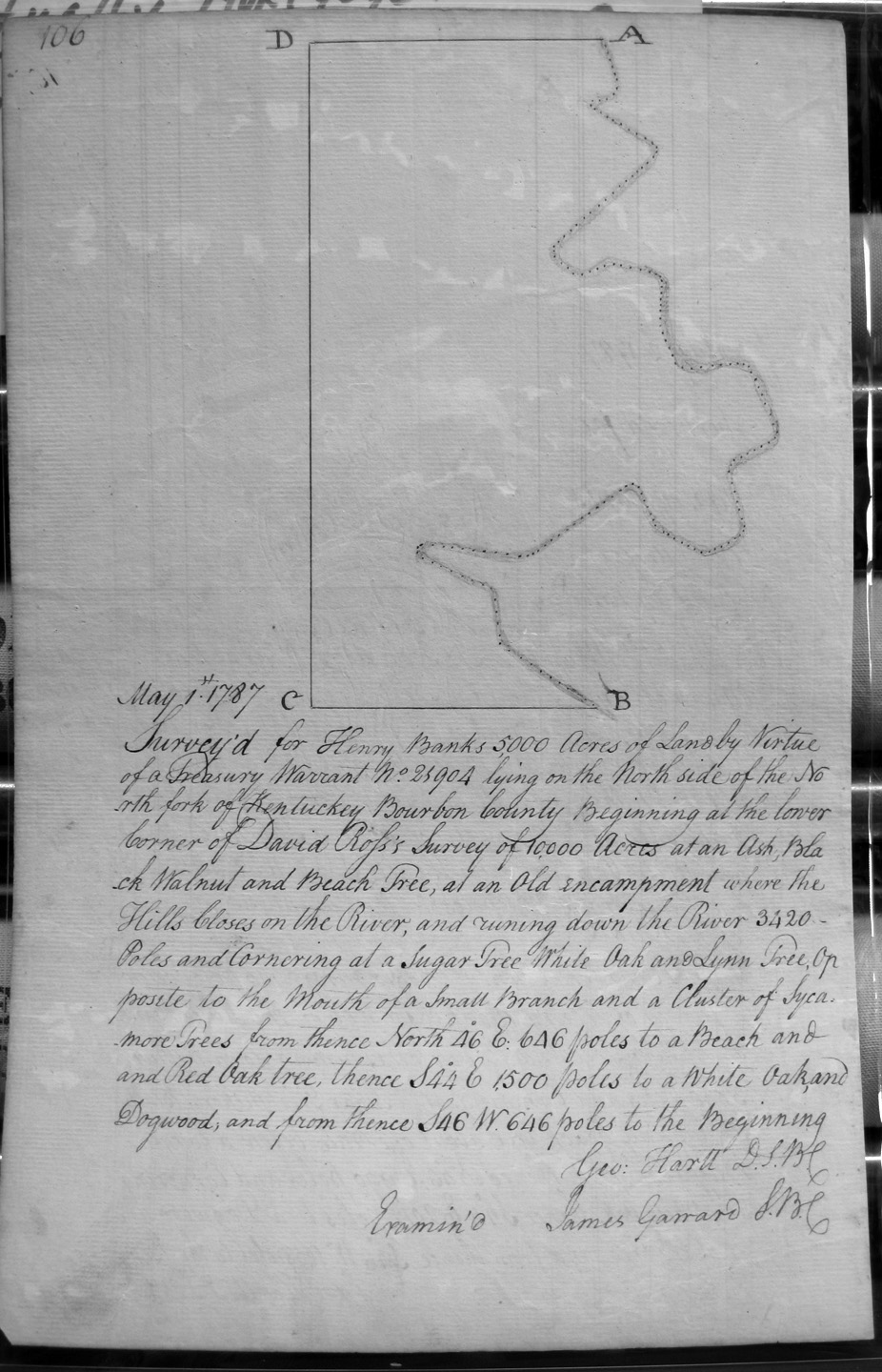
Banks, Henry
1 May 1787
5,000 acres
On the North side of the North Fork of Kentucky at the lower corner of David Ross's 10,000 acre survey, opposite an old encampment where the hills closes.
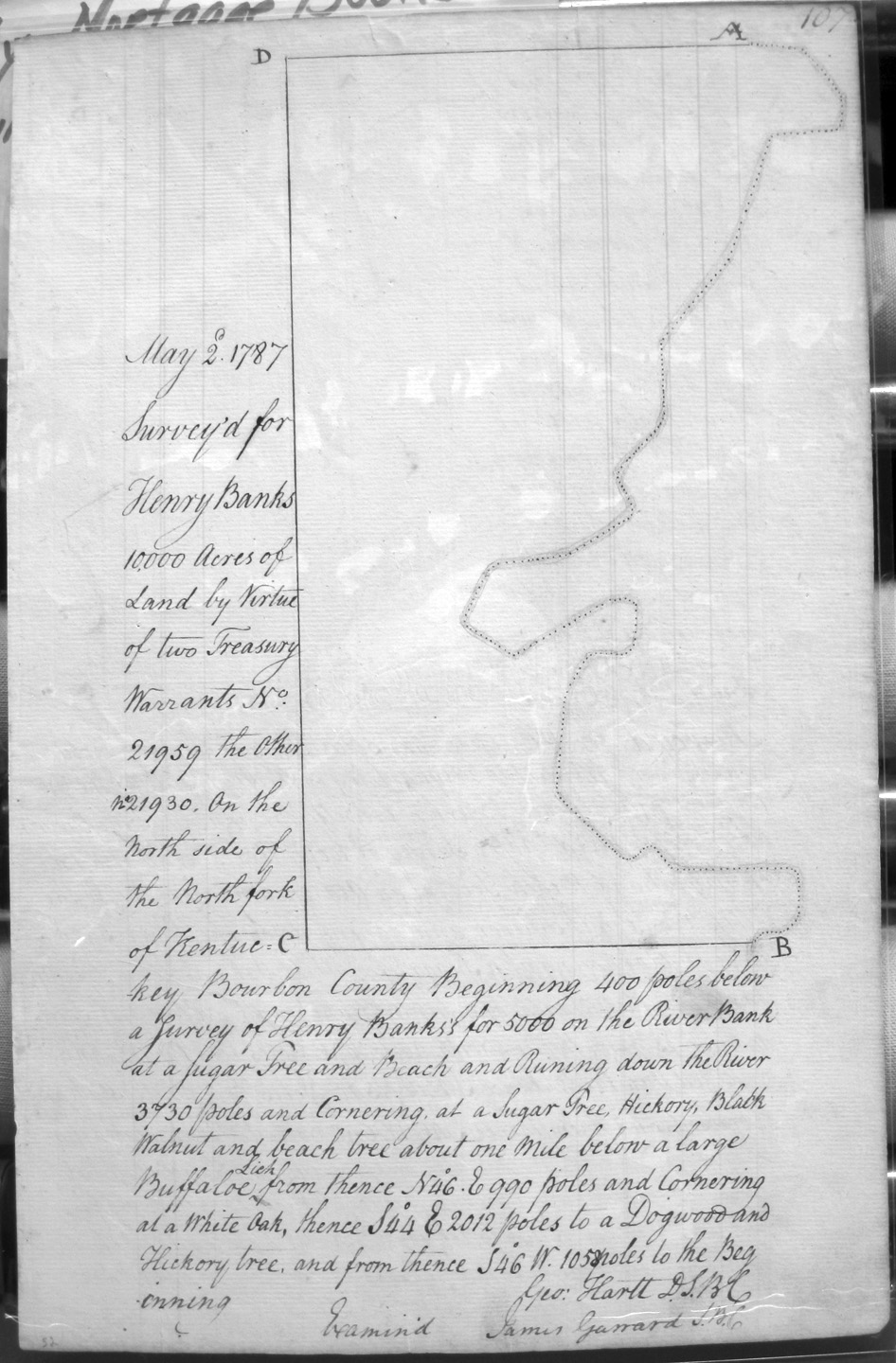
Banks, Henry
2 May 1787
10,000 acres
On the North side of the North Fork of Kentucky on Henry Banks's 5,000 acre survey, to about a mile below an old buffalo lick.
Banks, Henry
1 May 1787
5,000 acres
On the South side of the North Fork of Kentucky.
Beech, Robert
27 June 1788
4,000 acres
On Rock House Creek.
Bennett, Daniel and Charles Morgan
26 July 1786
1,000 acres
Near Richard Rexey's NE corner, on Grimm and Morgan's line, crossing branches of Grassey Lick and Stoners Fork creeks
Bell, James and Hannah
Page 247
26 Mar 1789
1,875 acres
On the Waters of Licking and near the mouth of Foxes Creek, bounded by the NE corner of the 20,000 acre survey of John Carter Littlepage.
Bell, John Assignee of William Jones
11 Aug 1787
4,000 acres
6 miles SW from the head of Little Sandy creek to the west corner of William Hickman's 35,000 (?) acre survey and with his line.
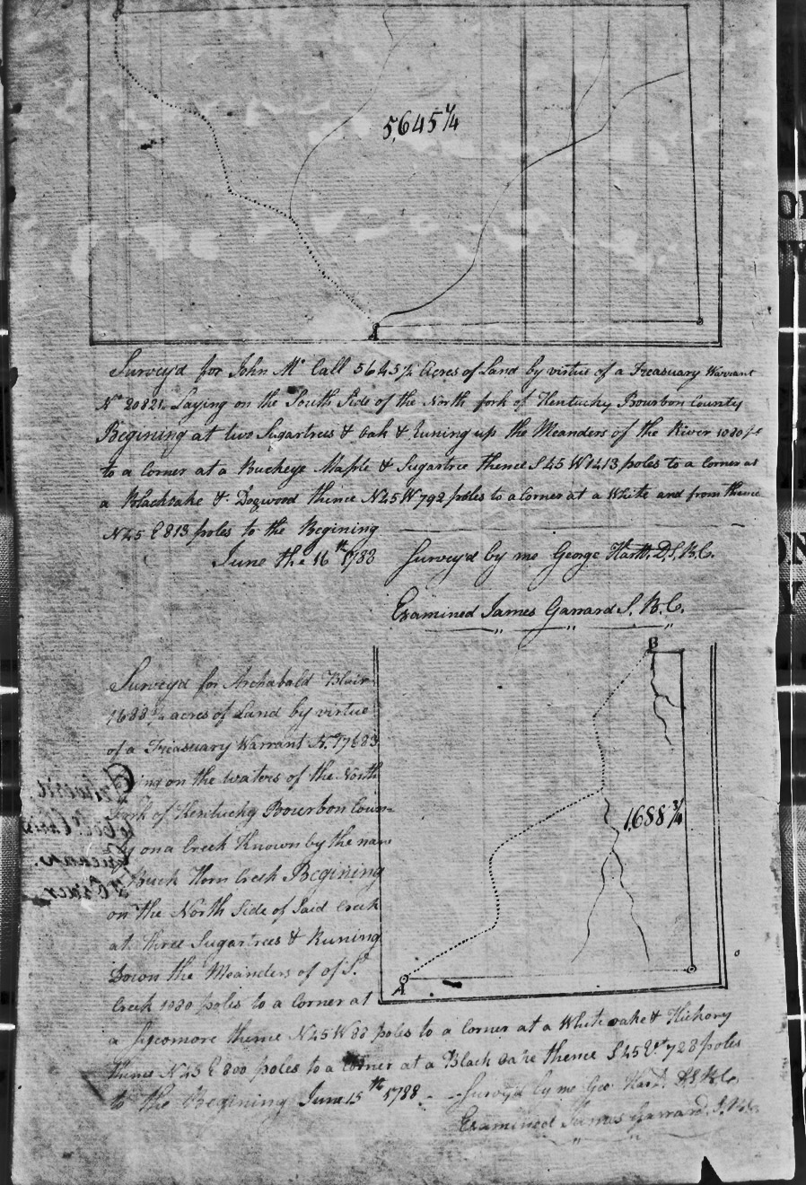
Blair, Archibald
15 June 1788
1688 3/4 acres
On the waters of the north fork of the Kentucky
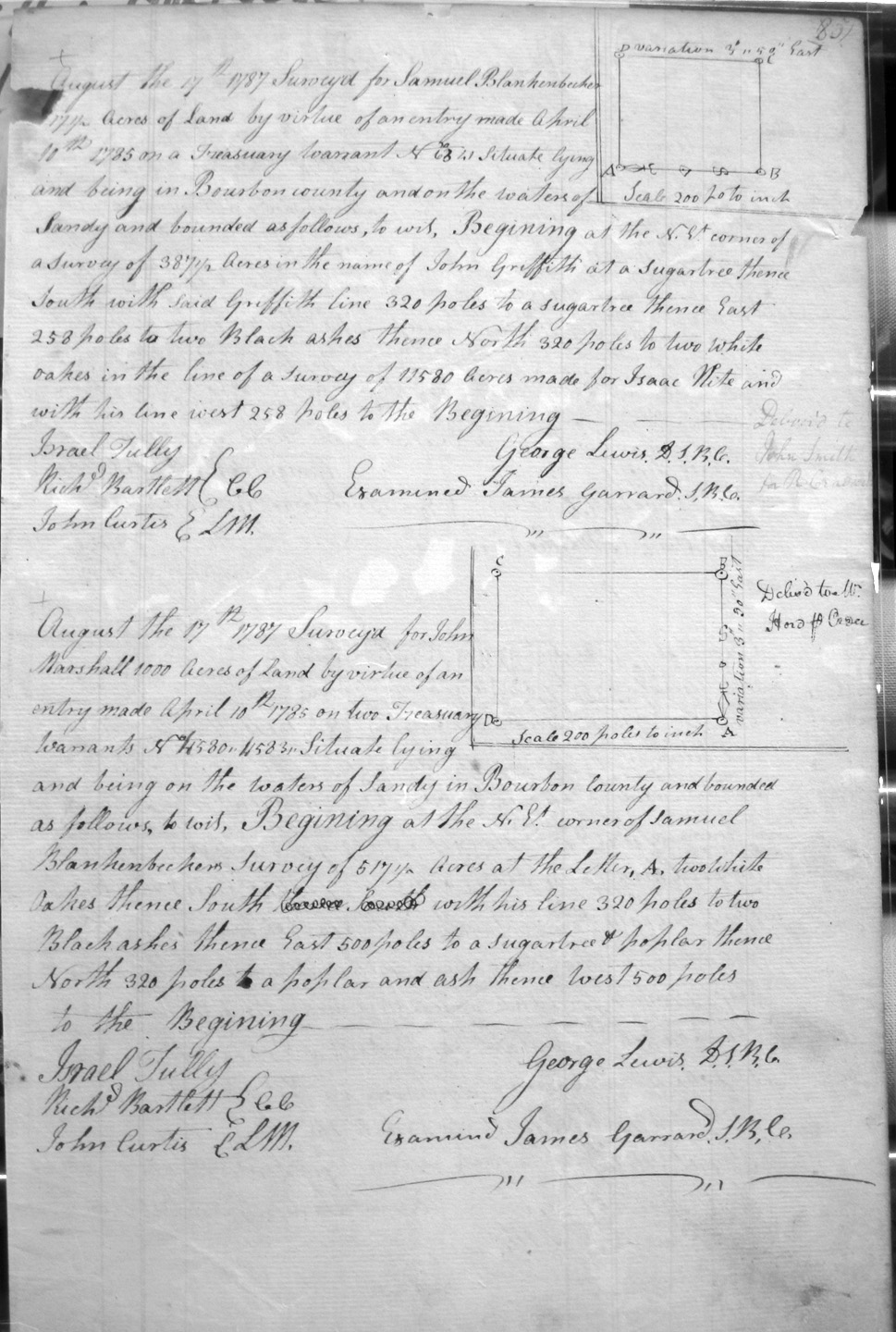
Blankenbecker, Samuel [or Blankenbaker]
17 Aug 1787
_17 1/2 (?) acres
On the waters of Sandy, and on the NE corner of John Griffith's 387 1/2 acre survey, and Israel Hite's 11,580 acres.
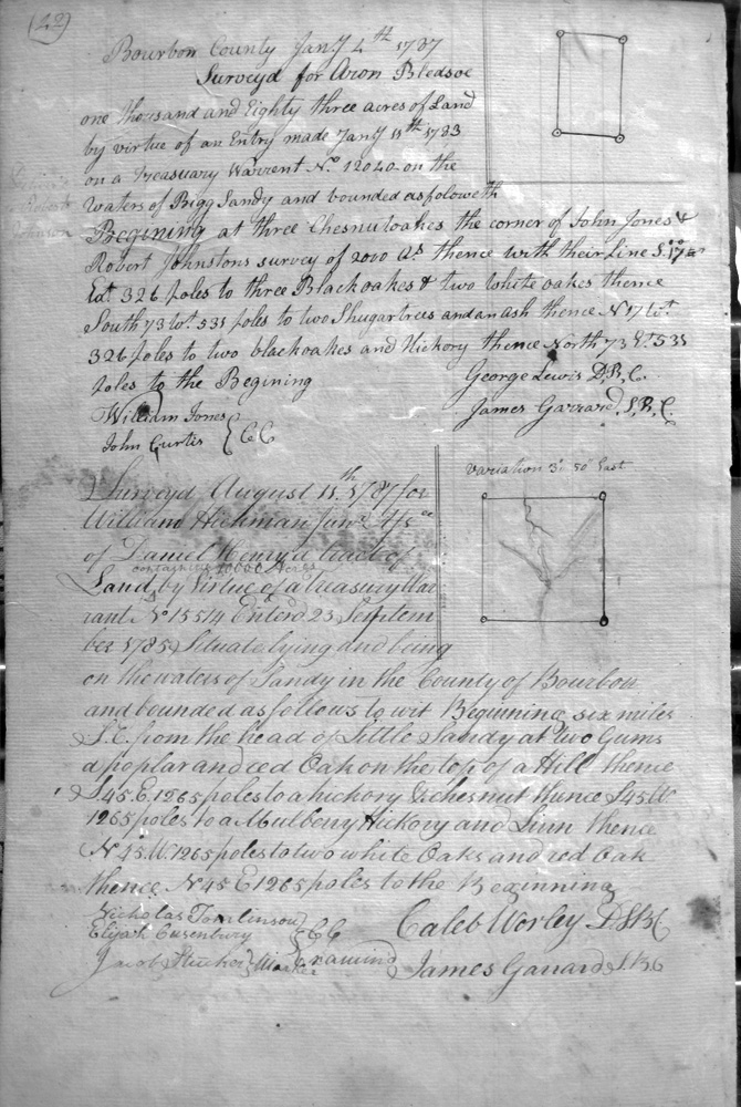
Bledsoe, Aron
4 Jan 1787
1,038 acres
On the waters of Bigg Sandy and the lines of John Jones and Robert Johnston's 2,000 acre survey.
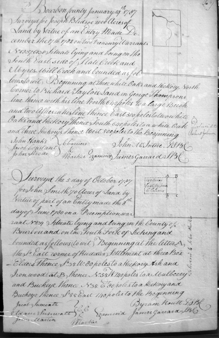
Bledsoe, Joseph
19 Jan 1787
2,000 acres
On the SE side of Slate Creek and Myars Mill Creek, on Richard Taylor's land in George Thompson's line.
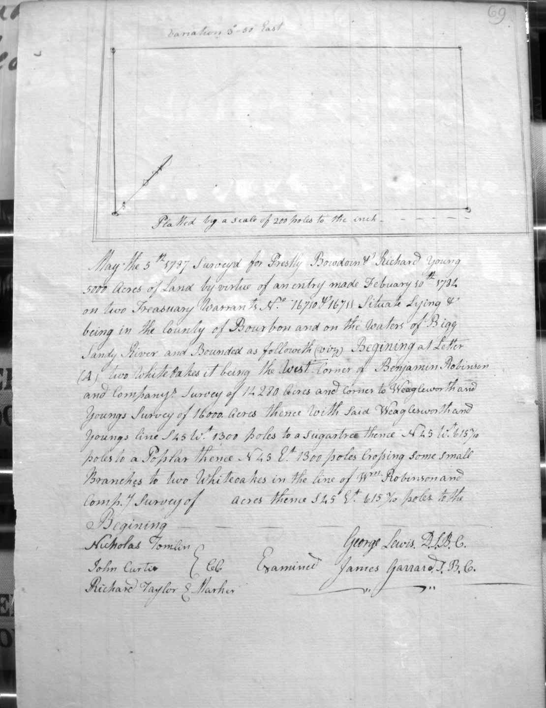
Bodoin, Prestley, and Richard Young
5 May 1787
5,000 acres
On the waters of Bigg Sandy River, and on the lines of Benjamin Robinson & Company's 14,280 acre survey, Weagleworth and Young's 16,000 acre survey, and Wm. Robinson and Company's __(left blank)___ acre survey.
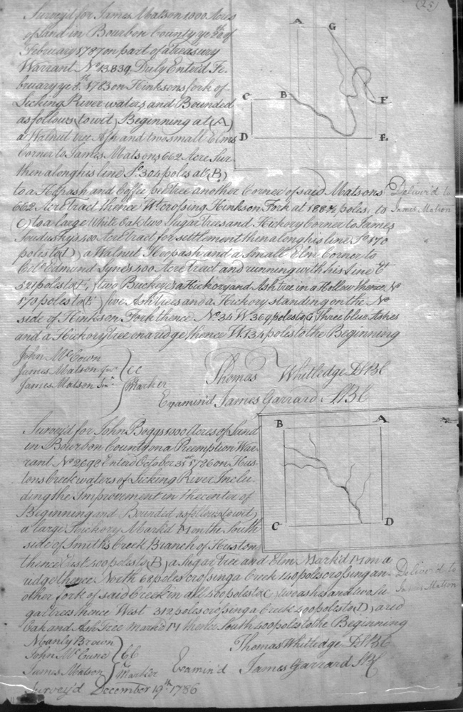
Boggs, John
31 Oct 1786
1,000 acres
On Houston's creek waters, on the south side of Smiths creek branch of Houston
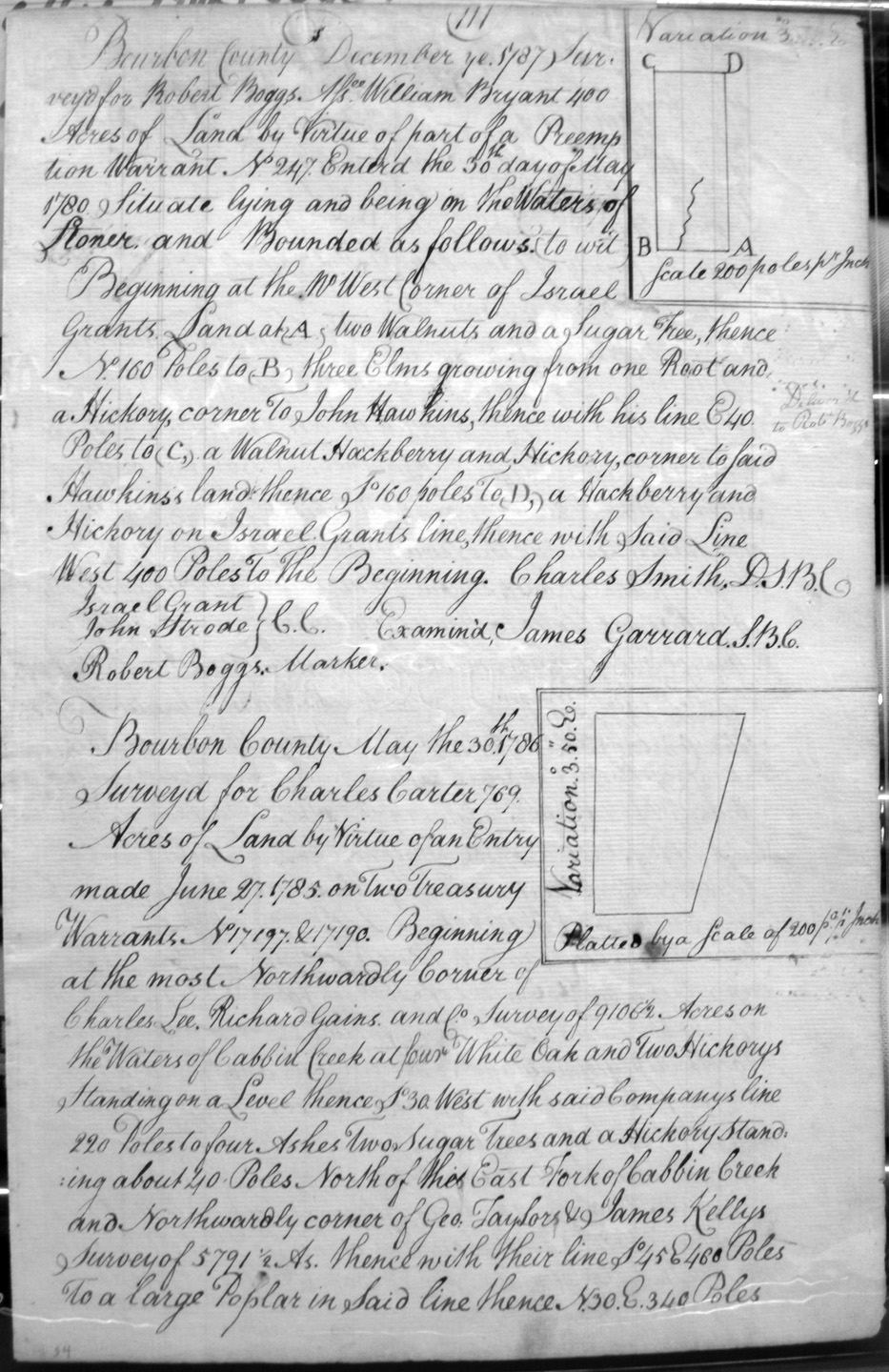
Boggs, Robert, Assignee of Wm. Bryant
1 Dec 1787
400 acres
On the waters of Stoner's Fork of Licking and on the NW corner of Israel Grant's land and the line of John Hawkins.
Bolling, Robert Jr.
15 Aug 1787
5,000 acres
On the most westerly corner of James Monroe's survey of 22,656 1/2 acres
Brent, Charles
6 Jan 1787
1,125 Acres
On the Little Salt Spring fork of Licking, on the lines of John Groves' 1,000 acre survey,
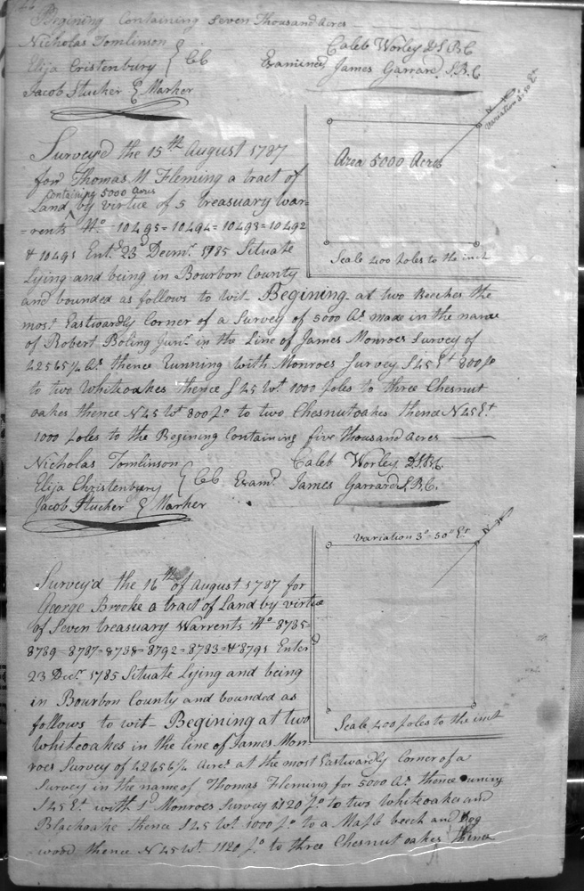
Brooke, George
16 Aug 1787
7,000 acres
On the lines of Thomas Fleming's 5,000 acre survey and James Monroe's 42,565 1/2 acre survey.
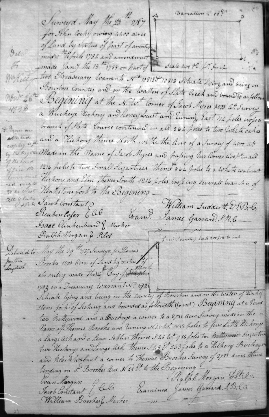
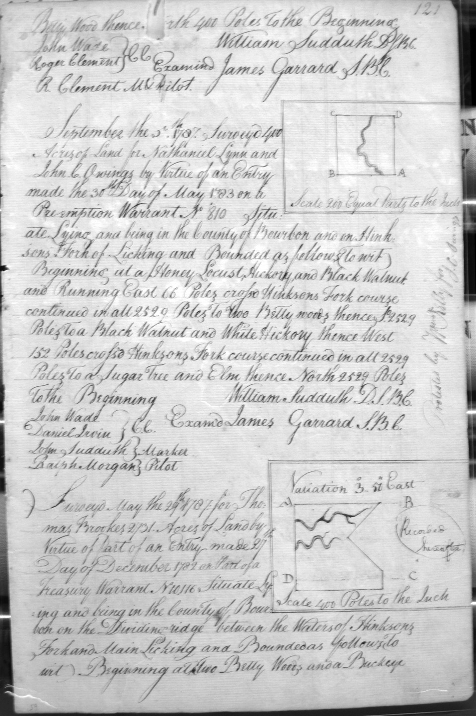
Brooks, Thomas
29 May 1787
On the waters of Hinkston's fork of Licking, and in the lines of Thomas Brookes 2,735 acre survey.
Brookes, Thomas
29 May 1787
2,731 acres
On the dividing ridge between the waters of Hinkson's Fork and Main Licking, on the lines of Thomas Swearingen's ___ acre survey,
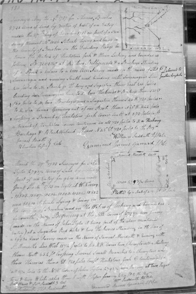
Brooks, Thomas
29 May 1787
2,731 acres
On the dividing ridge between Hinkston's fork and Main Licking, on the line of Thomas Swearingen's 1,000 acre survey.
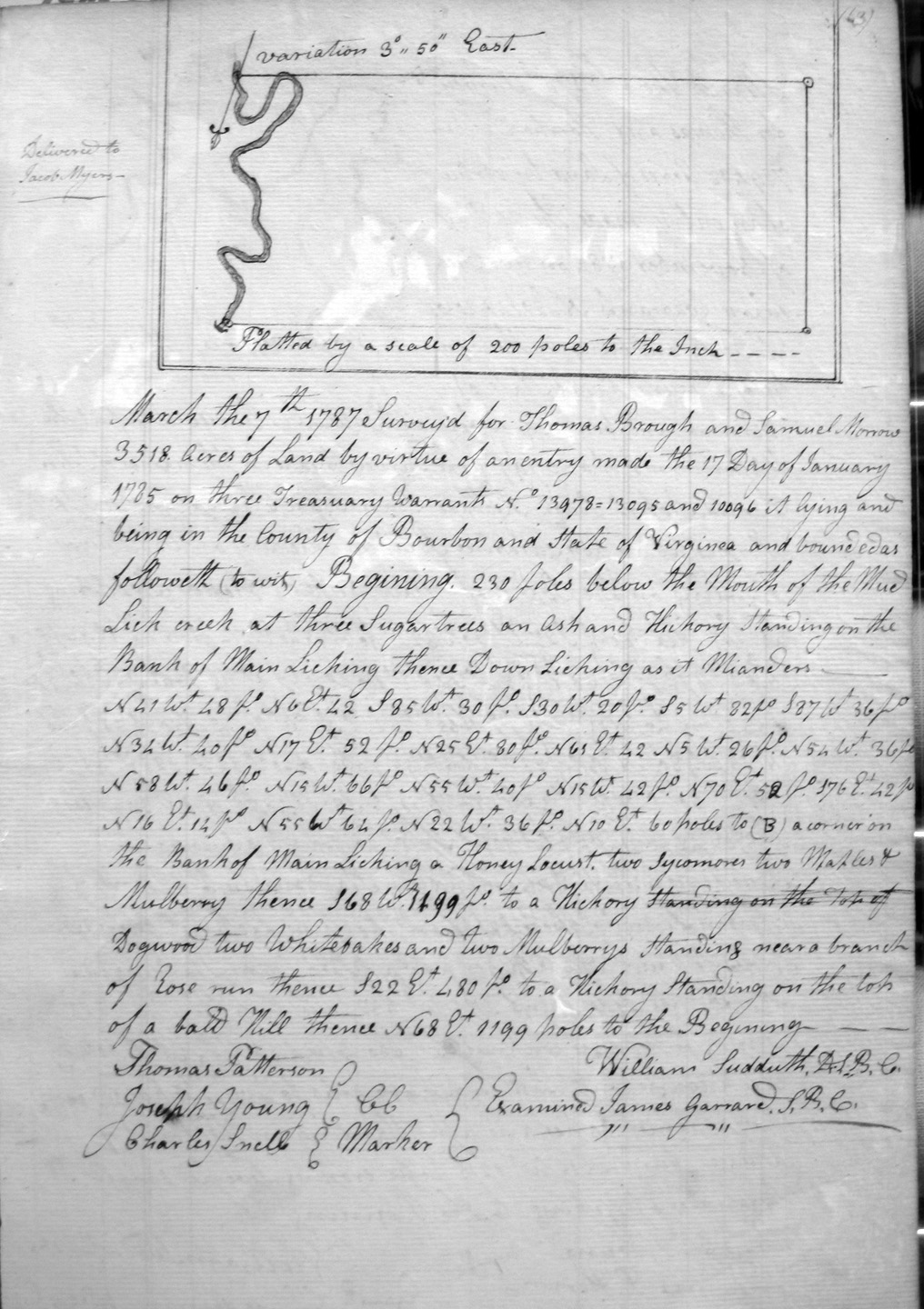
Brough, Thomas & Samuel Morris
7 Mar 1787
3,518 acres
Situate in Bourbon County and the State of Virginia,, below the mouth of Mud Lick and on the bank of Main Licking following down its meanders.
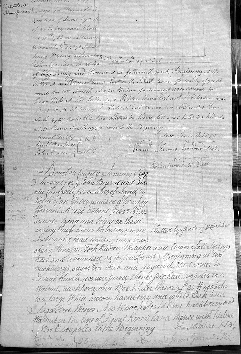
Bryant, John & David Campbell
17 Jan 1787
1,000 acres
On the dividing ridge between the waters of Main Licking and the head waters of the largest branches of Hinkson's fork between the upper and lower salt spring trace, on the E corner of Deval Keever's land [also spelled "Kever"].
Brynham, Richard & John Reed
20 Nov 1788
3,000 acres
On the North side of the South fork of Kentucky, along a place known by the Sand lick in the river
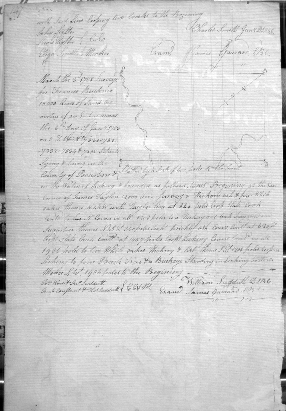
Buckner, Francis
3 Mar 1788
15,000 acres
On the waters of Licking, on the lines of James Taylor's 12,000 acres, crossing Slate Creek and Licking.
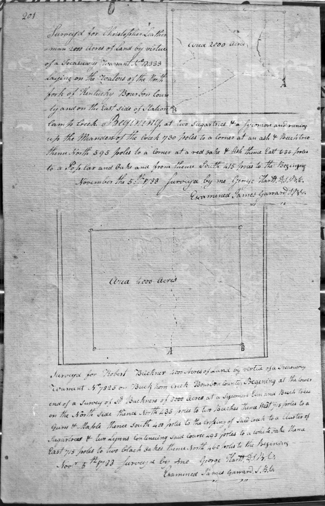
Buckner, Robert
5 Nov 1788
4,000 acres
On Buck Horn creek, on the lower end of Sd. Buckner's 3,000 acre survey,
Burton, Charles
22 Aug 1787
3,000 acres
On the waters of Bigg Sandy and on the NW corner of James McCray's 8,000 acre survey
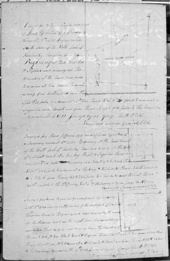
Byan, James
4 (or 11) Nov 1788
551 3/4 acres
On the waters of North fork of Kentucky, on a creek known as Troublesome
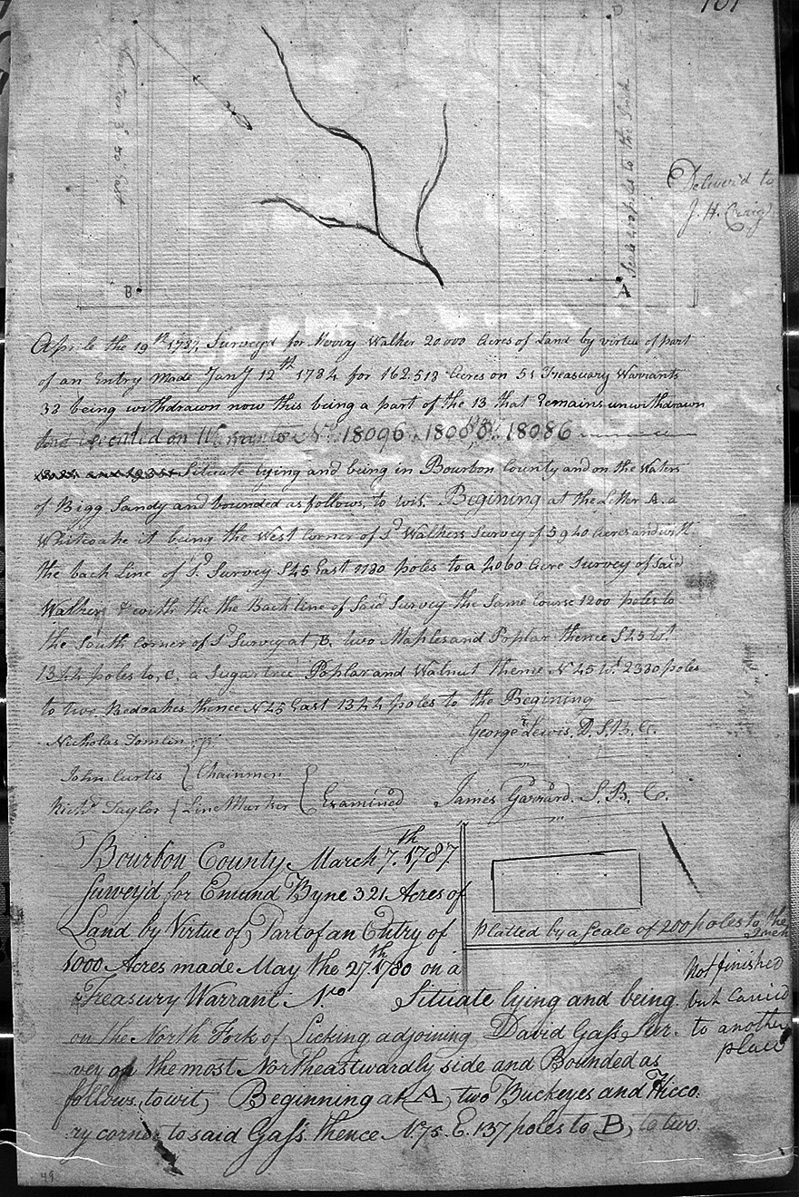
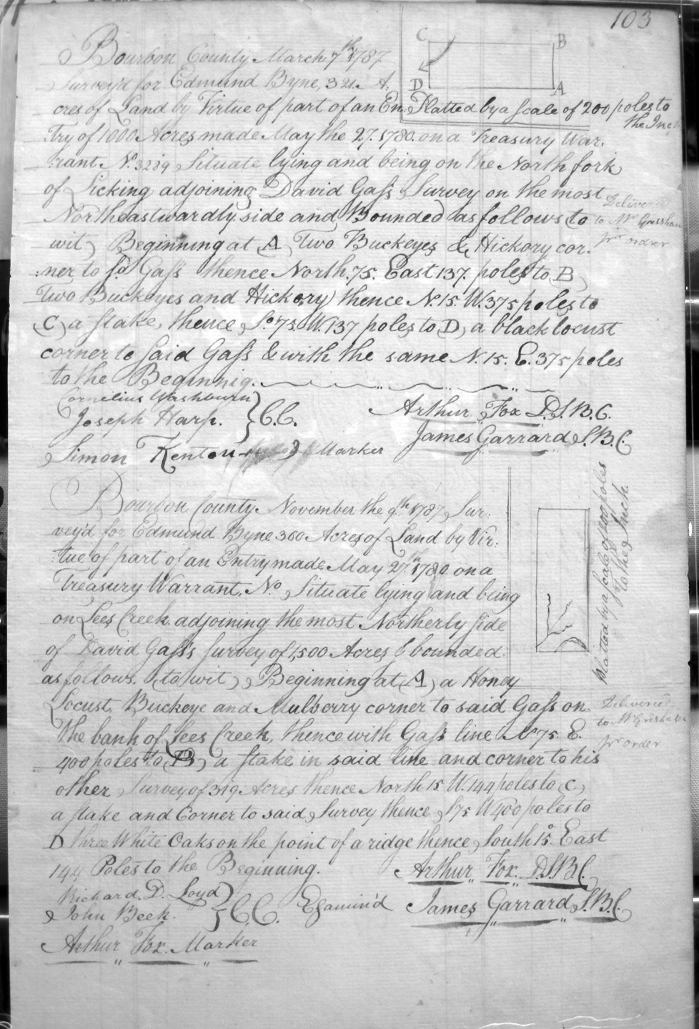
Byne, Edmund
7 Mar 1787
321 acres
On the waters of the North Fork of Licking on the lines of David Gass's survey on the most northeastwardly side.
Byne, Edmund
7 Mar 1787
321 acres
On the waters of the North Fork of Licking on the lines of David Gass's survey.
Byne, Edmund
9 Nov 1787
360 acres
On the waters of the Lee's creek and adjoining on the most northerly side of David Gass's 1,500 acres, and his other survey of 319 acres.
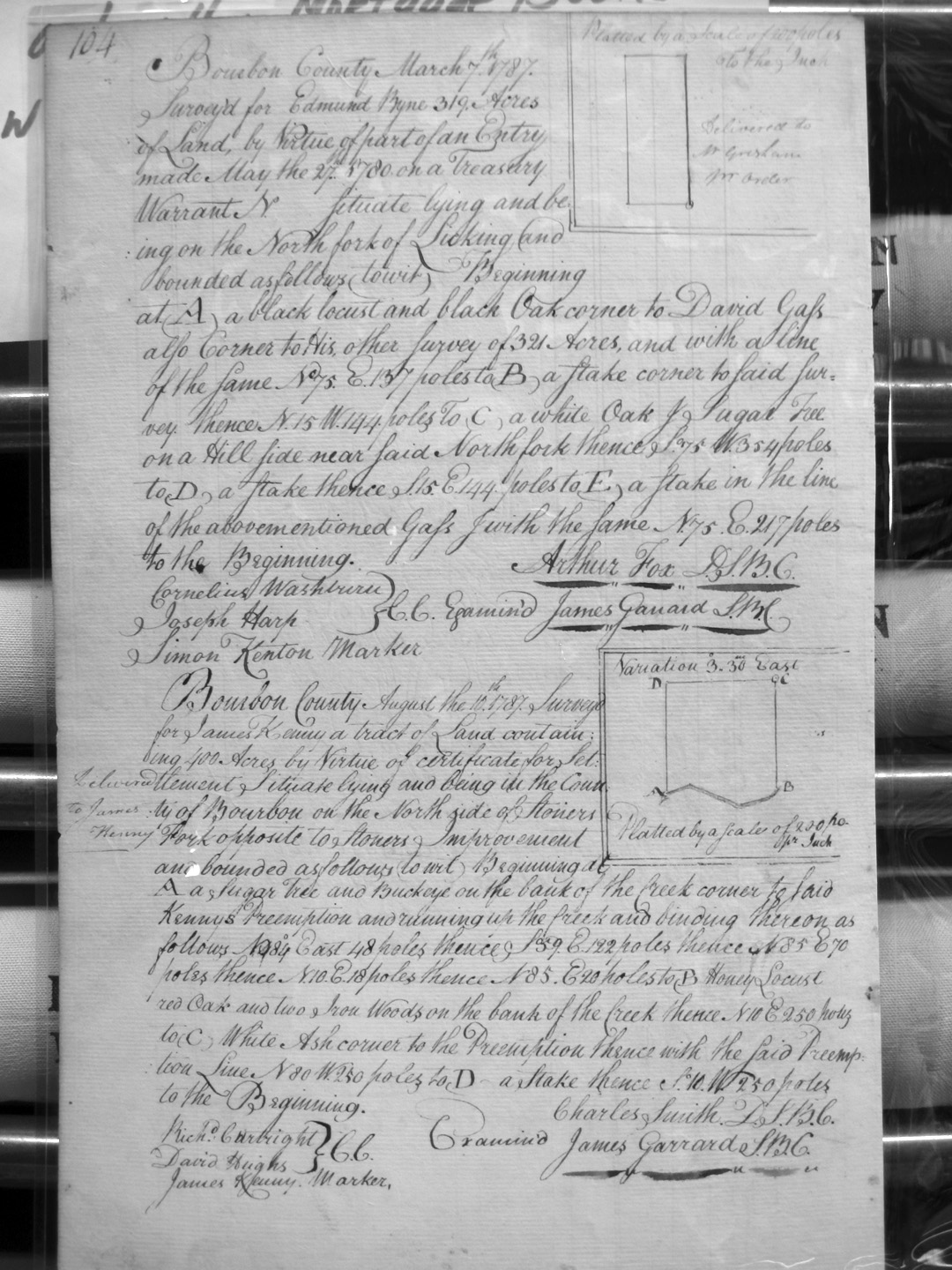
Byne, Edmund
7 Mar 1787
319 acres
On the waters of the North Fork of Licking on the lines of David Gass's survey and his other 321 acre survey.
Caldwell, George
30 Nov 1786
1,000 acres
On the South side of the South fork of Licking, on the upper corner of John Morton's 3,000 acre survey.
Caldwell, George
2 June 1787
1,000 acres
On the South side of the South Fork of Licking, adjoining the 3,000 acre survey of John Morton on the upper side.
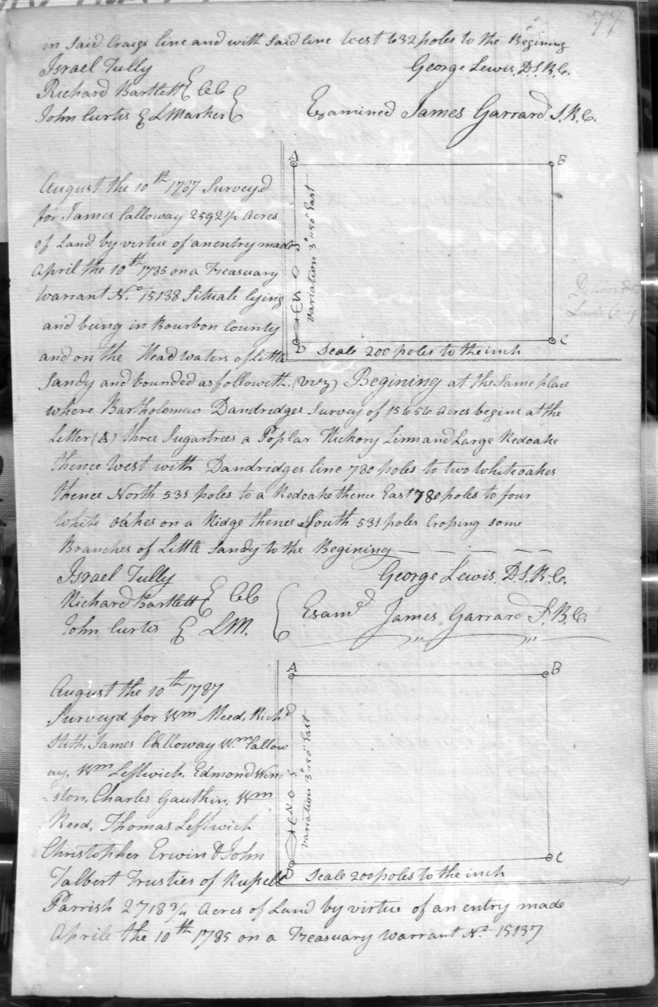
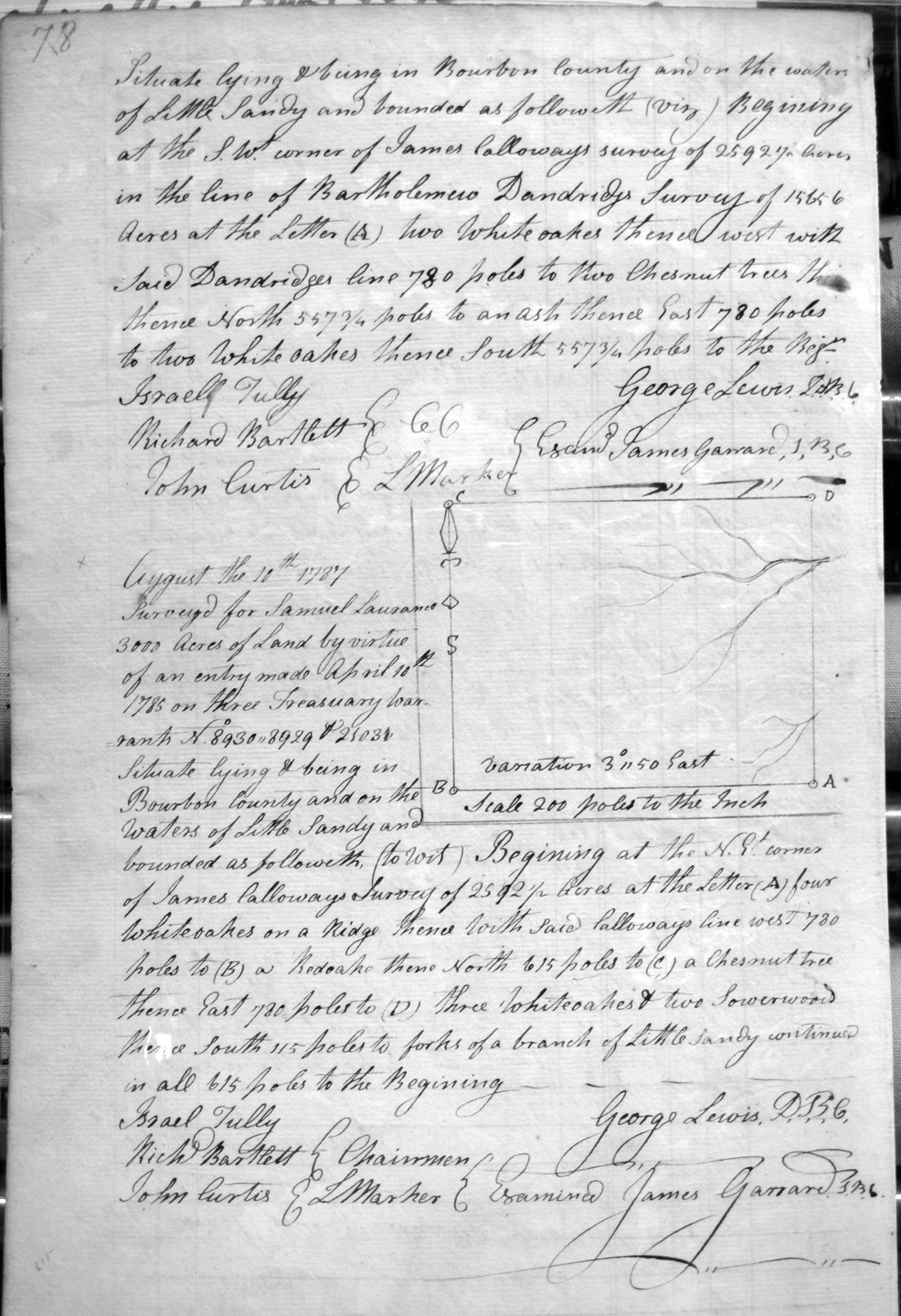
Calloway, James
10 Aug 1787
2,592 1/2 acres
On the headwaters of Little Sandy, on the lines of Bartholomew Dandridge 15,656 acre survey.
Calloway, James, Wm. Calloway, Wm. Leftwich, Edmond Winston, Charles Gauthin, Wm Reed, Thomas Leftwich, Christopher Erwin & John Talbert, Trustees of Russell Parrish
10 Aug 1787
2,718 3/4 acres
On the waters of Little Sandy, on the lines of James Calloway's 25, 927 acre survey and Bartholomew Dandridge's 15,656 acre survey.
Calwell (or Caldwell ?), George
23 Mar 1789
300 acres
On the South side of the North Fork of Licking, bounded by the lower corner of James McElroys 750 acre survey at the South bank of said fork at the lower side of a small run, then with McElroys line and following the meanders of the fork.
Campbell, Charles
29 Nov 1786
2,000 acres
On Johnson's Fork of Licking adjoining the S side of John Peters' Settlement, a Branch of Felmmins Fork
Campbell, James
No date
2,000 acres
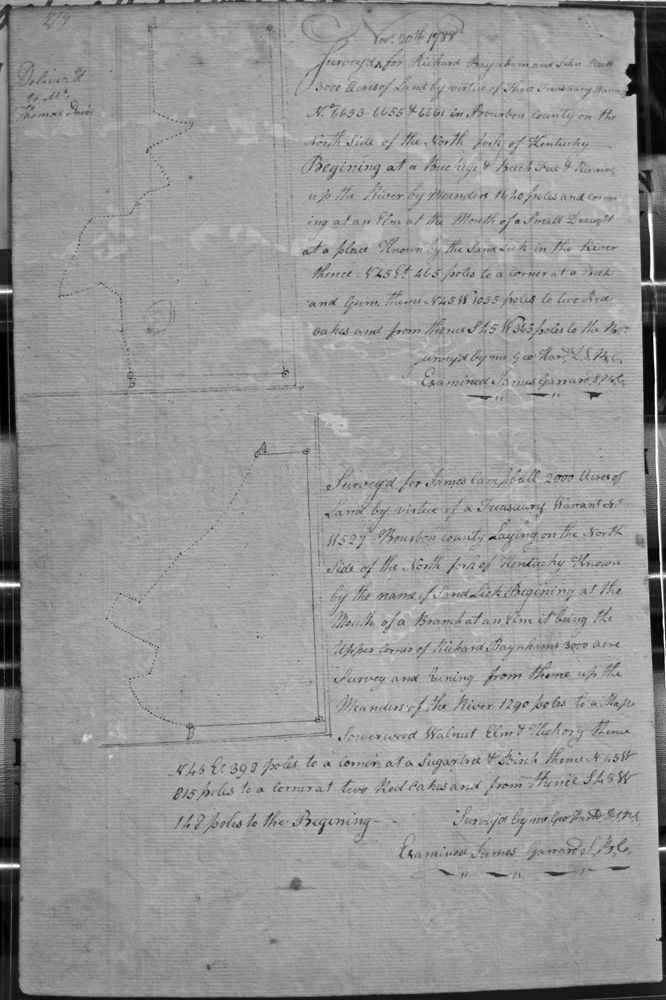
Lying on the North side of the North fork of Kentucky, known by the name of Sand Lick, It being the upper corner of Richard Baynham's 3,000 acre survey.
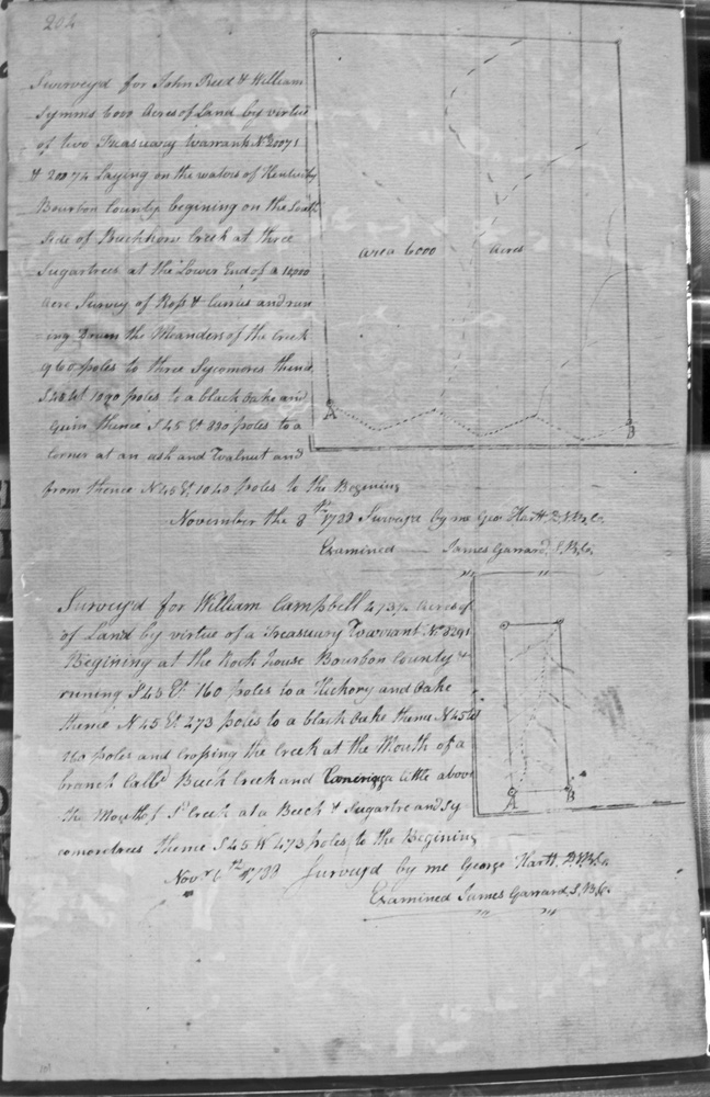
Campbell, William
6 Nov 1788
473 1/4 acres
Beginning at the Rock House, crossing the creek at a branch called Buck creek.
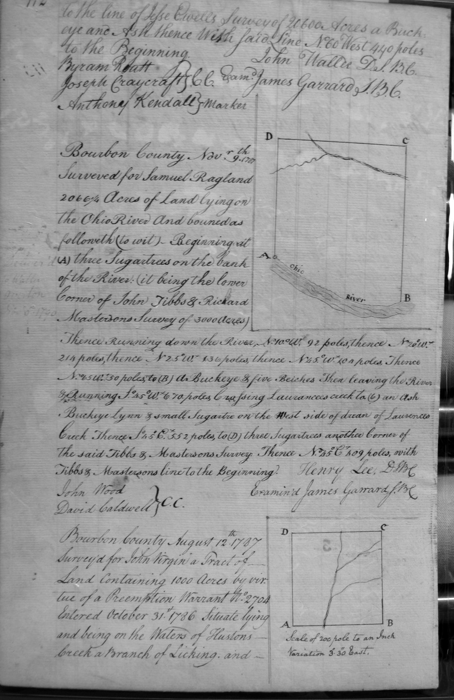
Carter, Charles
30 May 1786
767 acres
On the most northerly corner of Charles Lee, Richard Gains & Co's 9,106 1/2 acre survey on the waters of Cabbin Creek, and onto the East Fork of Cabbin Creek on the lines of Geo. Taylor and James Kelley's 5,791 1/2 acre survey, and the line of Jesse Ewell's 20,600 acre survey.
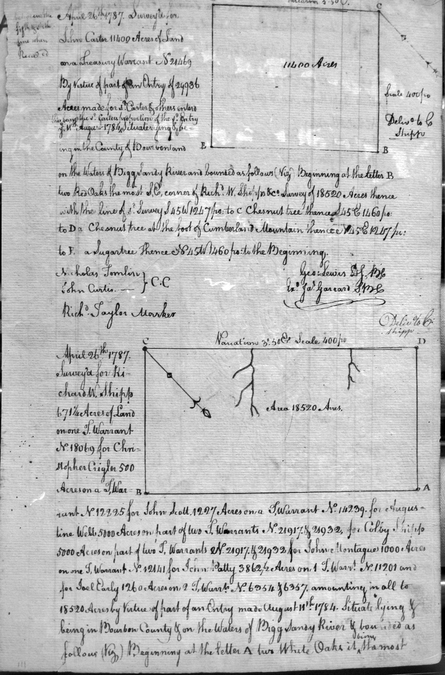
Carter, John
26 Apr 1787
11,400 acres
Part of an entry of 29,336 acres, on the waters of Bigg Sandy river, on the most SE corner of Richard E. Shipp's survey of 18,520 acres and on the base of Cumberland Mountain.
Cartwright, John
19 Mar 1789
4,000 acres
On the waters of Lulgerbrud, and bounded by the 316 acre survey of James McMillions.
Cartright, Thomas
10,000 acres
On the lines of Henry Banks's 5,000 acres.
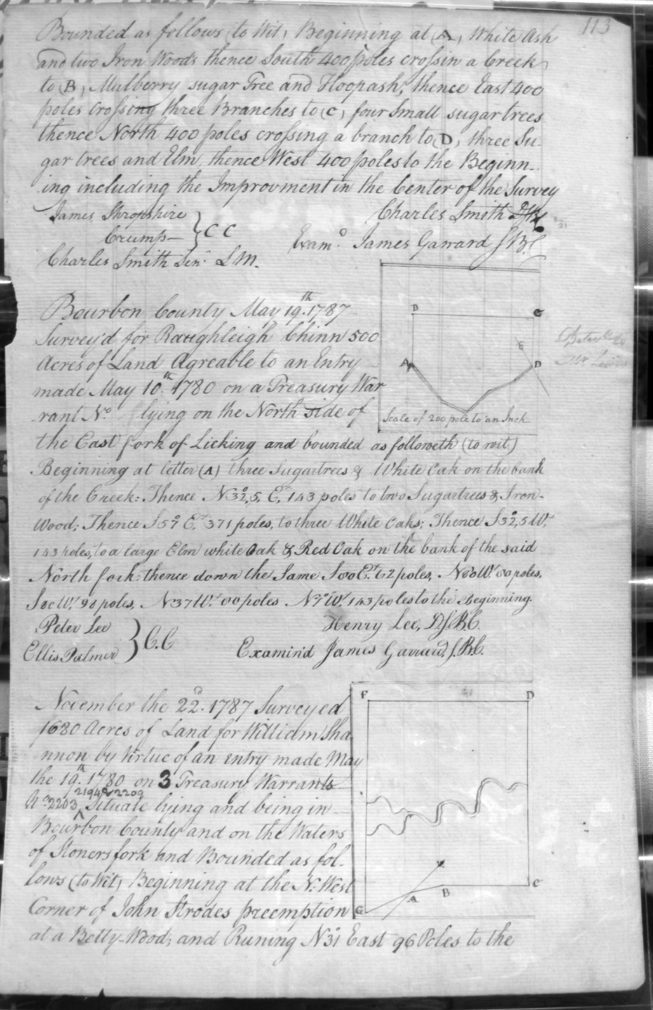
Chinn, Raughleigh
19 May 1787
500 acres
On the North side of the East side of Licking.
Chinn, Rawleigh
no date on an entry made 17 Apr 1787
2,883 acres
On the waters of the Ohio River and Bigg Sandy, and from the lower corner of the 2,883 acre survey of William Marshall, and on the 10,000 acre survey of William Grason.
Chinn, Rawleigh
1 Mar 1787
2,959 acres
With Chinn's line to the line of Grayson, to J.O.A. Down's 20,500 acre survey, with Hugh Storets (?) 14,906 1/4 acre survey, and E Logwood's 1,000 acre survey.
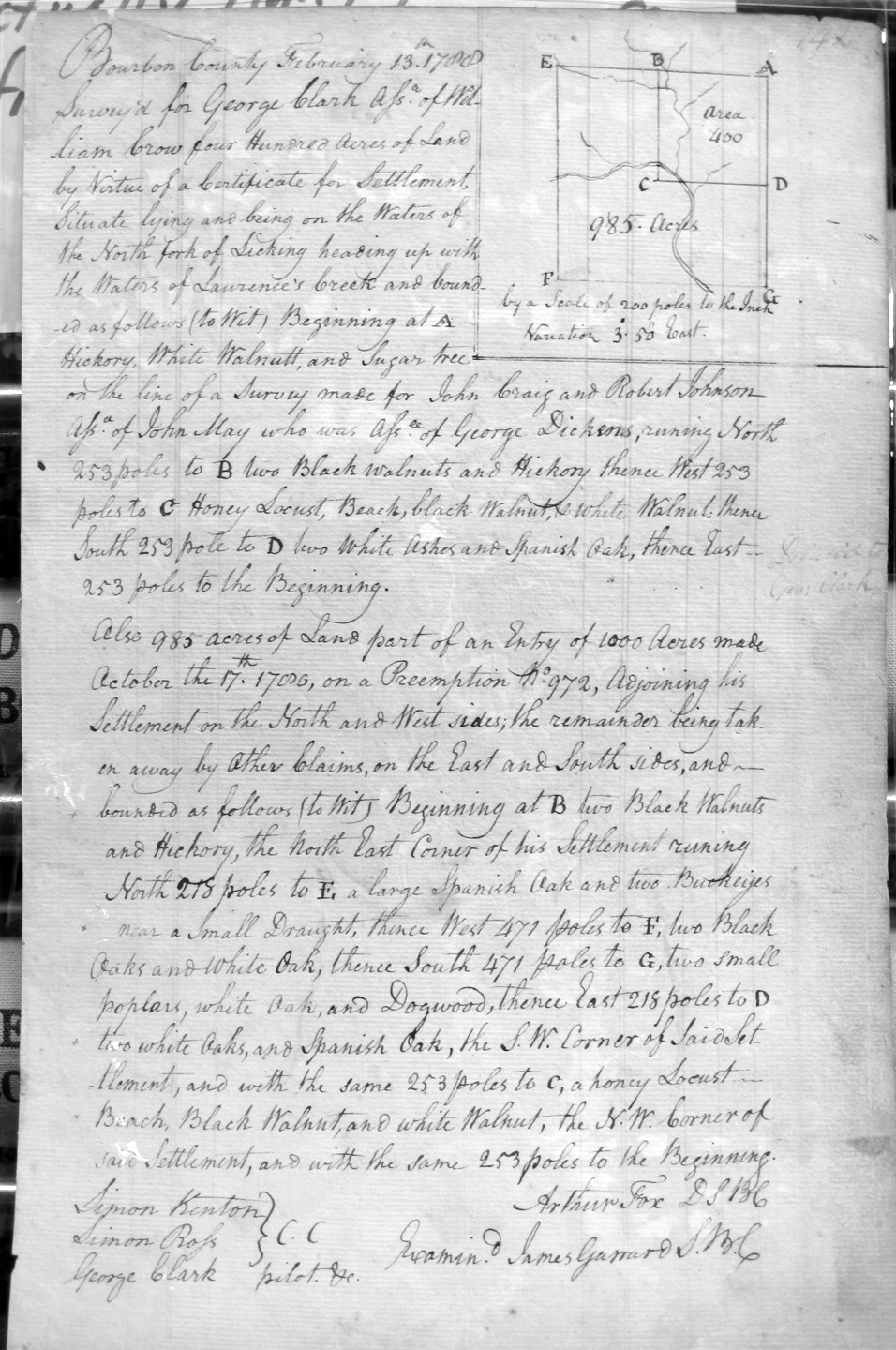
Clark, George, Assignee of William Crow
13 Feb 1788
1,385 acres
400 acre settlement on the waters of North Fork of Licking heading up the waters of Laurence's creek, on the lines of John Craig and Robert Johnson, Assignees of John May, Assignee of George Dickson's survey.
And, 985 acres on the South and West sides of his settlement.
Clark, James (? torn page)
3 Apr 1788
9.000 acres
On the waters of Bigg Sandy and on the lines of John May and David Ross 25,000 acre survey, and in the line of the 10,000 acre survey of Thomas Marshall Jr., and John & William Miller and
Clark, James
7 Apr 1788
9.000 acres
On the waters of Bigg Sandy and on the lines of John May and David Ross 25,000 acre survey, and corner to sd. Clark's 9,000 acre survey.
Clark, Robert
16 Aug 1787
2,500 acres
On the waters of Bigg Sandy and on the lines of John Hawkins Craig's 9,750 acre survey and Bartholomew Dandridge 15,656 acre survey.
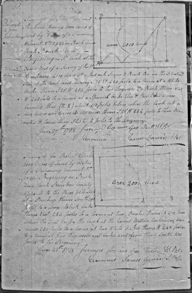
Clarke, Robert
23 June 1788
2,000 acres
On Buck Horn Creek opposite the Poige Elk Lick.
Coger, Michael, Henry Miller, James Frazier, Phillip Moyers, Assignees of Jacob Mayers
25 ___ember 1787
5,091 acres
On the waters of Sandy, on the most Eastarrlly corner of George Brooke's 7,000 acre survey and on the lines of James Monroe's 42, 656 1/4 acre survey.
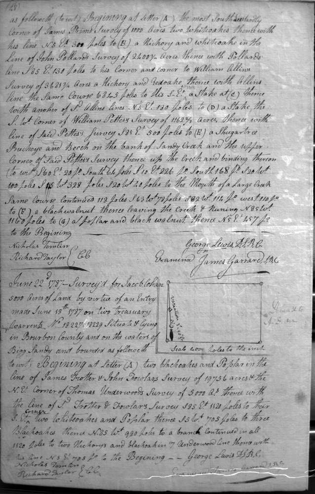
Cohan, Jacob
22 June 1787
5,000 acres
On the waters of Bigg Sandy and the lines of James Trotter and John Fowlar's 19,756 acre survey and Thomas Underwood's 5,000 acre survey,
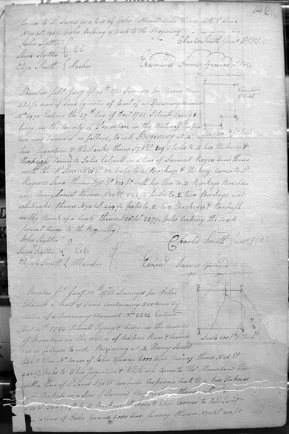
Coldwell, John [or Caldwell]*
15 Jan 1788
500 acres
On the waters of Cooper's Run, on the No corner of John Green's 6,000 acre survey, and on the lines of Thos. Moore and Samuel Rogers.
Coleman, Daniel
4 Mar 1788
13,501 1/2 acres
On the waters of Licking and on the East corner of Francis Buckner's 15,000 acres, crossing Locust creek several times, and crossing Triplett's creek.
Cooper, James's Heir at Law
20 Dec 1787
900 acres
400 acres on Hinkson's fork of Licking to include his improvement.
Also 250 acres adjoining his settlement on the North and West sides.
Also 250 acres on the third corner, East and South sides of the above survey.
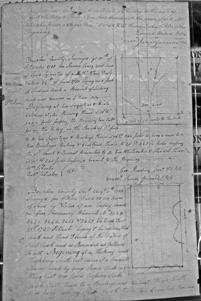
Craig, James
10 Sept 1788
2,000 acres
Lying on a fork of Indian Creek, a branch of Licking creek.
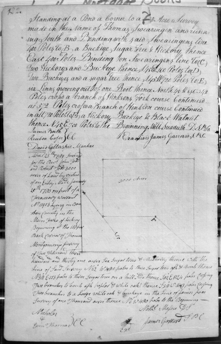
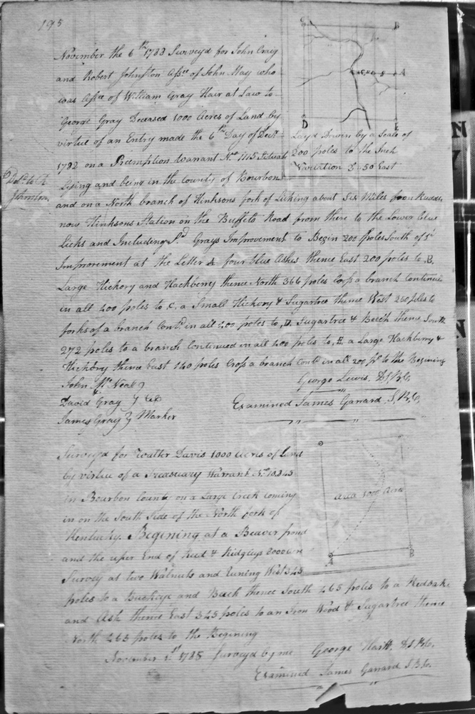
Craig, John and Robert Johnston, assignees of John May, assignee of William Gray, heir at law to George Gray, deceased
6 Nov 1788
1,000 acres
On the North branch of Hinksons fork of Licking, about 6 miles from Ruddles, now Hinksons station, on the Buffets Road, from there to the Blue Licks [John McNeal, and David and James Gray, assisted in the surveying]
Craig, John, of Bottetourt & John Craig of Fayette County
14 Feb 1789
800 acres
Situate, laying and being on Mud Lick Creek, emptying into Salt Spring Fork of Licking, on the south side and bounded by the NW corner of the 500 acre survey of Jacob Myres, and with Myres line crossing Mud Lick Creek.
Craig, John, of Bottetourt & John Craig of Fayette County
14 Feb 1789
915 1/2 acres
Situate, laying and being on Mud Lick Creek, emptying into Salt Spring Fork of Licking, on the south side and bounded by their 800 acre survey, and crossing Mud Lick Creek and passing their corner.
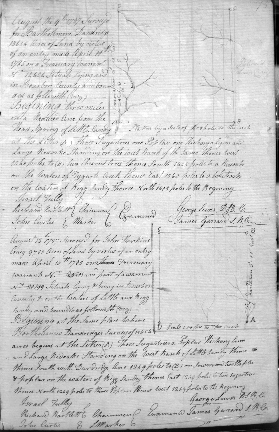
Craig, John Hawkins
13 Aug 1787
9,750 acres
On the waters of Little and Bigg Sandy, beginning in the same place as Bartholemew Dandridge's 15,656 acre survey.
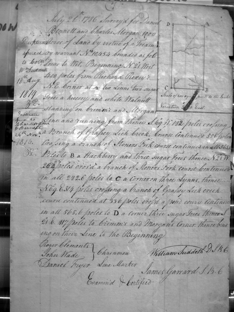
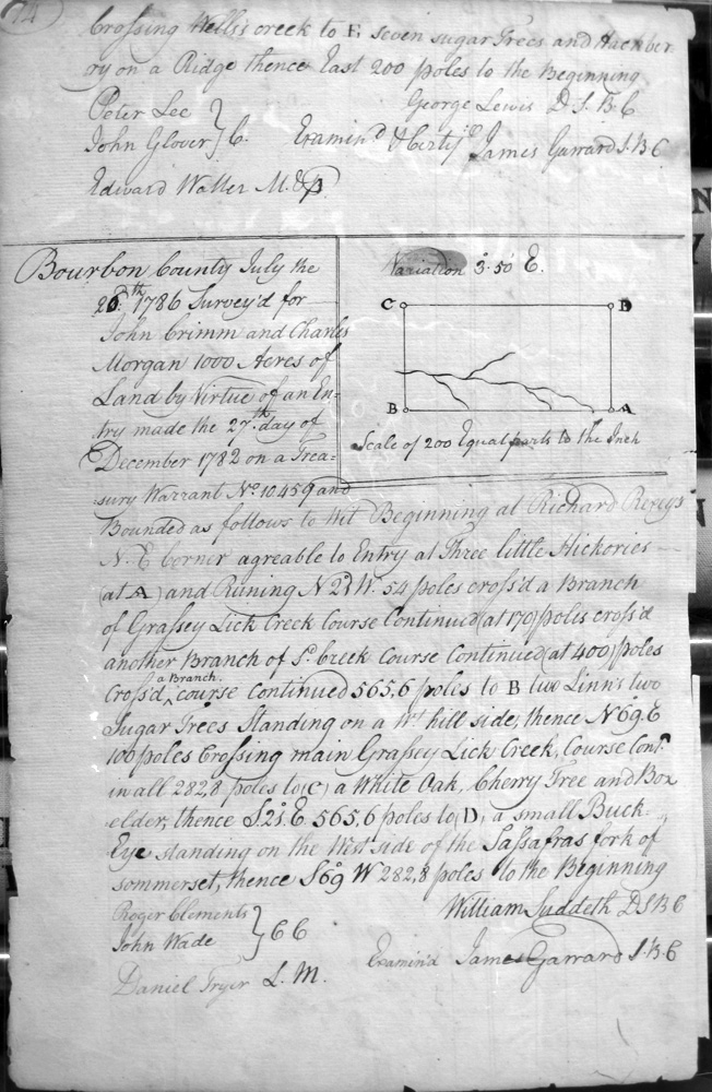
Crimm, John & Charles Morgan
26 July 1786
1,000 acres
Near Richard Rexey's NE corner, on Grimm's and Morgan's line and crossing branches of Grassey Lick
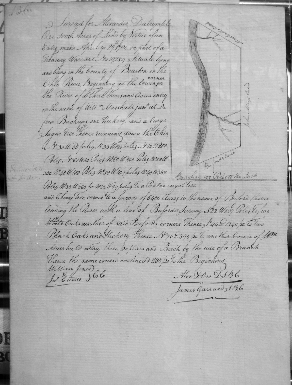
Dalrymple, Alexander
29 Apr 1786 (Entry date)
5,000 acres
On the Ohio River, on the lower corner of Will'm Marshall Jr.'s 3,000 acre survey, and the lines of Buford's 6,400 acre survey.
Dandridge, Bartholemew
9 Aug 1787
15,656 acres
On the waters of Tygart's creek and Bigg Sandy River, beginning three miles on a Reduced (?) line of the Head Spring of Little Sandy.
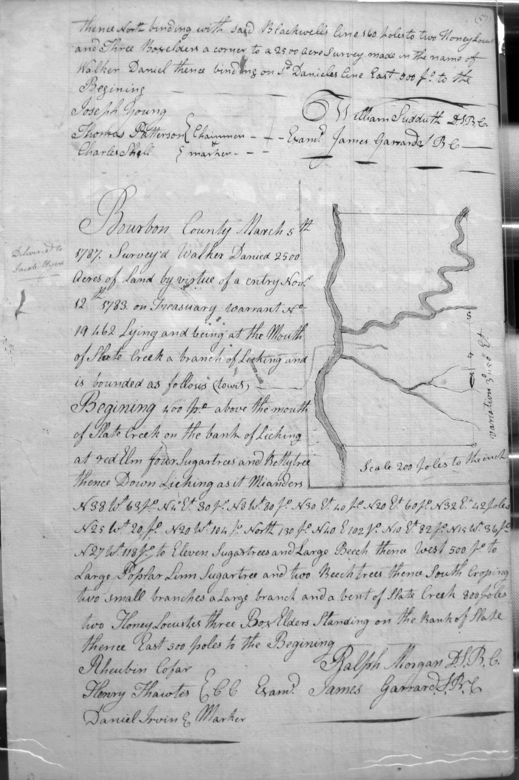
Daniel, Walker
5 Mar 1787
2,500 acres
At the mouth of Slate Creek, a branch of Licking, and on the banks of Licking.
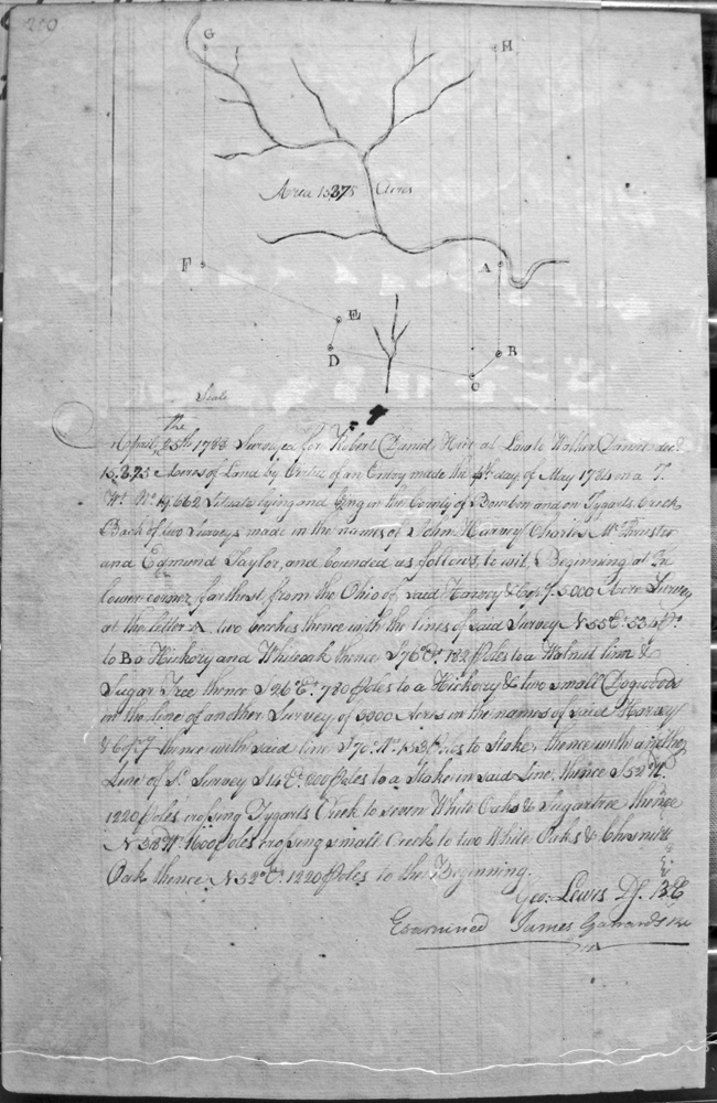
Daniels, Robert, heir at law to Walker Daniels, dec'd
25 April 1788
15,325 acres
On Tygart's Creek, in back of two surveys made in the names of John Harvey, Charles McThuster (?) and Edmond Taylor, beginning on the corner farthest from the Ohio and Harvey & Company's 5,000 acre survey and with the lines of said survey, and other lines to Harvey & Company's survey of 3,000 acres, and crossing Tygart's Creek.
Dapwell (or Daswell), James, and John Reed
13 Sept 1788
2,145 3/4 acres
On the North Fork of Kentucky on the South side, at the lower end of Frederick Ridgley's survey of 3,000, and with the meanders of the river, to Ridgley's upper end.
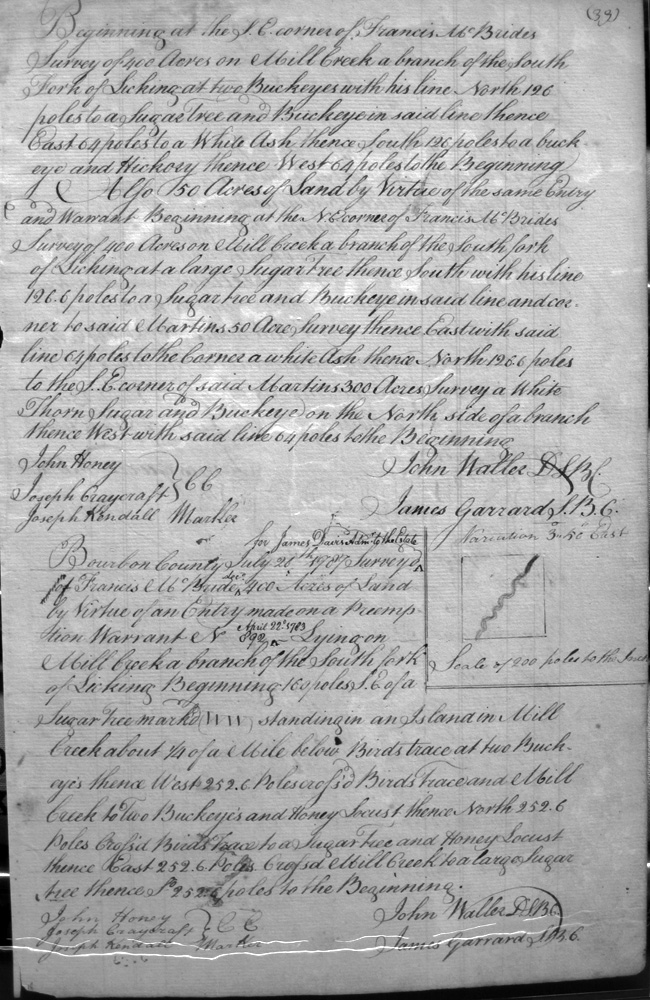
Davis, James Admin to the Estate of Francis McBride, dec'd
26 July 1787
400 acres
On Mill creek a branch of South fork of Licking, incl. an island in Mill creek about 1/4 mile south of Bird's trace
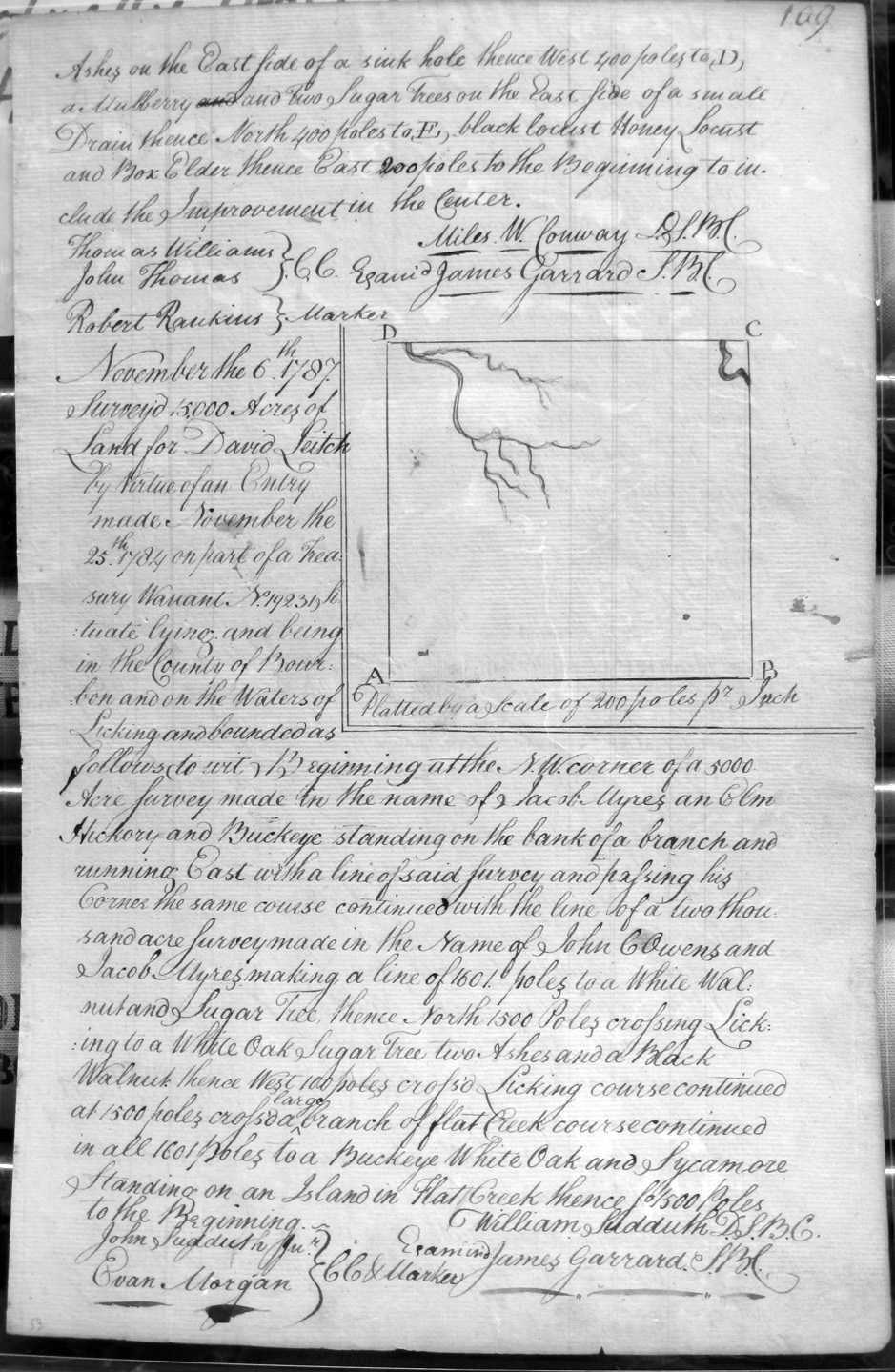
Davis, George and Robert Daniel, heir-at-law to Walker Daniel, deceased, and George May
28 Apr 1789
10,141 1/4 acres
On the West side of Bigg Sandy River and bounded by the lower corner on Sandy of James Garrard's 23,250 acre survey, and by the upper end of a large cane bottom and upper corner of Lewis Lunsford's 3,725 acre survey.
Davis, Walter
1 Nov 1785
1,000 acres
On a large creek coming on the South side of North fork of Kentucky, on the end of Reed and Ridgley's 8,000 acre survey
Davis, William
15 Aug 1788
10,000 acres
On Slate Creek and the head drains of the waters of Flat Creek, on the line of a private survey made by George Rogers Clark i 1775 (?), and crossing Slate and Flat creeks.
Dickey, John & James Dickey, Assignees of Thomas Smith
22 Mar 1788
200 acres
Adjoining James Henderson's 400 acre survey which lies no the East branch of Cooper's Run on the upper side.
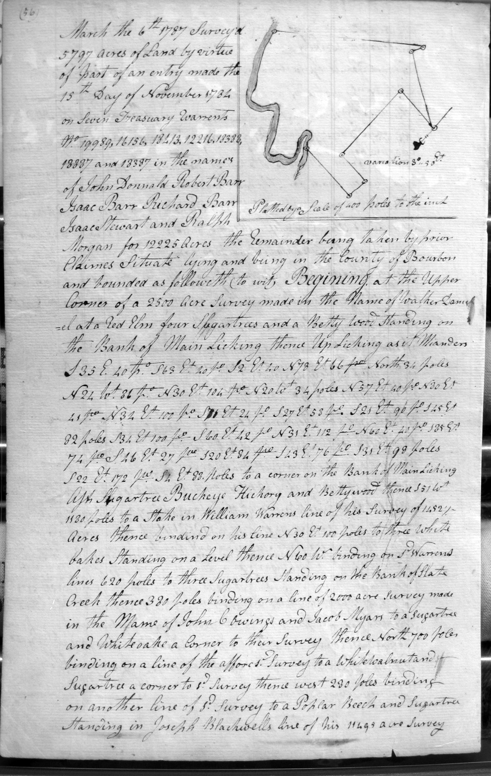
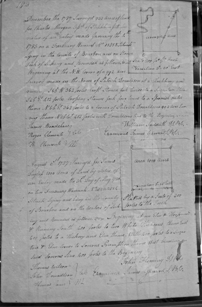
Donnald, John, Robert Barr, Isaac Barr, Richard Barr, Isaac Stuart and Ralph Morgan
6 Mar 1787
12,225 acres
On the banks of Main Licing, and the lines of Walker Daniel's 2,500 acre survey, William Warren's 1,452 1/2 acre survey, Slate Creek, John Cowing and Jacob Myars 2,000 acre survey, and Joseph Blackwell's 11,495 acre survey.
Dowdall, James
25 Aug 1788
1,000 acres
On the waters of Slate Creek, and bounded by the SE corner of John March's survey.
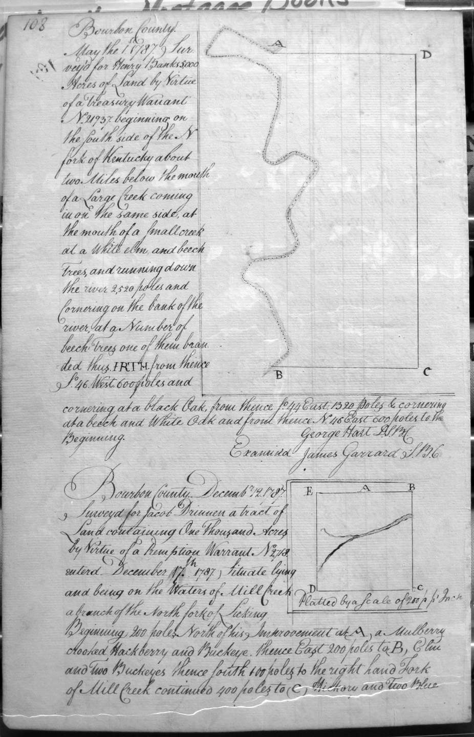
Drinnen, Jacob
12 Dec 1787
1,000 acres
On the waters of Mill Creek, a branch of the North Fork of Licking, to include his Improvement in the center.
Dudgeon, Ralph
23 Mar 1789
400 acres
On the side of the North fork of Licking on the lower corner of Thomas Height's 600 acre survey, the South bank of the North fork of Licking and the meanders of the fork.
Duglap (Dunlap ?), Charles
1 Aug 1787
1,000 acres
On the waters of Licking, on the line of Severn's preemption
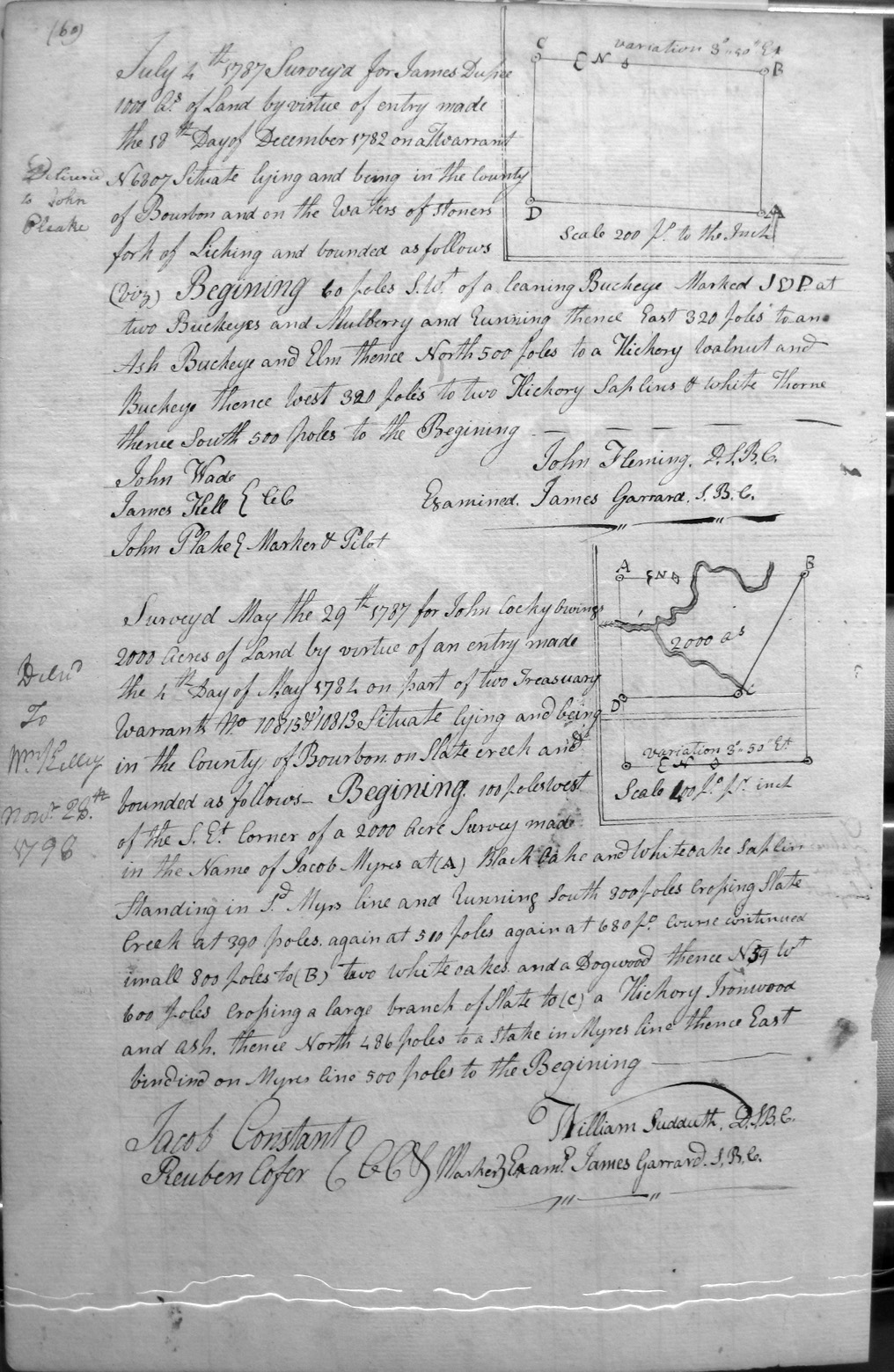
Dupee, James
4 July 1787
1,000 acres
On the waters of Stoner's fork of Licking.
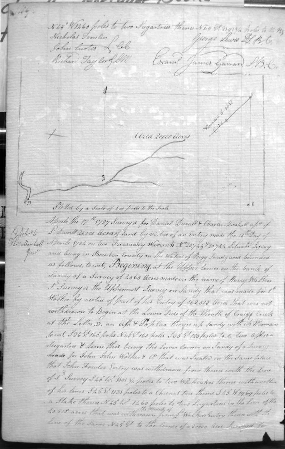
Duvall, Daniel and Charles Marshall
17 Apr 1787
20,000 acres
On the waters of Bigg Sandy, at the Upper corner at the bank of Sandy of Merry Walker's 4,060 acre survey, the lower side of the mouth of Craig's creek, this being the lower corner on Sandy of John Walker and Co's survey, in teh same place John Fowler's entry was withdrawn, and with Walker's lines.
Edwards, John, assignee of William Hoy (or Foy), assignee of Samuel Evins
8 Apr 1789
600 acres
On the waters of Lulbegrud, and crossin the creek several times.
Edwards, John
21 Mar 1789
2,000 acres
Adjoining his 5,000 acres on the North, and bounded by a former 1,000 acre survey of sd Edwards.
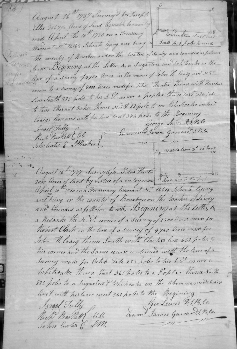
Ellis, Joseph
16 Aug 1787
2,067 1/2 acres
On the waters of Sandy, and on the lines of John W. Craig's 9,750 acre survey and and the NE corner of Titus Hunter's 2,000 acre survey.
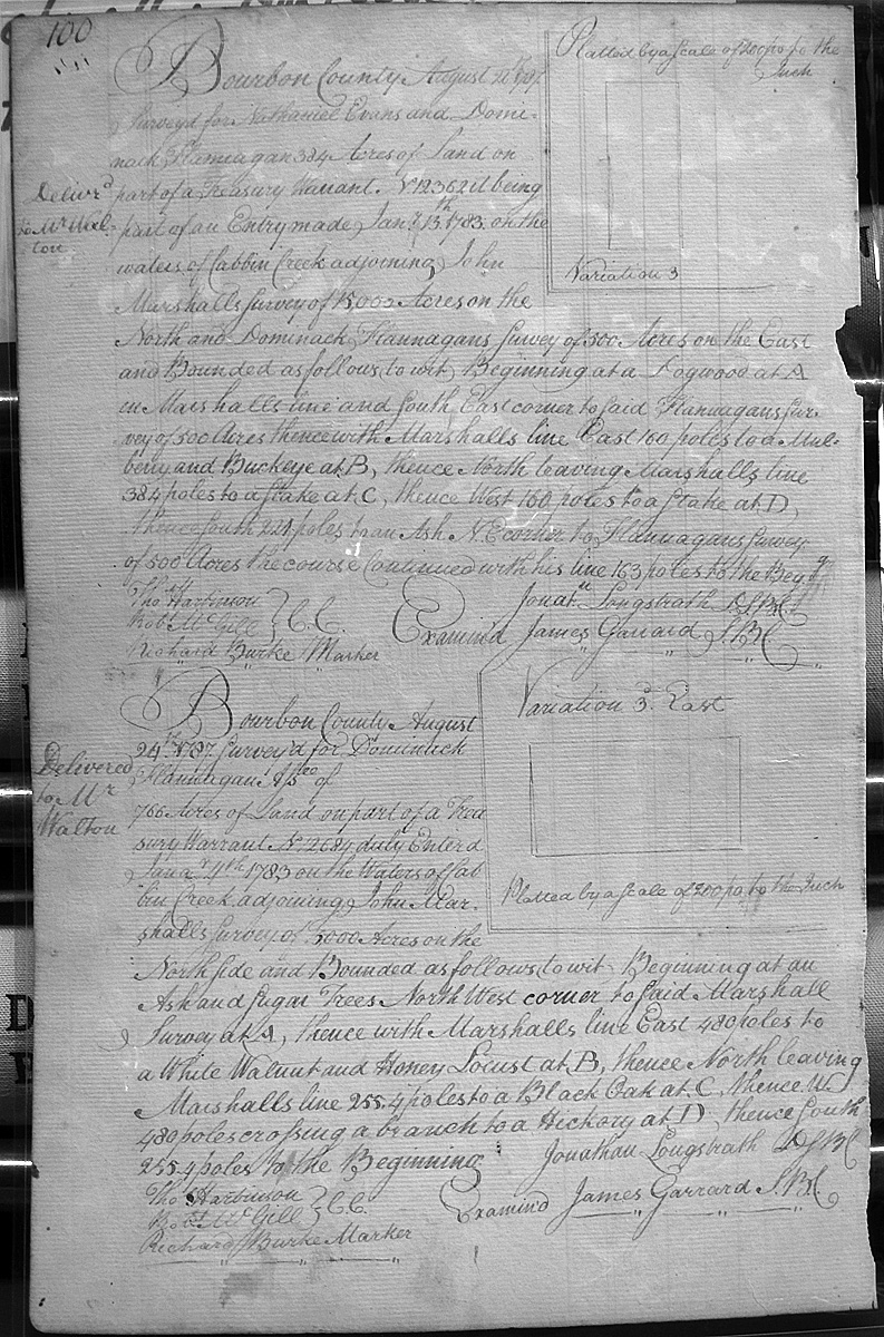
Evans, Nathaniel & Domonick Flanagan
26 (?) Aug 1787
384 (?) acres
On the waters of Cabin creek, djoining the other part of said entry on the North.
Evans, Nathaniel & Domonick Flanagan
28 (?) Aug 1787
384 acres
On the waters of Cabbin creek and adjoining John Marshall's 15,000 acre survey on the North and Dominick Flanagan's 500 acre survey on the East.
Ficklin, Fielding
23 Aug 1786
60 acres
On the line of Simon Kenton's 2,000 acre survey, and the line of John Marshall's 4,000 acre survey.
Fields, Benj.
20 Oct 1789
4,813 (or 4,873) acres
On Slate Creek, bounded by a SE corner of a survey of John Cockey Owings and Jacob Myres of 2,000 acres, crossing and re-crossing Slate Creek to the East bank.
Finley, Andrew
15 Dec 1788
1,000 acres
On the waters of the North Fork of Licking, bounded by Thompsons 1773 survey.
Finley (or Firley), John
19 Mar 1789
4,000 acres (?)
On the Main Fork of Licking and bounded by the top of a ridge, Finley's 1778 survey,
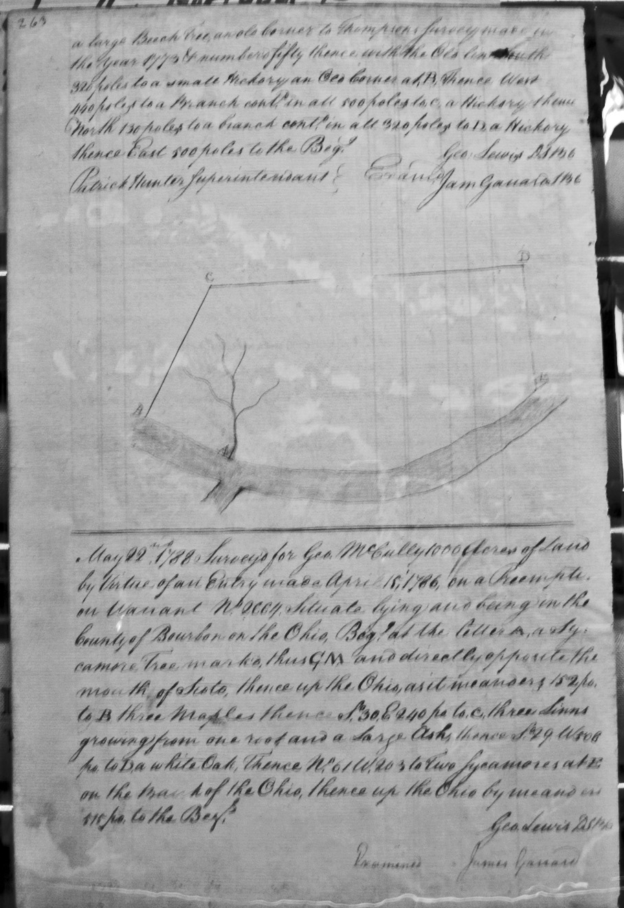
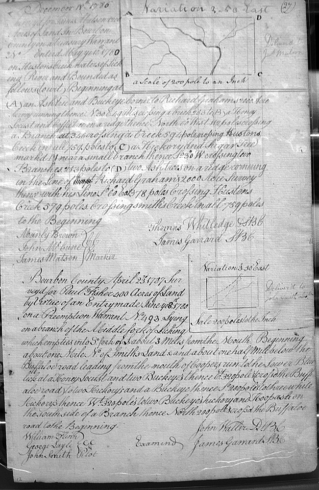
Fisher, Paul
23 Apr 1787
400 acres
On a branch of Middle fork of Licking which empties into the South fork of L, about 3 miles from the mouth, about a mile N of Smith's land & about a half a mile above the Buffalo Road leading from mouth of Cooper's Run to Lower Blue Lick.
Flanagan, Dominack, Assignee of Andrew Moore
25 Aug 1787
500 acres
On the waters of Cabbin creek adjoining John Marshall's survey of 15,000 (?) acres on the North, and of said Flanagan's survey of 766 acres on the East.
Flanagan, Dominick, Assignee of ____________
24 Aug 1787
766 acres
On the waters of Cabbin creek and adjoining John Marshall's 15,000 acre survey and on his lines.
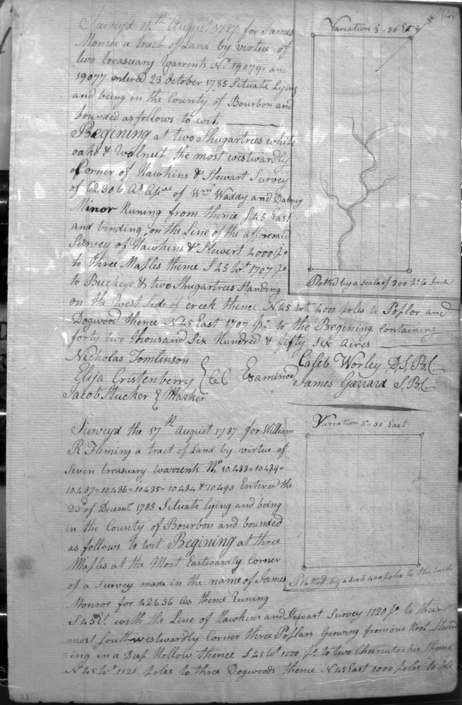
Fleming, Thomas M.
15 Aug 1787
5,000 acres
On the lines of Robert Boling Junr.'s 5,000 acre survey and James Monroe's 42,565 1/2 acre survey.
Fleming, Wm. R.
17 Aug 1787
7,000 acres
On the lines of James Monroe's 42,656 acre survey, Hawkins and Stewart's survey
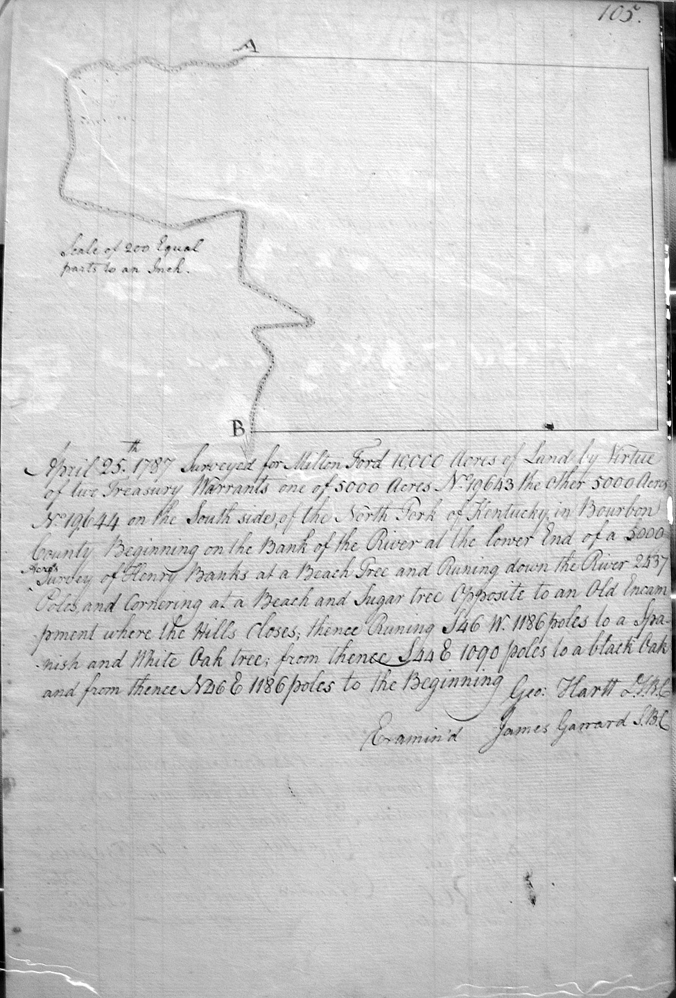
Ford, Milton
25 Apr 1787
10,000 acres
On the South side of the North Fork of Kentucky on the lower end of Henry Banks's 5,000 acre survey, opposite an old encampment where the hills closes.
Ford, Lewis, James Jenkins, Obediah Clark, Samuel Overton, Christopher Ford, John Bookers & Samuel Ford
25 May 1788
40,000 acres
On the main South Fork of Licking (otherwise called Elkhorn Fork), bounded at the junction of the sd Fork and the Main Fork about 20 miles from the head of Main Licking,
Fox, Arthur, assignee of Will'm Kennedy
11 Nov 1788
640 acres
Part of a 1,000 acre Treasury Warrant, on the waters of the North Fork of Licking, on the North side, and bounded by George Clarke's Settlement, Simon Kenton's 2,000 acre survey, a line of John Craig and Robert Johnstons, and Thomas (?) Marshall's survey.
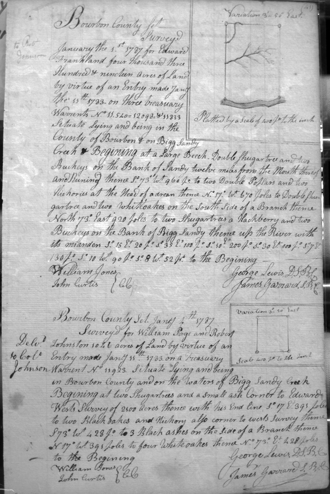
Frankland, Edward
1 Jan 1787
4,319 acres
On the bank of Sandy 12 miles from the mouth thereof


