Page, Matthew
14 Mar 1783 (Entry Date, no other date given)
6,250 acres
On the waters of little Sandy a branch of the Ohio, on Edmund Logwood's 10,000 acre survey.
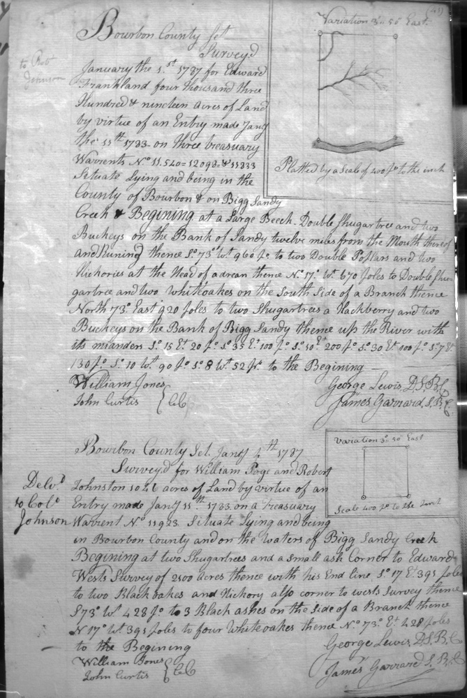
Page, William & Robert Johnston
4 (?) Jan 1787
1,946 acres
On the waters of Bigg Sandy creek on the lines of Edward West's 2.500 acre survey.
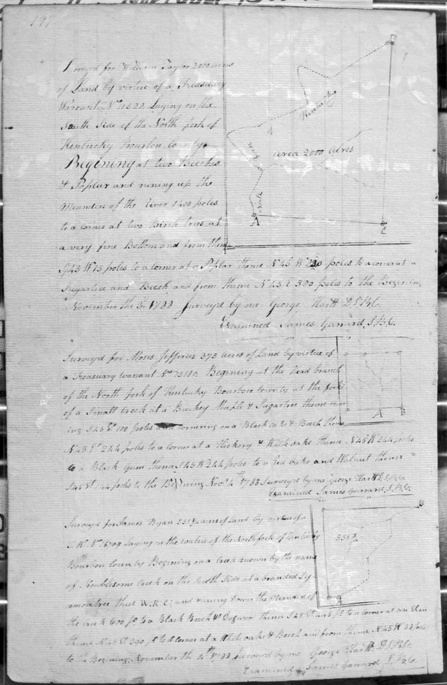
Parker, John
23 Apr 1789
2,000 acres
On the North side of the South Fork of Licking on both sides of Brigs (?) Road, bounded by a 3,000 acre survey of John and Robert Todd in Montgomeries (Montgomery's) line, then with Montgomeries line and passing his corner, and with Todd's line to the beginning.
Parsons, George
31 July 1787
2,181 acres
On the most easterly branch of Grassey lick fork of Hinkstons fork of Licking, bounded by Harris, Aaron Higings (Higgins ?), James Higings, Francis Peyton,
Pattie, James
20 Jan 1787
800 acres
On Slate creek, on John Sanders's 1,500 acre survey and George Thompson's 5,000 acres.
Pattison, Matthew (Patterson ?)
10 Aug 1788
400 acres
Adjoining Hrode Thompson on the East on Red River.
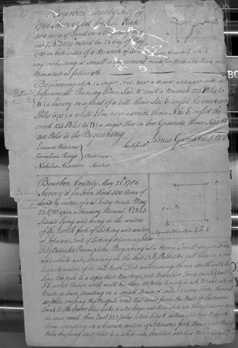
Peak, Jesse
19 July 1786
300 acres
Both sides of a Branch of Licking
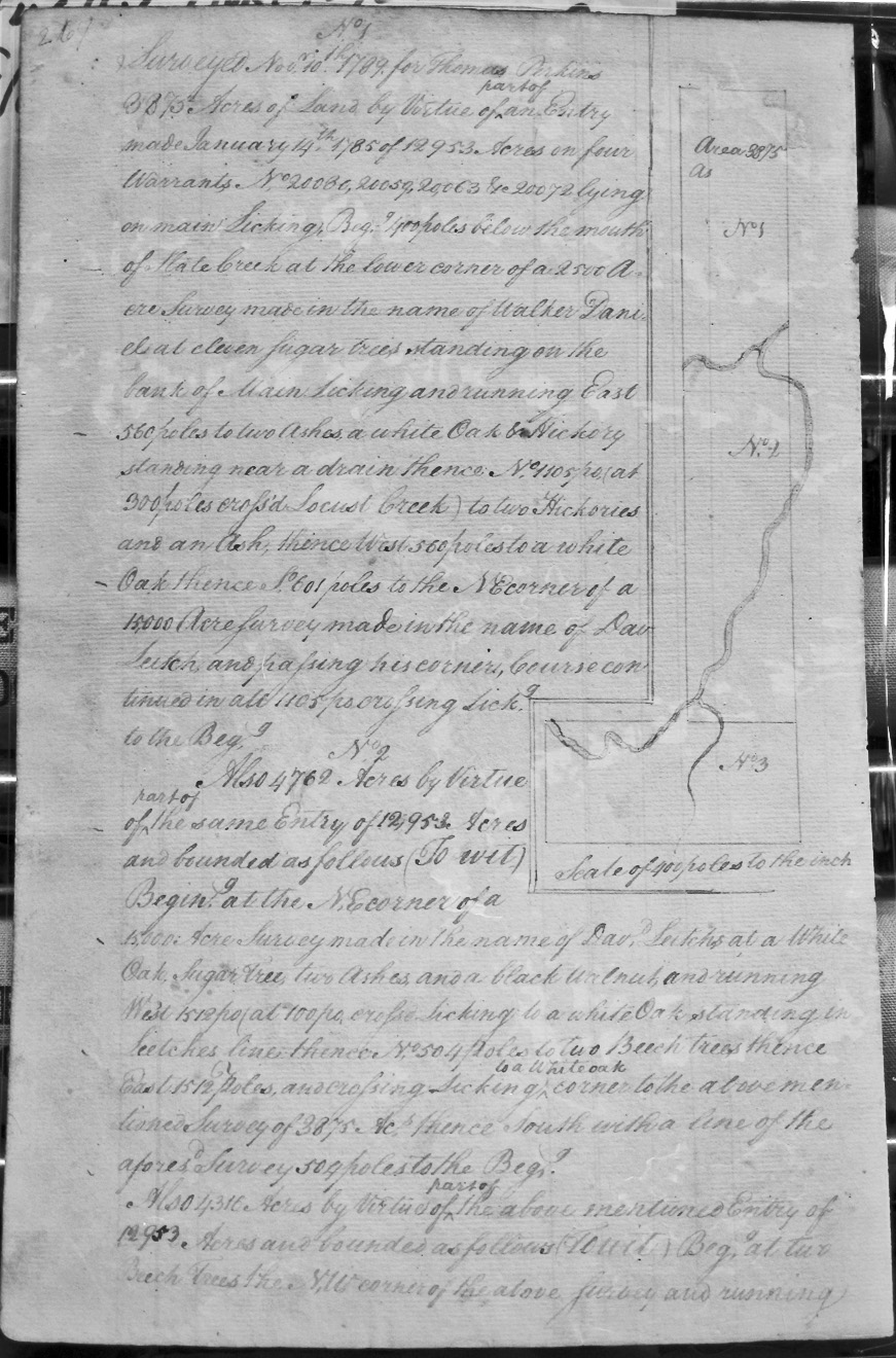
Perkins, Thomas
10 Nov 1789
3,875 acres On Main Licking beginning 400 poles below the mouth of Slate Creek at the lower corner of a 2,500 acre surveymade in the name of Walker Daniel, the bank of Main Licking, crossing Locust Creek, and the NE corner of a 15,000 acre survey made in the name of David Leitch.
And, also:
4762 acres By virtue of the same warrant, and on the NE corner of a 15,000 acre survey made in the name of David Leitch, and crossing Licking twice before meeting the above mentioned survey.
And, also:
4,316 acres By virtue of the same warrant, and on the NW corner of the above mentioned survey, and crossing Licking to the NW corner of Jno. Crittendon's and and Luke Cannon's 50,000 acres and continuing East to their corner with Leitch.
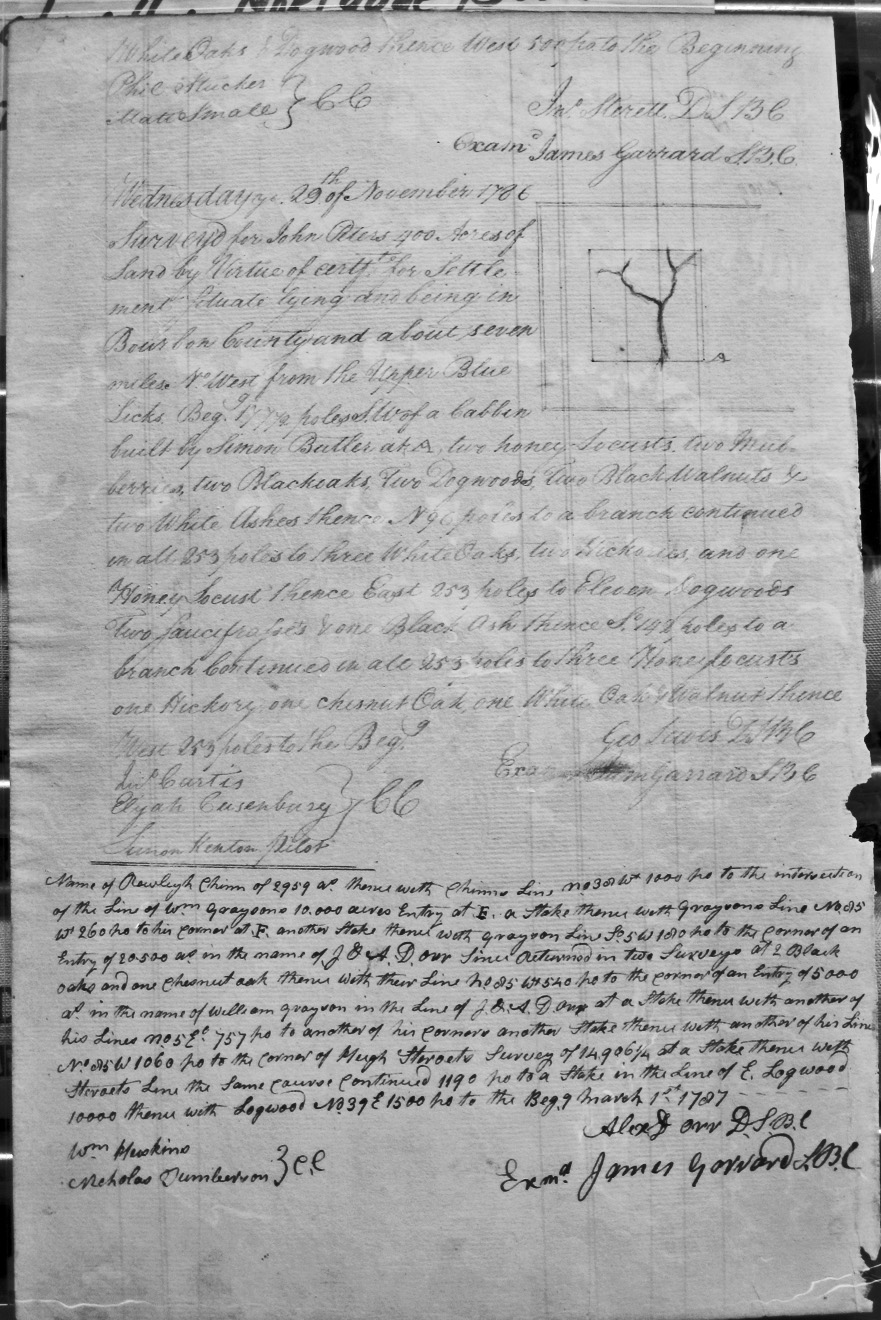
Peters, John
29 Nov 1786
400 acres
About 7 miles from the Upper Blue Licks, and West of a cabbin built by Simon Butler.
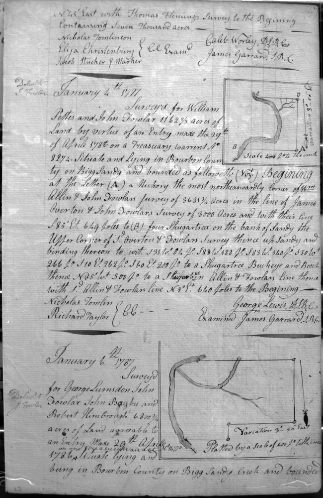
Pettes, William and John Fowlar
4 Jan 1787
1,162 2/3 acres
On Bigg Sandy on the lines of Wm. Allin and John Fowlar's 3,635 3/4 acre survey, James Overton and John Fowlar's 3,000 acre survey.
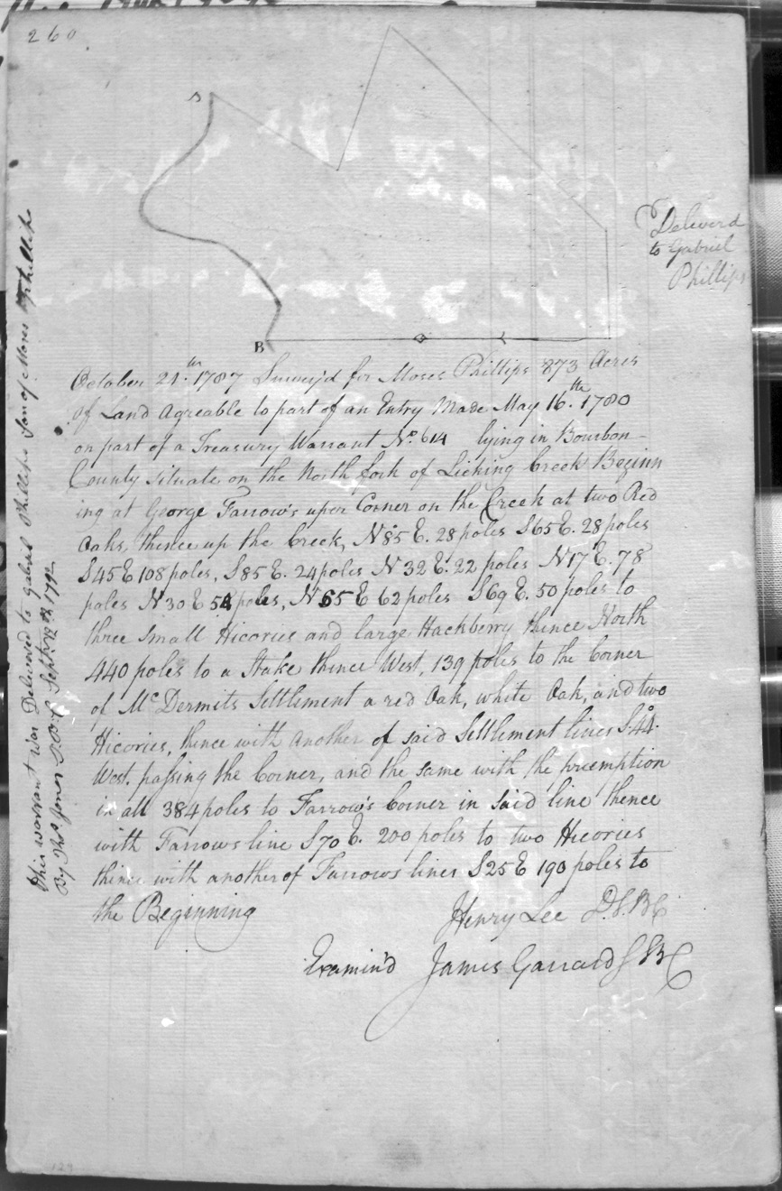
Phillips, Moses
24 Oct 1787
873 acres
On the North Fork of Licking Creek, bounded by George Farrow's upper Corner on the Creek, and McDermit's [McDermott ?] settlement.
Poindexter, Thomas
23 Apr 1789
10,000 acres
On the headwaters of Cabbin creek and the head of the North fork of Licking, bounded by a gap in the Siotha Mountains, and crossing and recrossing a branch of Salt Lick Creek.
Pollard, John
5 Jan 1787
2,499 3/4 acres
On the waters of Bigg Sandy and on the lines of Edward Montjoy's 1,000 acre survey, Richard Graham's 138,320 acres,
Polland, Wm 1,000 acres
Glasscock, Gregory & William Wallace 2,958 acres
Boyan, Andrew 500 acres
Shacklford, John 600 acres
West, Charles part of 400 acres
Williams, John 950 acres
Wigglesworth, John 6,000 acres
[Incomplete: Pages 118 & 119 not in my copy]
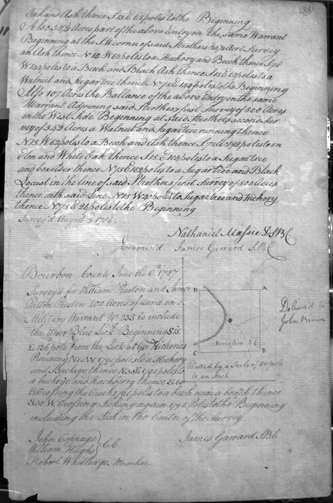
Preston, William
6 June 1787
200 acres
A Military Warrant on Licking, to include the upper Blue Lick.
Primm (or Priman), James
2 Jan 1787
1,000 acres
On the waters of Bigg Sandy on Richard Graham's survey of 138,320 acres on the South side of John Pollard's entry 2200 3/4 acres
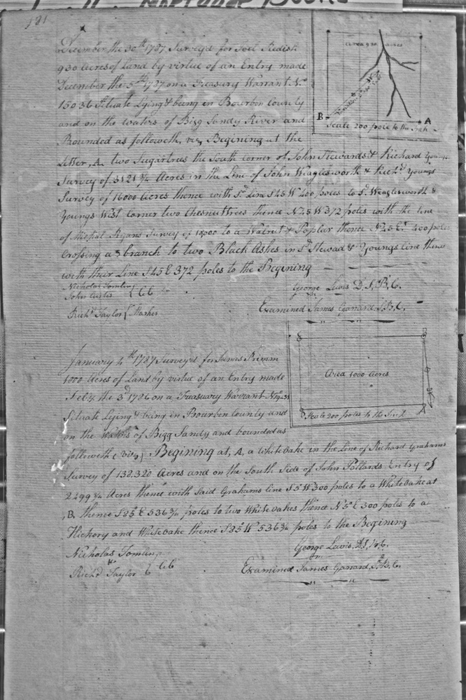
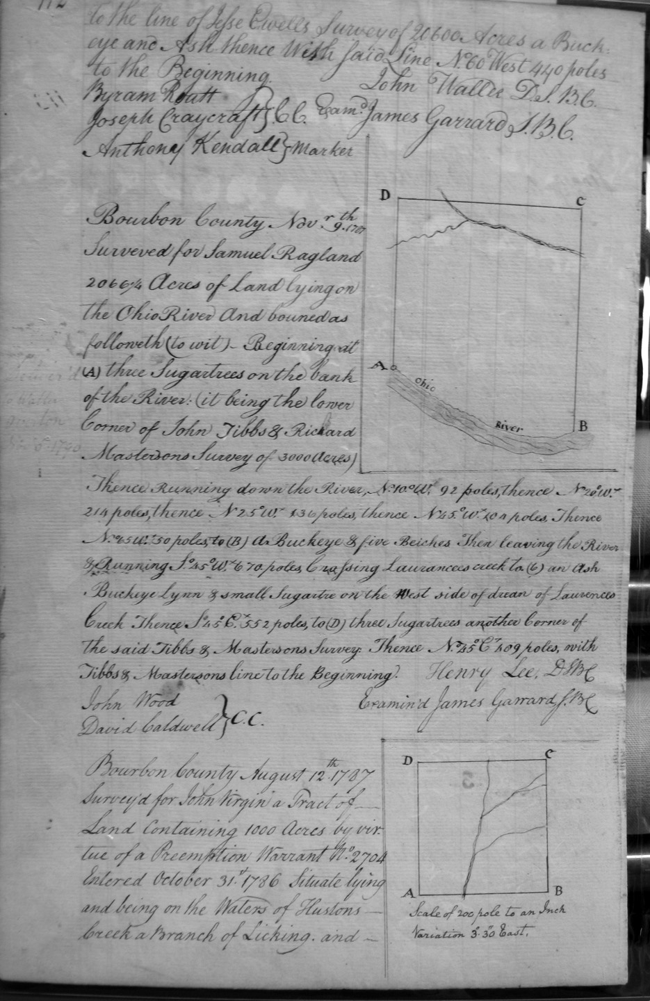
Ragland, Samuel
9 Nov 1787
2,066 1/4 acres
On the Ohio River, on the lower corner of John Tibbs and Richard Masterson's 3,000 acre survey, and crossing Laurance's creek.
Raidkin, Laurence
15 July 1788
500 acres
On the waters of Licking adjoining Ovid Boone on the West.
Ramsey, Nathaniel
15 Apr 1789
1,076 acres
At the West side of Bigg Sandy, and beginning at the lower corner of Sandy on George Lewis's survey of 19,050 acres.
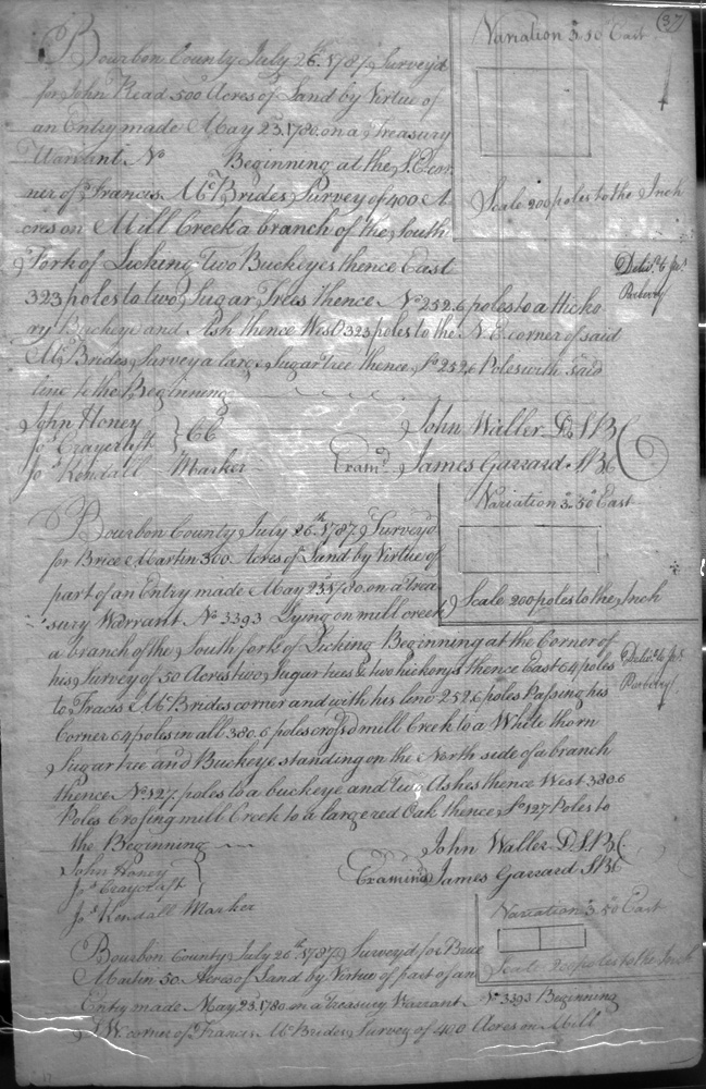
Read, John
26 July 1787
500 acres
On the lines of Francis McBride's 400 acre survey on Mill creek a branch of the South fork of Licking.
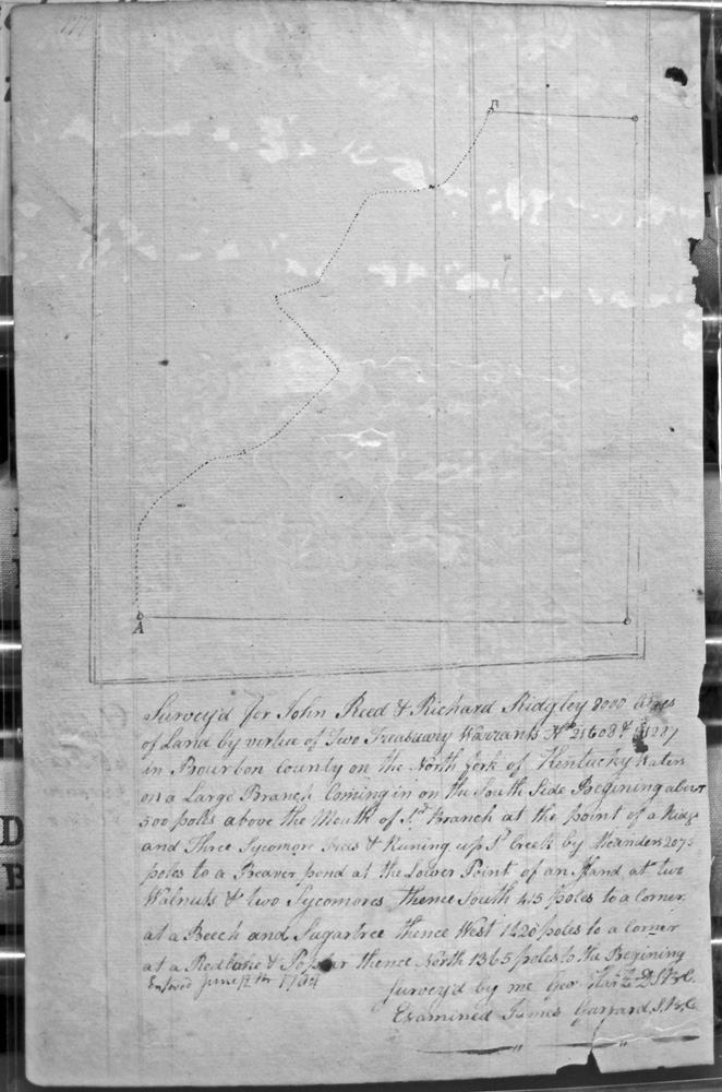
Read, John & Richard Ridgley
12 June 1784 (or 1789)
8,000 acres
South fork of the waters of Kentucky on a large branch coming in on the South side.
Redish, Joel
30 Dec 1787
930 acres
On the waters of Bigg Sandy on the lines of John Steward and Richard Young's survey of 3121 acres and of John Waglesworth and Richard Young's 16000 acre survey, and Michael Ryan's 10,000 acre survey.
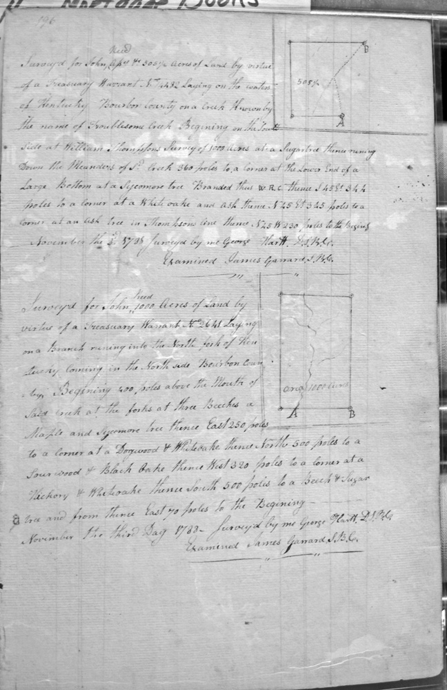
Reed, John
3 Nov 1788
1,000 acres
Laying on a branch running into the North fork of Kentucky, coming in the North side of Bourbon County,
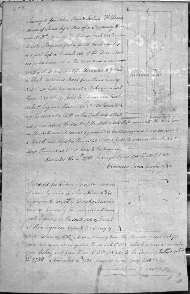
Reed, John & Joshua Hobbs
6 Nov 1788
3,000 acres
On Rock house creek, on a fertile (?) bank about 7 or 8 feet high on the South side of the River, and above the mouth of the first creek that comes into the Rock house on the North side
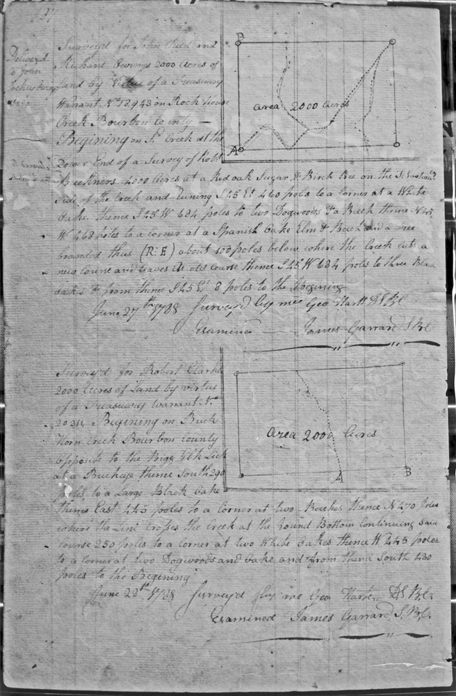
Reed, John & Richard Owings
27 June 1788
2,000 acres
On Rock House Creek, on the lower end of Robert Buckner's 4,000 acre survey
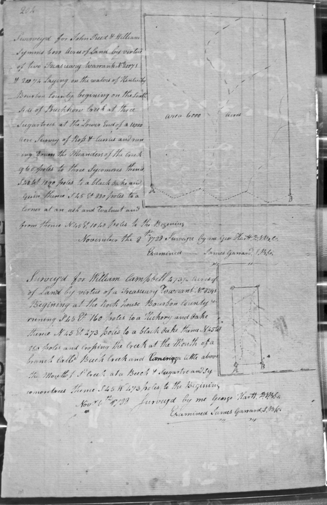
Reed, John & William Symmes
8 Nov 1788
6,000 acres
On the waters of Kentucky, beginning at the South side of Buckhorn creek, at the lower end of a 10,000 acre survey of Ross and Curries.
Reed, John & William Symmes
11 Nov 1788
3,000 acres
On the waters of Rock House creek, at a large creek coming in on the SW side, coming up the creek where Robert Buckner's line strikes the creek in the forks of a branch.
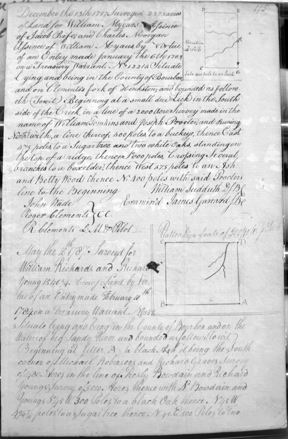
Richards, William & Richard Young
16 May 1787
1,546 3/4 acres
On the waters of Big Sandy River, and on the lines of Michael Robinson and Richard Graves's 1480 acre survey, and Presley Bowdain and Richard Young's 5,000 acre survey.
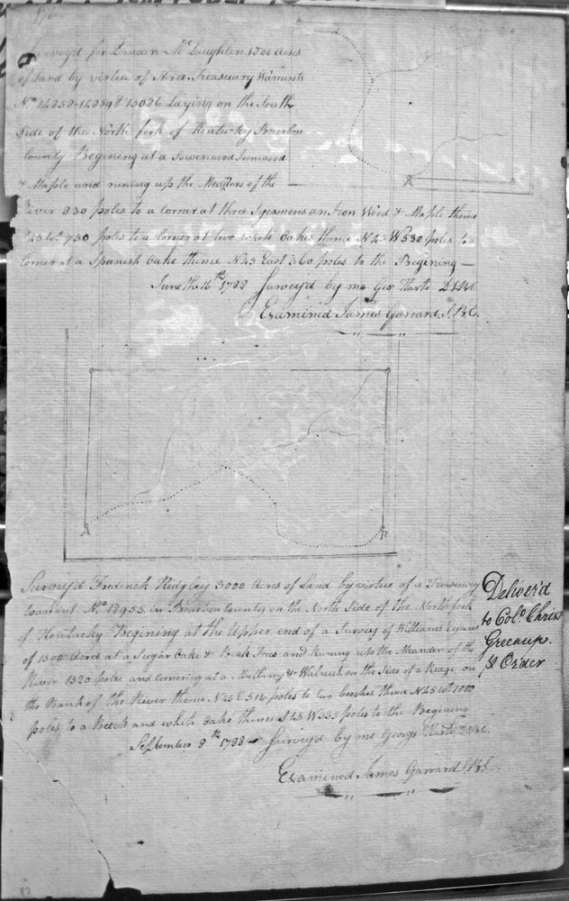
Ridgley, Frederick
3 Sept 1788
3,000 acres
On the upper end of a survey of William Evans' 1,500 acres
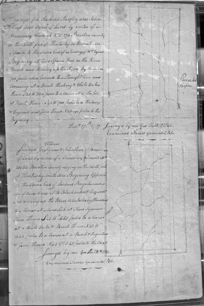
Ridgley, Richard and John Reed
No Survey Date, but entered with the County on 3 Mar 1786
8,000 acres
Lying on the North side of the North fork of Kentucky, with the meanders of the river.
Ridgley, Richard & John Reed
17 Sep 1787
4,000 acres
On the North fork of Kentucky, on the South side opposite the lower end of William Egins survey,
Ridgley, Richard & John Reed (Repeat from 163)
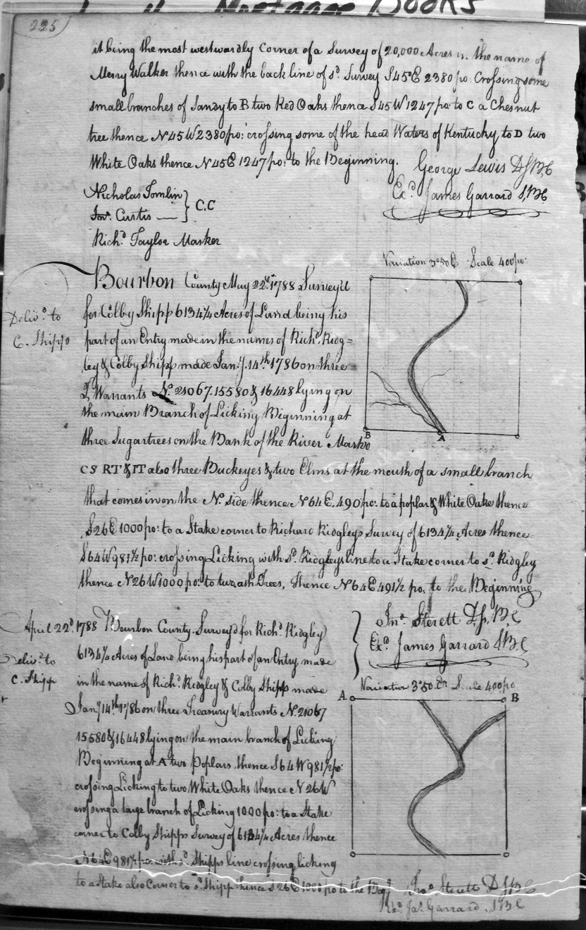
Ridgley, Richard
14, Jan 1786
6,134 1/4 acres
Lying on the main branch of Licking and on Colby Shipp's 6,134 acre survey, and with Shipp's line crossing Licking
Robertson, Matt
6 Apr 1790
20,000 acres
On the Reo (or Red) River, bounded by the SW corner of Edward Payne and Will Calk's 2,235 acres, crossing and re-crossing Reo River.
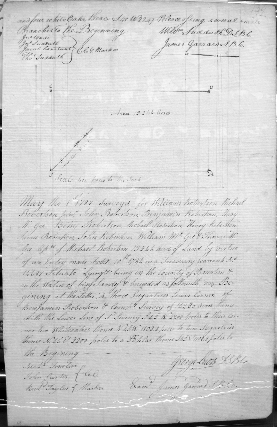
Robertson, William and Michael Robertson, Junr., Mary McGee, Betsy Robertson, Michael Robertson, Henry Robertson, James Robertson, John Robertson, Will'm McGee & Robert McGee, Assignees of Michael Robertson
1 May 1787
15,246 acres
On bigg Sandy, and on the lower corner of Benjamin Robertson & Co.'s 14,280 acres.
Robinson, Michael & Richard Graves
5 May 1787
1,450 acres
On the waters of Big Sandy, and the lines of Wm. Robinson & Co's 15,246 acre survey.
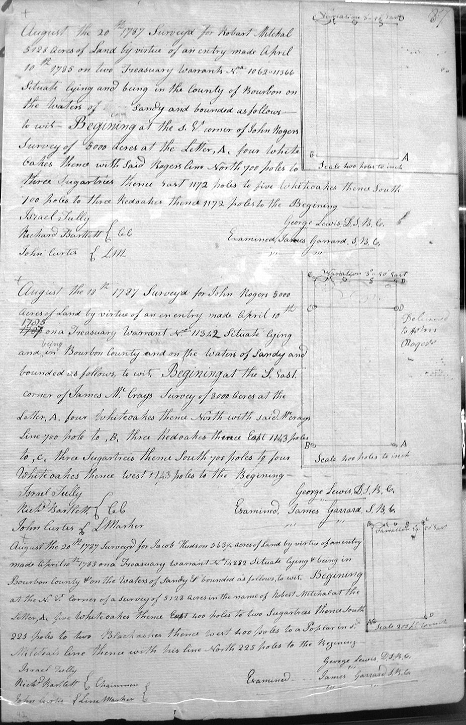
Rogers, John
18 Aug 1787
5,000 acres
On the Sandy and on the lines of James McCray's 8,000 acre survey.
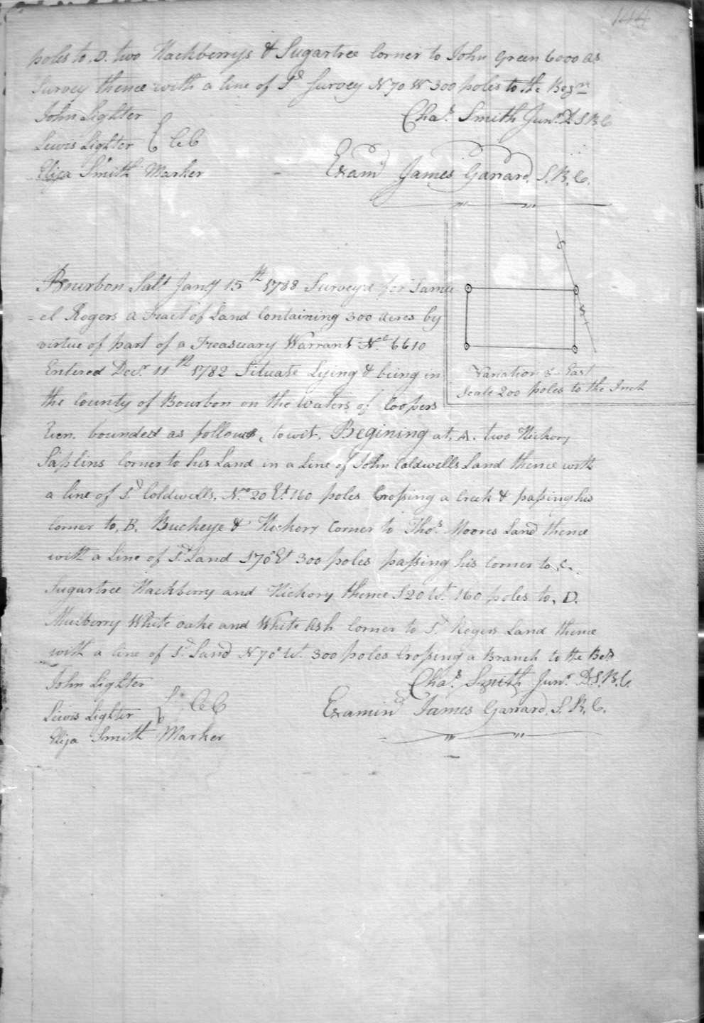
Rogers, Samuel*
15 Jan 1788
300 acres
On Jn'o Coldwell's [or Caldwell] line in a line of John Green's 6,000 acre survey, and corner to S'l Rogers' land.
Rogers, Samuel*
15 Jan 1788
300 acres
On Cooper's Run, on a corner of his land on Jn'o Coldwell's [or Caldwell] line in a line of Thos. Moore's land.
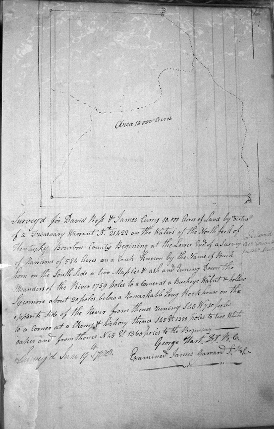
Ross, David & James Curry
21 June 1788
10,000 acres
On the waters of the North fork of the Kentucky at the lower end of Harrison's 584 acre survey on Buck Horn Creek, below a Remarkable long rock house on the opposite side of the river.
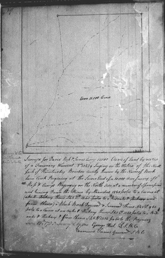
Ross, David & James Curry
21 June 1788
10,000 acres
On the waters of the North fork of the Kentucky known as Buck Horn Creek, and at the lower end of a 10,000 acre survey of Ross & Curry.
Ross, David & James Curry
21 June 1788
10,000 acres
On the waters of the North fork of the Kentucky, known as Buck Horn Creek, and at the lower end of Jones's 584 acre survey.
Ross, David & James Carrie
15 June 1788
2,097 acres
On the North side of the North fork of Kentucky.
Ross, David & James Curry (or Carry)
No date given
15,000 acres
On a large branch of a creek known as Black Horn, and on Main (?) creek.
Ross, David & James Curry
18 June 1788
10,000 acres
On the waters of the North fork of the Kentucky, known as Buck Horn Creek.
Ross, David & James Currie
25 May 1788
10.000 acres
On the waters of North fork of Kentucky, at the lower edge of sd. Ross and Currie's 15,000 acre survey near Buck Horn creek.
Ross, David & James Currie
25 May 1788
10.000 acres
On the waters of North fork of Kentucky, at the lower end of sd. Ross and Currie's 15,000 acre survey and running down the meanders of the creek.
Ross, David & James Currie
8 Sep 1788
6.000 acres
On the waters of North fork of Kentucky, on Buck Horn creek at the forks of sd. creek, and with the meanders of the creek.
Ross, David & James Currie
8 Sep 1788
5.000 acres
On the waters of Rock House creek, coming in on the Southeast side known by the name of Glade Creek and the line crossing the head of the creek.
Ross, David
8 Sep 1788\
4.000 acres
On the waters of Rock House creek, beginning at the mouth of Buck creek, at the upper end of Campbell's 473 1/4 acre survey.
Ross, David & James Currie
8 Sep 1788
4.000 acres
On the waters of North fork of Kentucky, on Buck Horn creek, and down the meanders of the creek.
Ross, David
27 May 1788
4.000 acres
On the south side of Rock House creek, at an old flat creek crossing.
Ross, David & James Currie
8 Sep 1788
4.000 acres
On a flat lick at the upper end of Ross's 4,000 acre survey.
Ross, David & James Currie
10 Sept 1788 (?)
334 acres
On the waters of North fork of Kentucky, at the lower end of a 2,000 acre survey of Robert Buckner,
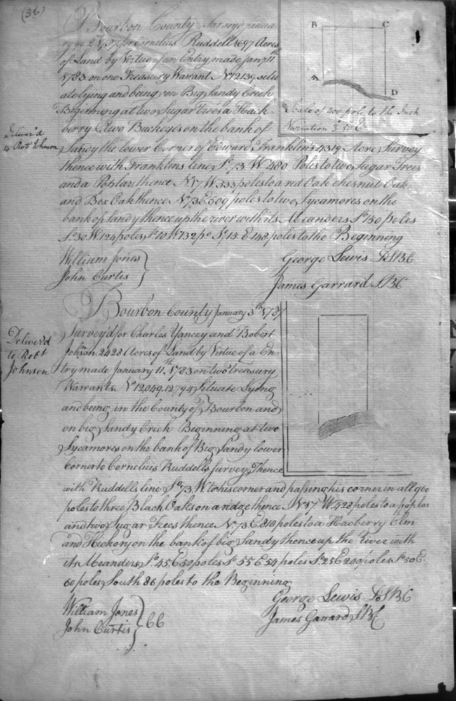
Ruddell, Cornelius
7 Jan 1787
1,697 acres
On Big Sandy Creek, on the line of Edward Franklin's 4.319 acre survey.
Russell, Joseph
23 Mar 1789
239 1/4 acres
On the waters of North fork of Licking adjoining William Henry's survey 1,080 acres on the north, and the line of John Metcalf's survey of 2,972 acres.
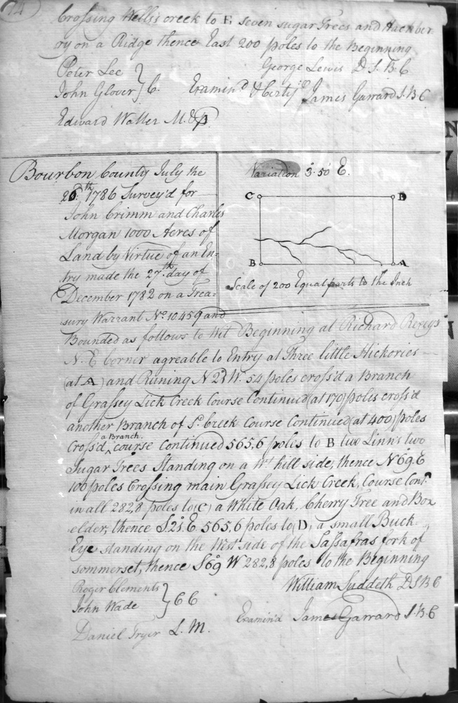
Rust, Matthew & Edward Waller
25 Nov 1786
1,000 acres
Wells's creek, a branch of the North fork of Licking
Rust, Matthew & Edward Waller
25 Nov 1786
1,000 acres
On Wells's creek, a branch of the North fork of Licking
Ryan, Michael & Assignees (?)
4 May 1787
10,000 acres
On the waters of the Bigg Sandy River, and on the lines of the south corner of J. Weaglesworth & Richard Young's 16,000 acre survey, and Merry Walker's 162,518 acre survey. [Walker's survey referred to on other surveys at 162,513]
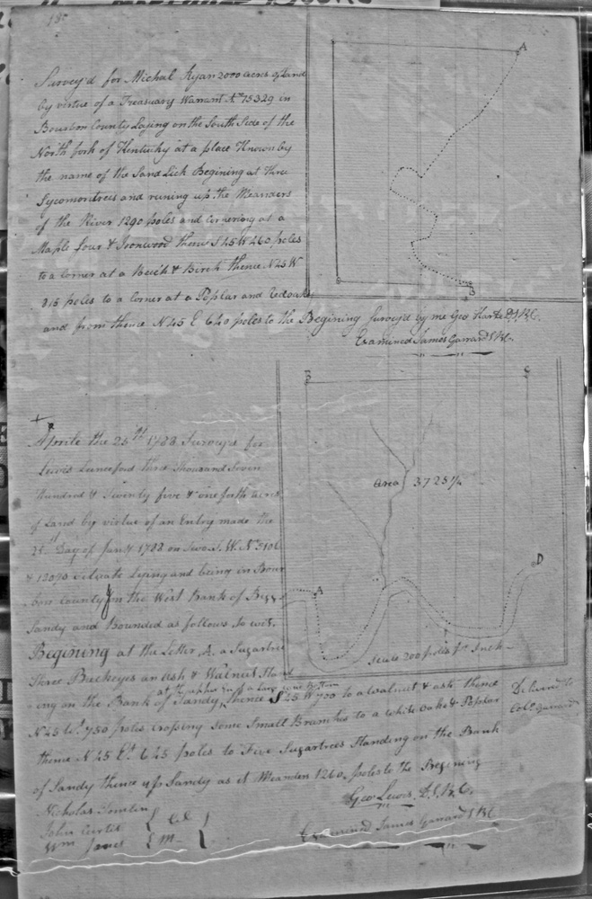
Ryan, Michael
No date
2,000 acres
On the South side of the North fork of Kentucky in a place known by the name of Sand Lick
Sanders, John
20 Jan 1787
1,500 acres
On Slate creek, on the line of George Thompson's 5,000 acre survey
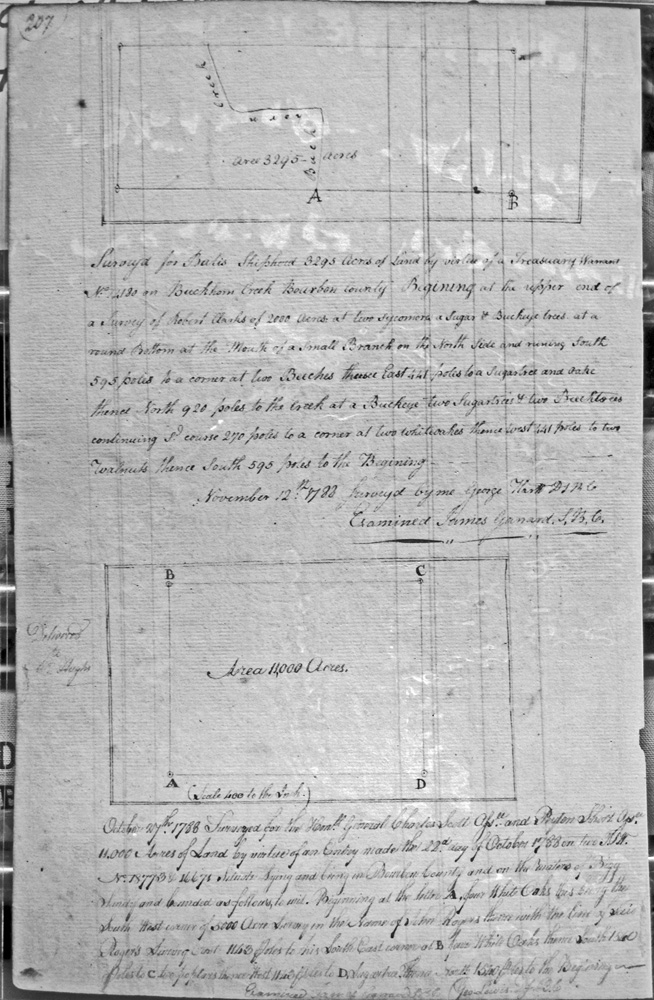
Scott, General Charles, & Peyton Short, assignees
27 Oct 1788
11,000 acres
On the waters of Bigg Sandy and bounded on the SW corner by a 5,000 acre survey in the name of John Rogers.
Scott, General Charles, & Nicholas Mosely
No date
9.739 acres
On Tygarts creek, adjoining on the back lines of some surveys made in the names of John Harlow, Charles M. Thruston, and Edmund Taylor, by virtue of a 10,000 acre entry
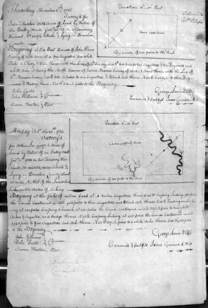
See, Arthur
30 Oct 1786
9,937 acres
About 25 miles NW of the Lower Blue Licks on the waters of Licking
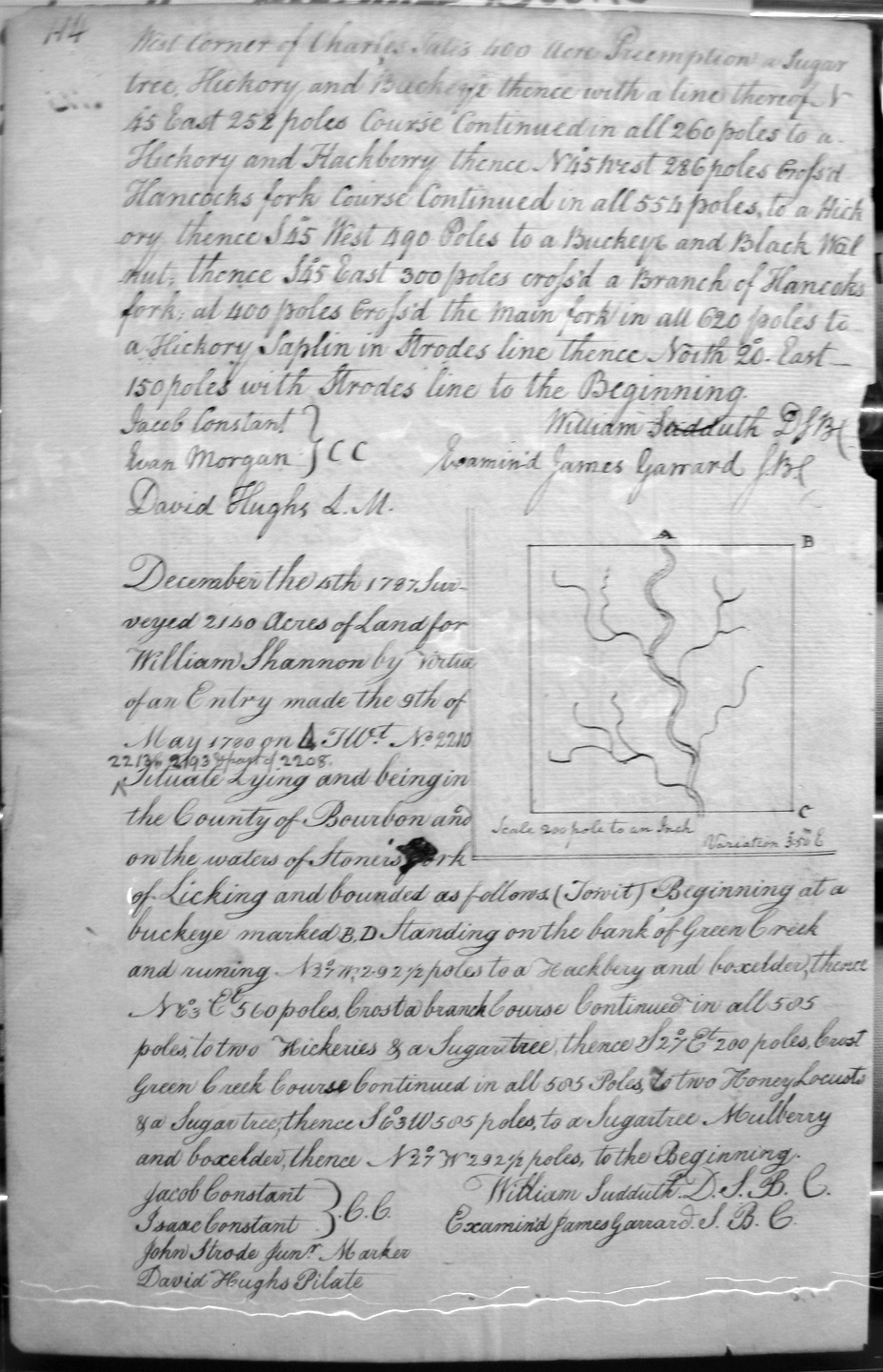
Shannon, William
22 Nov 1787
1,680 acres
On the waters of Stoner's Fork, and on the NW corner of John Strode's Preemption, the West corner of Charles Tate's 400 acre Preemption, crossing Hancock's course.
Shannon, William
4 Dec 1787
2,140 acres
On the waters of Stoner's fork of Licking, and on the bank of Green Creek.
Shannon, William
1 Feb 1789
1,868 acres
On the waters of Hunting creek (now called Greens creek) and David Jones fork of Elkhorn, and in a line of Charles Smith's. Surveyor Charles Smith, Jr., and chain carriers, Charles Smith Sr., Jas (?) Shropshire and David Hughes.
Shannon, William
15 Dec 1788 (?)
560 acres
Beginning at the SE corner of a 1,000 acre tract owned by Joseph (?) Tomlinson on the waters of Flat Creek, then crossing the branch and the Main branch, then to a drain, and crossing again 100 feet above Tomlinson's improvement.
Shannon, William
5 Mar 1789
2,000 acres
On the Waters Emptying into Stoner's fork on the West Side.
Shastern, Renny
20 Jan 1787
600 acres
On Slate creek, on the lines of James Pattie and George Thompson
Shiphord (Shephard ?), Balis (Baylis?)
12 Nov 1788
2,395 acres
On Buckhorn Creek, beginning at the upper end of Robert Clarke's 2,000 acre survey, and at the round bottom of a small branch on the North side,
Shipp, Colby and Richard Ridgley, as tenants in common
22 May 1788
12,268 3/4 acres
Lying on the main branch of Licking.
Shipp, Colby
22 May 1788
6.134 1/4 acres
On the main branch of Licking at the mouth of a small branch on the N side, on Richard Ridgley's 6,134 1/4 acre survey and crossing Licking with Ridgley's line.
Shipp, Laban (Colby Shipp & Thomas James)
23 May 1788
1,000 acres
[Incomplete]
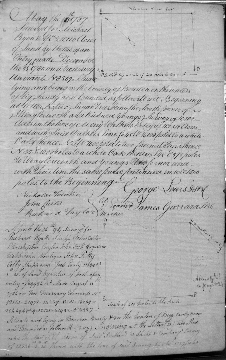
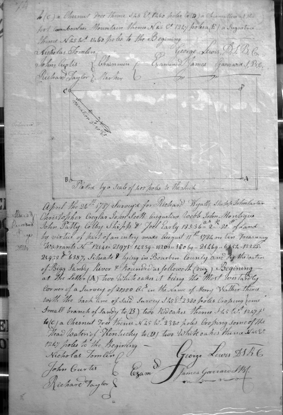
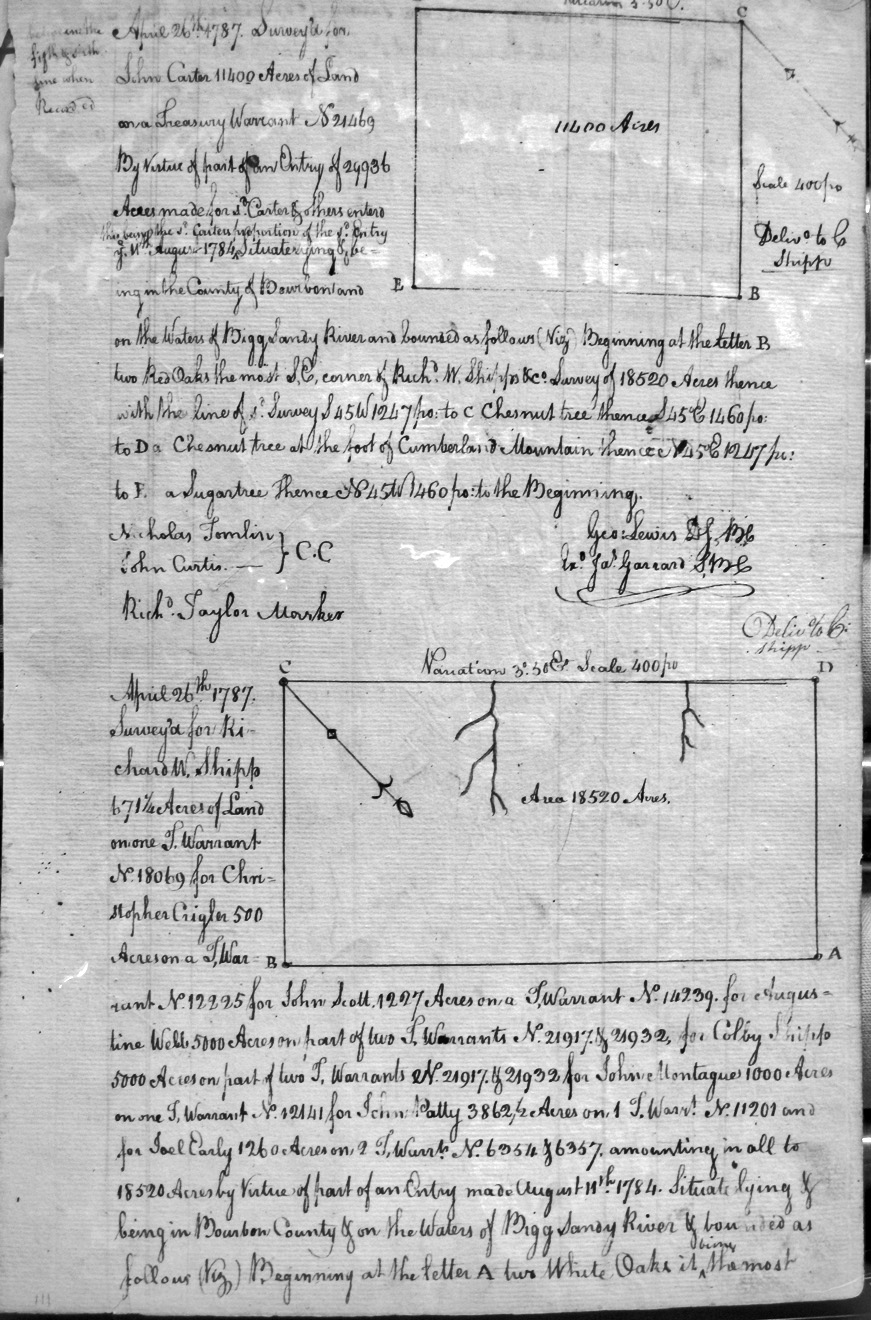
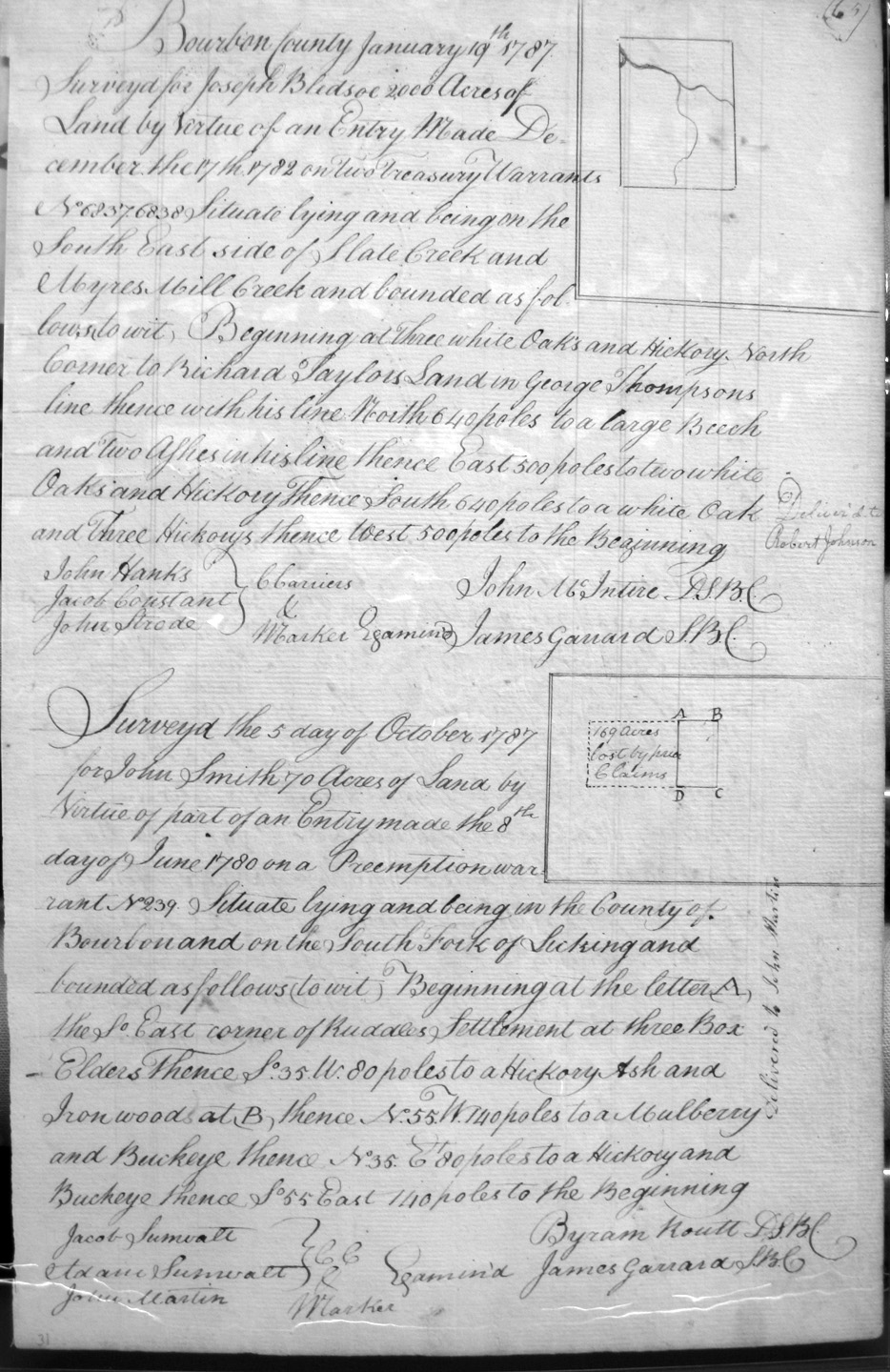
Shipp, Richard Wyatte, John Carter, Christopher Creagler, John Scott, Augustine Webb, John Montigue, John Patty, Colby Shipp & Joel Early
26 Apr 1787
113,990 acres
On the waters of the Bigg Sandy River, and on the lines of the most S.E. corner of Richard W. Shipp & Company's 18,536 acre survey and at the foot of Cumberslan (?) Mountain.
Shipp, Richard Wyatte, John Carter, Christopher Creagler, John Scott, Augustine Webb, John Montigue, John Patty, Colby Shipp & Joel Early
26 Apr 1787
13,536 [or 8,536] acres
On the waters of the Bigg Sandy River and crossing some of the head waters of Kentucky, and on the lines of the most westerly corner of Merry Walker's 20,000 acre survey.
totalling 18,520 acres
26 April 1787
Shipp, Richard W. 671 1/4 acres
Cragler, Christopher 500 acres
Scott, John 1,227 acres
Wells, Augustine 5,000 acres
Shipp, Colby 5,000 acres
Montegue, John 1,000 acres
Patty, John 3,762 1/2 acres
Early, Joel 1,260 acres
On the waters of Bigg Sandy River, on the most westwardly corner of Merry Walker's 20,000 acre survey and crossing some of the headwaters of the Kentucky.
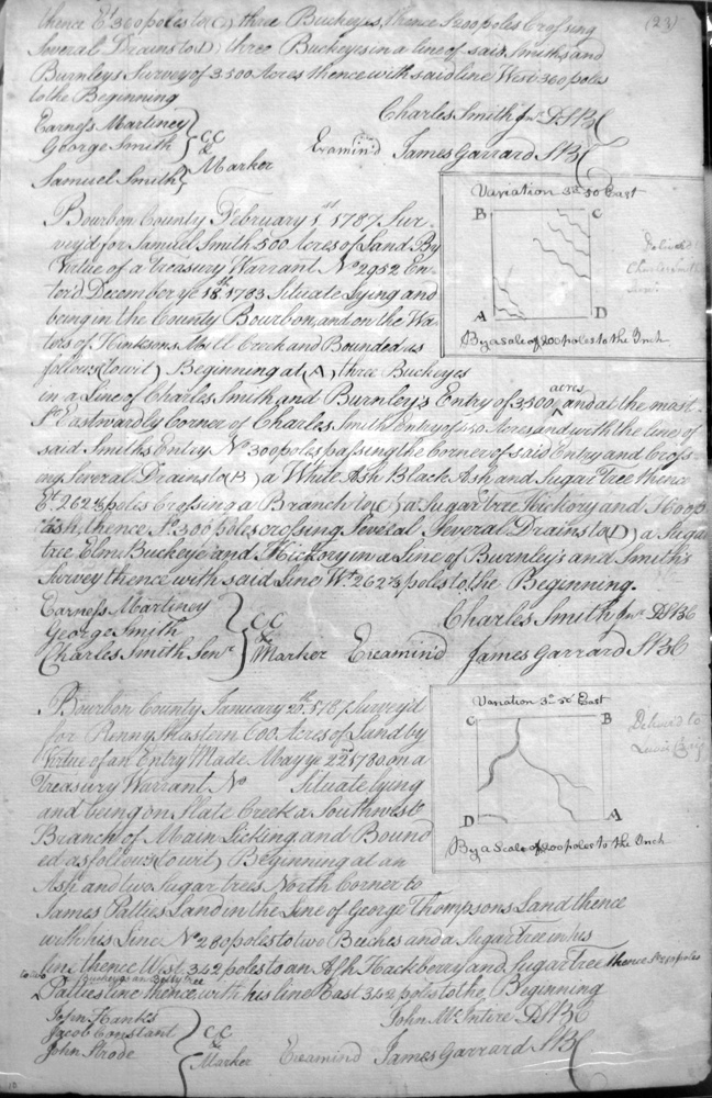
Smith, Charles, Jun.
__ Feb 1787
450 acres
On Hinksons mill creek, on the North side of Burnley and Smith's survey of 4,500 acres, on the lines of McMillion's survey
Smith, John
5 Oct 1787
70 acres
On the South Fork of Licking on the So. East corner of Ruddle's Settlement.
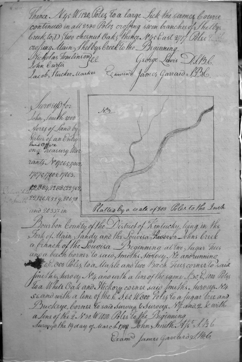
Smith, John, No. 3
19 Mar 1788
5,000 acres
On the fork of Main Sandy and the Lowisa River on John's Creek, a branch of Lowisa, on Smith's survey No. 2.
Smith, John, No. 6
19 Mar 1788
5,000 acres
On the fork of Main Sandy and the Lowisa River on John's Creek, a branch of Lowisa, that empties into said River on the East side, and on Smith's survey No. 5.
Smith, John, No. 1
19 Mar 1788
5,000 acres
On the fork of Main Sandy and the Lowisa River on John's Creek, a branch of Lowisa, that empties into said River on the NorthEast side, and corners on a bank of the creek near a mile above the mouth of Raccoon creek, and on Smith's Surveys Nos. 2, 7 & 8.
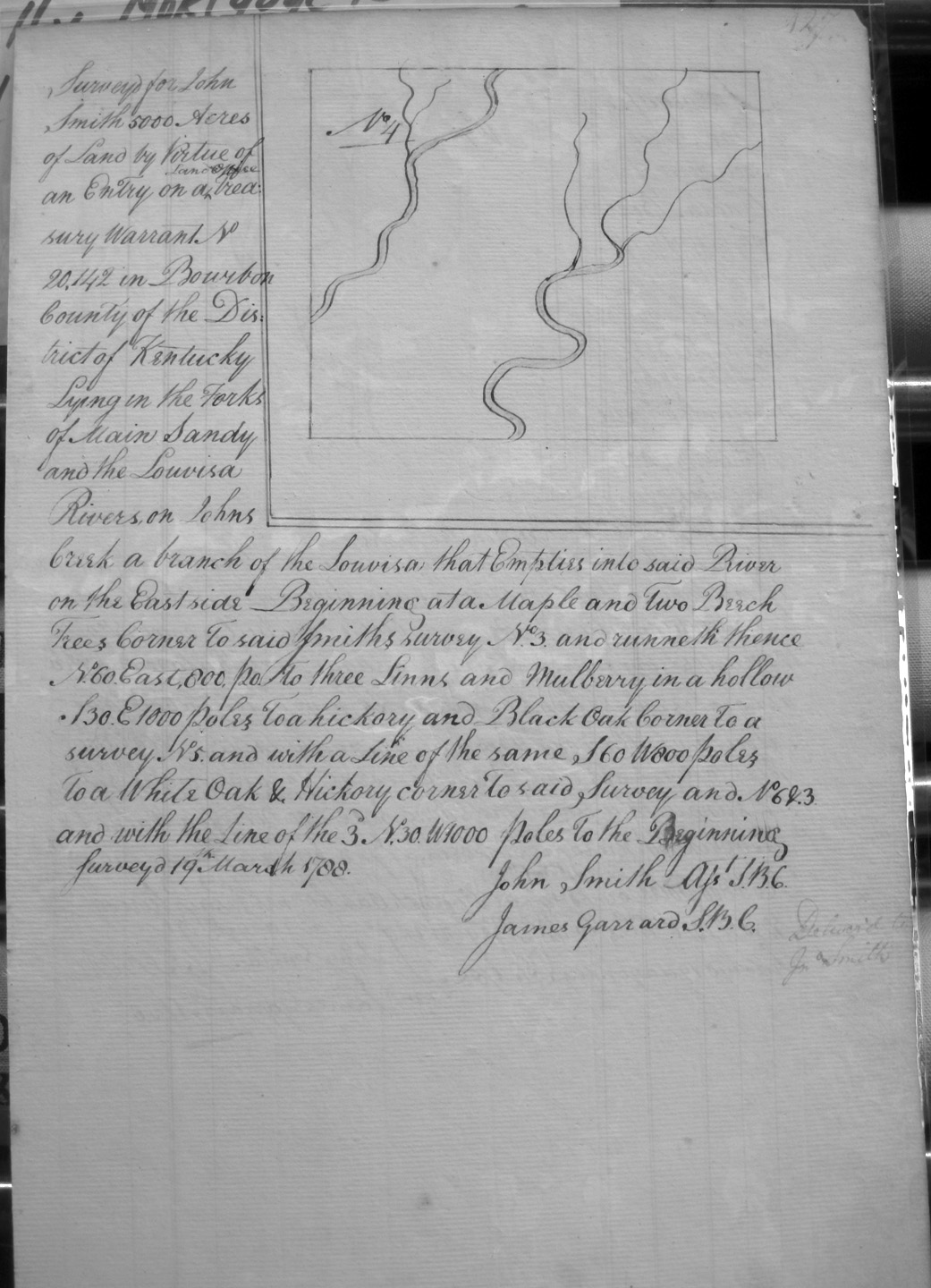
Smith, John, No. 4
19 Mar 1788
5,000 acres
On the forks of Main Sandy and the Lowisa River on John's Creek, that empties into said River on the East side, and on Smith's Surveys Nos. 3, 5 & 6.
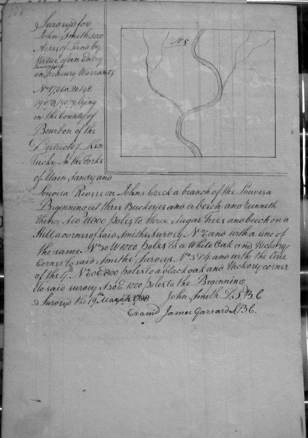
Smith, John, No. 5
19 Mar 1788
5,000 acres
On the forks of Main Sandy and the Lowisa River on John's Creek, that empties into said River on the East side, and on Smith's Surveys Nos. 1, 2, 3, 4, 5 & 6.
Smith, John, No. 7
19 Mar 1788
5,000 acres
On the forks of Main Sandy and the Lowisa River on John's Creek, that empties into said River on the East side, and on Smith's Surveys Nos. 1, 2, 3, 6 & 8.
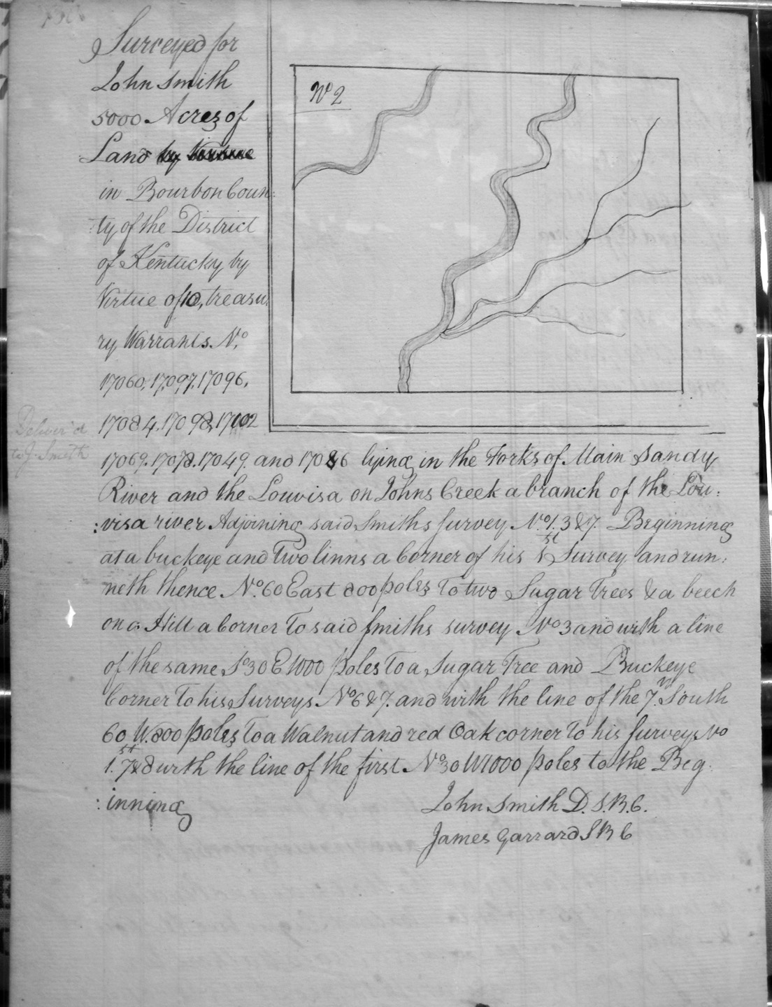
Smith, John, No. 2
19 Mar 1788
5,000 acres
On the forks of Main Sandy and the Lowisa River on John's Creek, that empties into said River on the East side, and on Smith's Surveys Nos. 1, 3, 6 & 7.
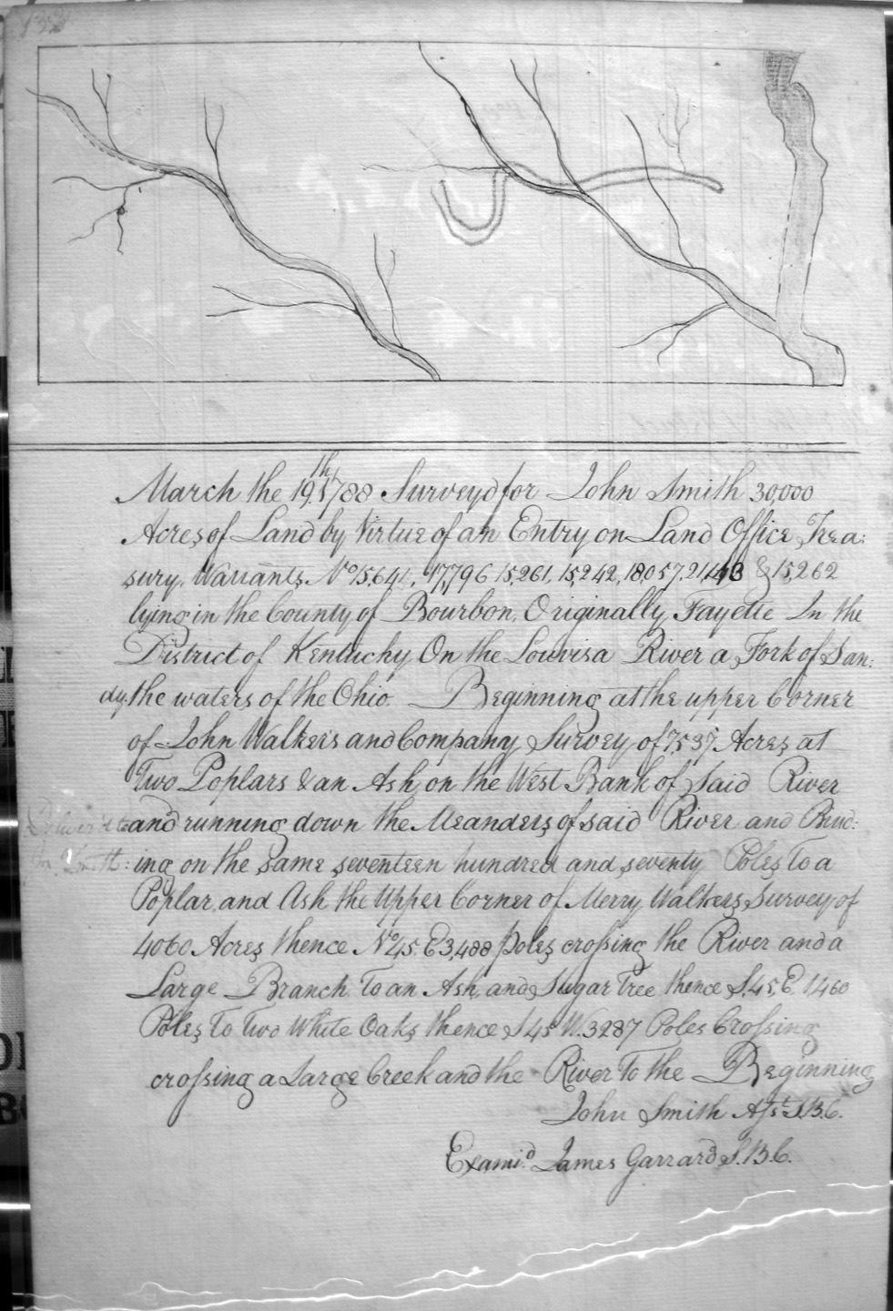
Smith, John
19 Mar 1788
30,000 acres
On the forks of Main Sandy and the Lowisa River on John's Creek, that empties into said River on the East side, and on Smith's Surveys Nos. 1, and on Merry Walker's 4,060 and 5,940 acre surveys.
Smith, John
19 Mar 1788
5,000 acres
On the forks of Main Sandy and the Lowisa River on John's Creek, that empties into said River on the East side, and on Smith's Surveys Nos. 1, and on John Walker's 7537 acre survey and Merry Walker's 4060 acre survey.
Smith, John, No. 8
20 Mar 1788
5,000 acres
On the forks of Main Sandy and the Lowisa River on John's Creek, that empties into said River on the East side, and on Smith's Surveys Nos. 3, 6 & 7.
Smith, Samuel
5 Feb 1787
500 acres
On the waters of Hinksons mill creek, on the line of Charles Smith and Burnleys survey
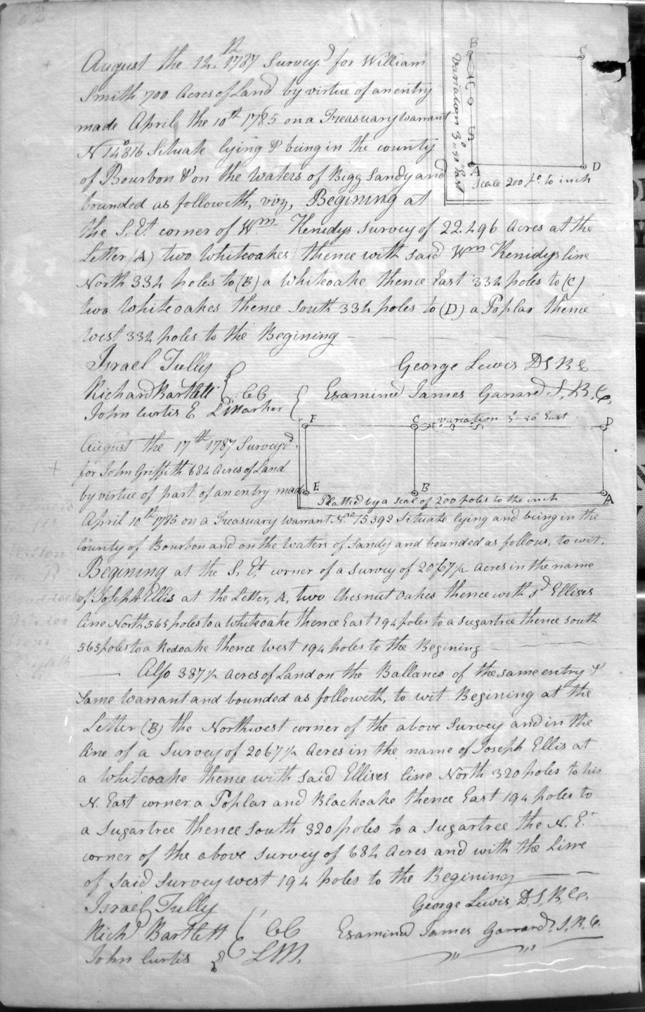
Smith, William
12 Aug 1787
700 acres
On the waters of Bigg Sandy and on the SE corner of Wm. Kenedy's 22,296 acre survey.
Steel, William, assignee of William Flinn
18 Feb 1787
1,000 acres
On the South side of Hinktson's Fork of Licing River on the lines of Said Steel's Preemption, adjoining a Preemption of James Power assignee of Joseph Huston, Wm Neasbit's Preemption, and Sam'l Neasbit's Preemption.
Strother, French
2 Aug 1786
500 acres
On Hinksons Fork Waters of Licking, adjoining Lawrence Slaughter's 1,000 acre survey, John Conway's 1,000 acre Preemption, and French Strother's line
Strother, French
Entry dated 15 May 1780
284 acres
On the waters of Hinkston's fork of Licking adjoining the Strothers 500 acre survey on the East side. Also on the lines of John Conway's Preemption, a small branch in Ale__ Blain's line, plus 54 1/2 acres on the North side of Strother's 500 acre survey.
Also 107 acres on the West side of Strother's 500 acre survey.
Strother, French
4 Aug 1786
312 acres
44 acres on the East side of Strother's 284 acre survey, Alex'r Blaine's 1200 acre survey.
Also, 98 acres adjoining Strother's 54 1/2 acre survey on the North side and Strother's 98 acre survey.
Also, another 98 acres adjoining Strother's 98 acre survey on the NW corner.
Also, 162 acres adjoining Strother's 107 acre survey on the West, Laurance Slaughter's 1,000 acre survey, and Strother's 98 acre survey.
Strother, Joseph
1 Apr 1788
7,221 acres (says 7,214 on map)
On the Waters of Bigg Sandy and bounded by a survey of 25,000 acres of John May an David Ross, and Lewis's survey.
Strother, William
1 Apr 1788
1,108 acres
On the waters of Bigg Sandy and bounded by a 7,221 acre survey of Joseph Strother and the bank of a small creek.
Stuart, David
5 Feb 1787
On the lines of Wm. Hunters 21,791 acre survey and crossing Locust creek.
Stuart, Hugh
21 Dec 1785
14,900 acres
On the line of John A. Dorr's (?) 10,000 acre survey near the Ohio, and Dorr's 6,335 acre survey.
Symmes, William
5 Jan 1787
30,000 acres
On the waters of Licking on the North side thereof, on the dividing ridge between the Salt Rock fork of Sandy and Triplett's creek
Symmes, William & John Reed
No date
3,000 acres
On the North fork of Kentucky, South side, opposite the lower end of Richard Baynhams' survey of 2,000
Symmes, William & John Reed
10 Nov 1788
3,000 acres
On the waters of Buckhorn creek, on Lick creek, on a dividing ridge between Buckhorn and Rock House.
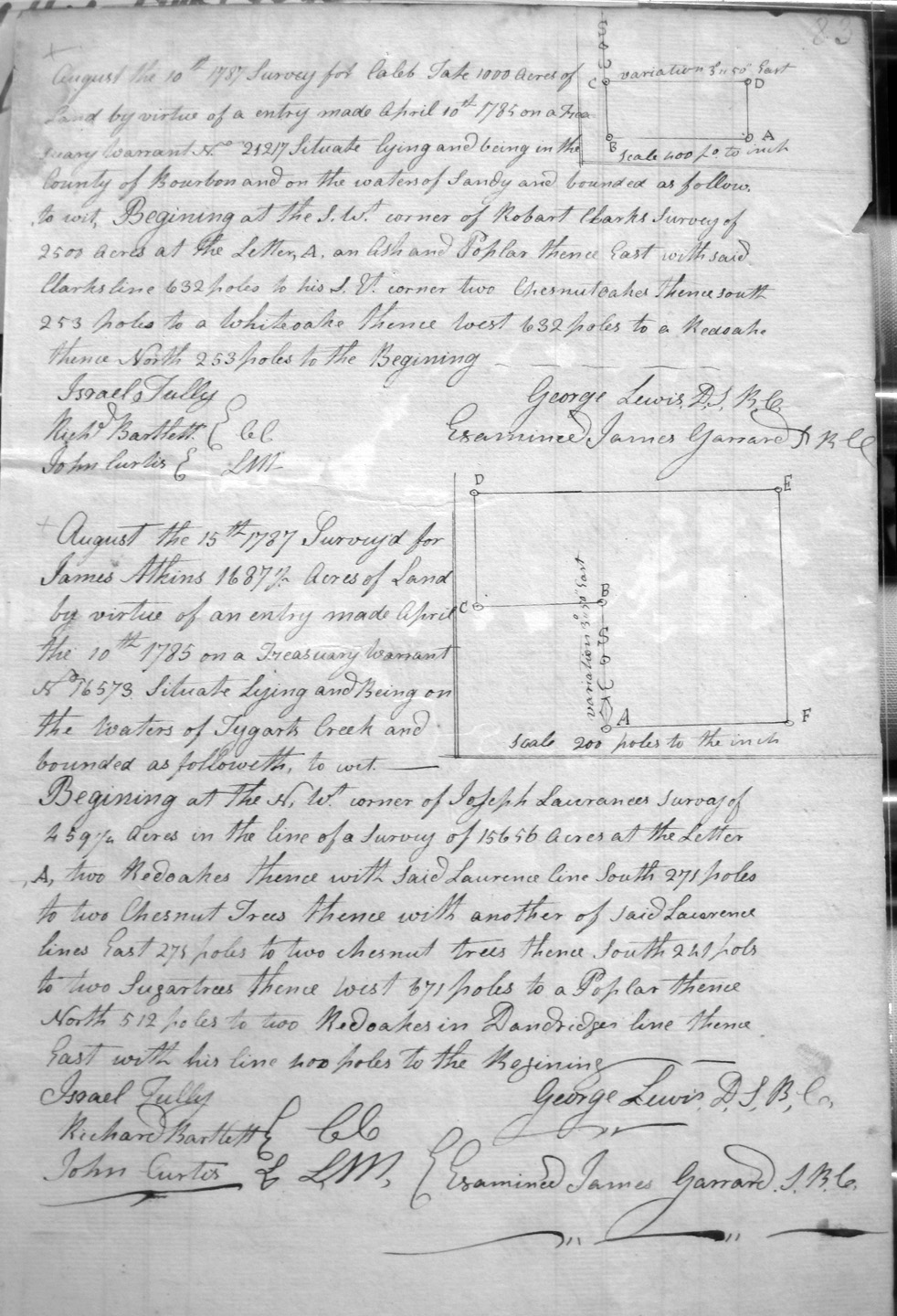
Tate, Caleb
10 Aug 1787
1,000 acres
On the waters of Sandy, on teh SW corner of Robert Clark's 2,500 acre survey.
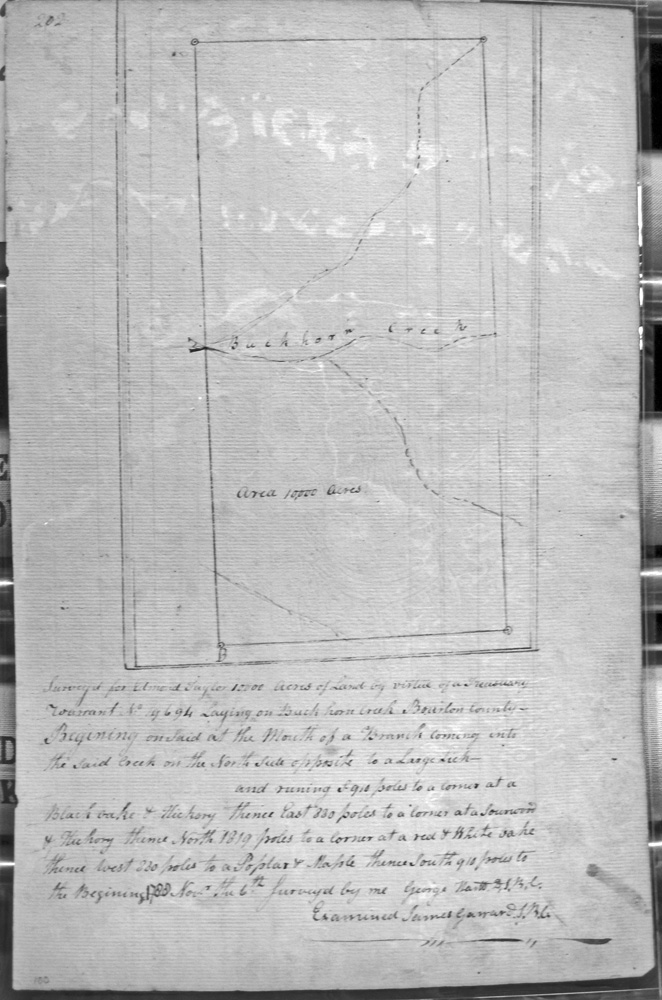
Taylor, Edmond
6 Nov 1788
10,000 acres
On Buck Horn creek at the mouth of branch coming in the creek from the North side opposite a large lick.
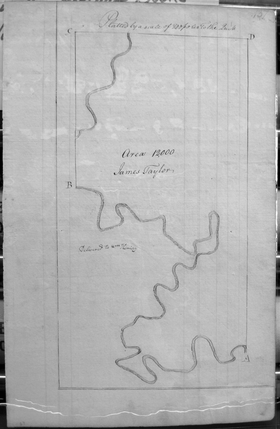
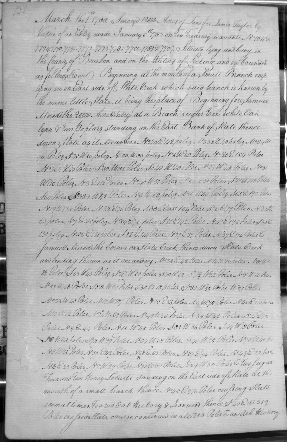
Taylor, James
1 Mar 1788
12,000 acres
On Licking, on the mouth of Little Slate on the line of Samuel Meredith's 20,000 acre entry, on the East side of Slate Creek, and down Slate Creek.
Taylor, John
16 Jany 1787
2,000 acres
On the waters of Licking and on the lines of a large Indian Camp on the south side of Licking.
Taylor, John
Page 192 (appears to be a repeat of page 67 above)
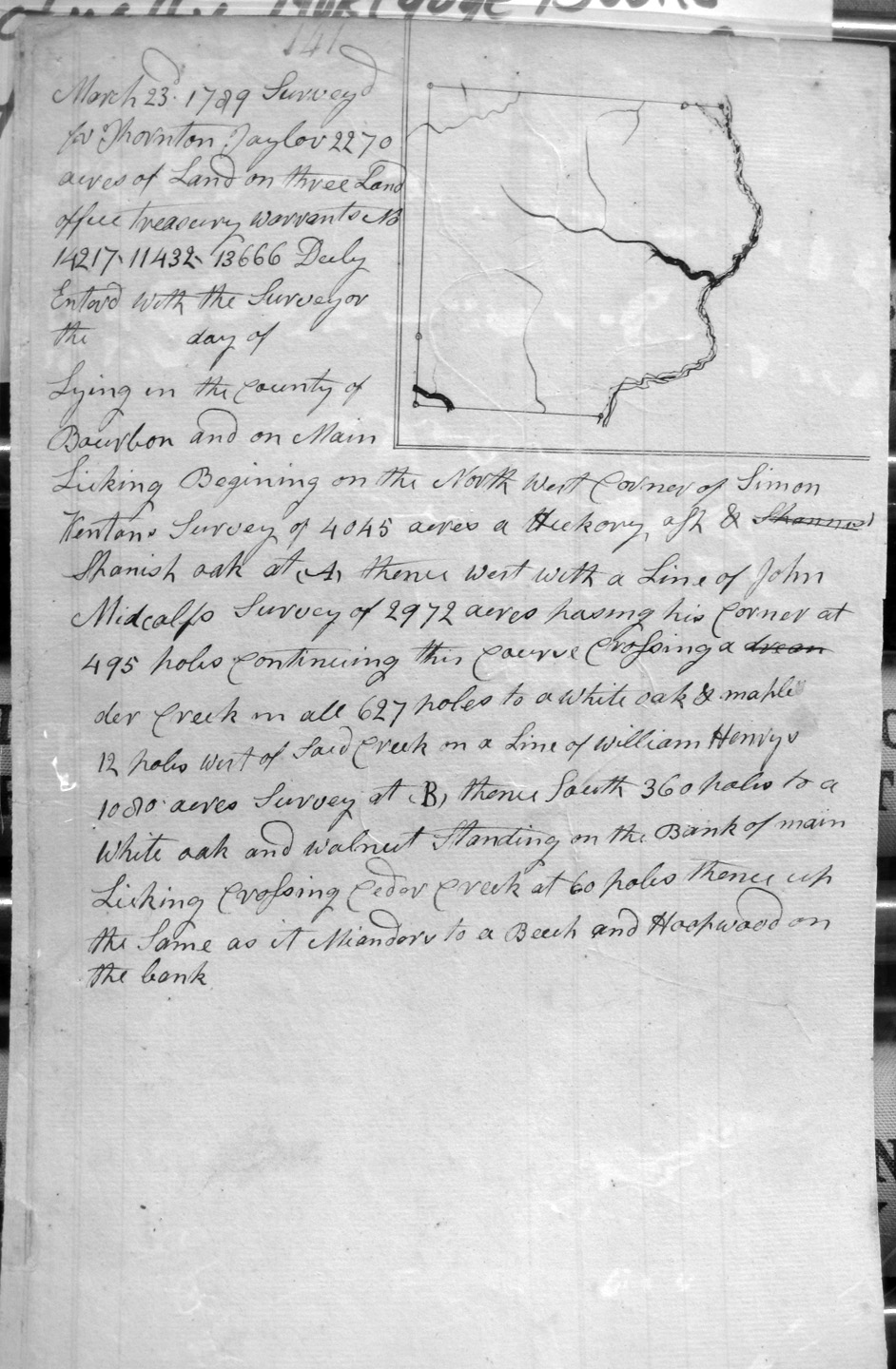
Taylor, Thornton
23 Mar 1789
2,270 acres
On Main Licking, on the NW corner of Simon Kenton's 4,045 acres and with the lines of John Meetcalf's 2,972 acres, William Henry's _____ acre survey and crossing Cedar creek.
Taylor, William
2 Nov 1788
2,000 acres
On the South side of the North fork of Kentucky.
Thompson, James
6 Feb 1787
1,000 acres
Waters of Hinkston's fork of Licking
Thompson, Laurence, Assignee of Nath'l Hart
14 Feb 1789
2,000 acres
Entered with the surveyor of Fayette County on the Waters of Licking, and bounded by Jeremiah Parks (?) survey of 600 acres.
Thompson, Laurence, Assignee of Nath'l Hart
14 Feb 1789
2,000 acres
Entered with the surveyor of Fayette County on the Waters of Licking, and bounded by a line of the former survey made on the same entry.
Thompson, Laurence, Assignee of Nath'l Hart
Page 280
26 May 1784 (or 1789)
1,000 acres
In Fayette County on the waters of Lulbegrud. [Note: recorded by mistake it being Fayette County]
Thompson, William
22 Oct 1788
1,000 acre preemption
On the waters of Kentucky, known by the name of Troublesome creek, beginning on the South side of sd. creek opposite of Arch'd Blair's 1,688 3/4 acres and running with the meanders of sd creek.
Thornton, John
2 Nov 1786
1,286 acres
On the lines of John Winn's 2,632 acre survey, the N corner of James Monroe's Survey of 4,242 & 1/2 acre
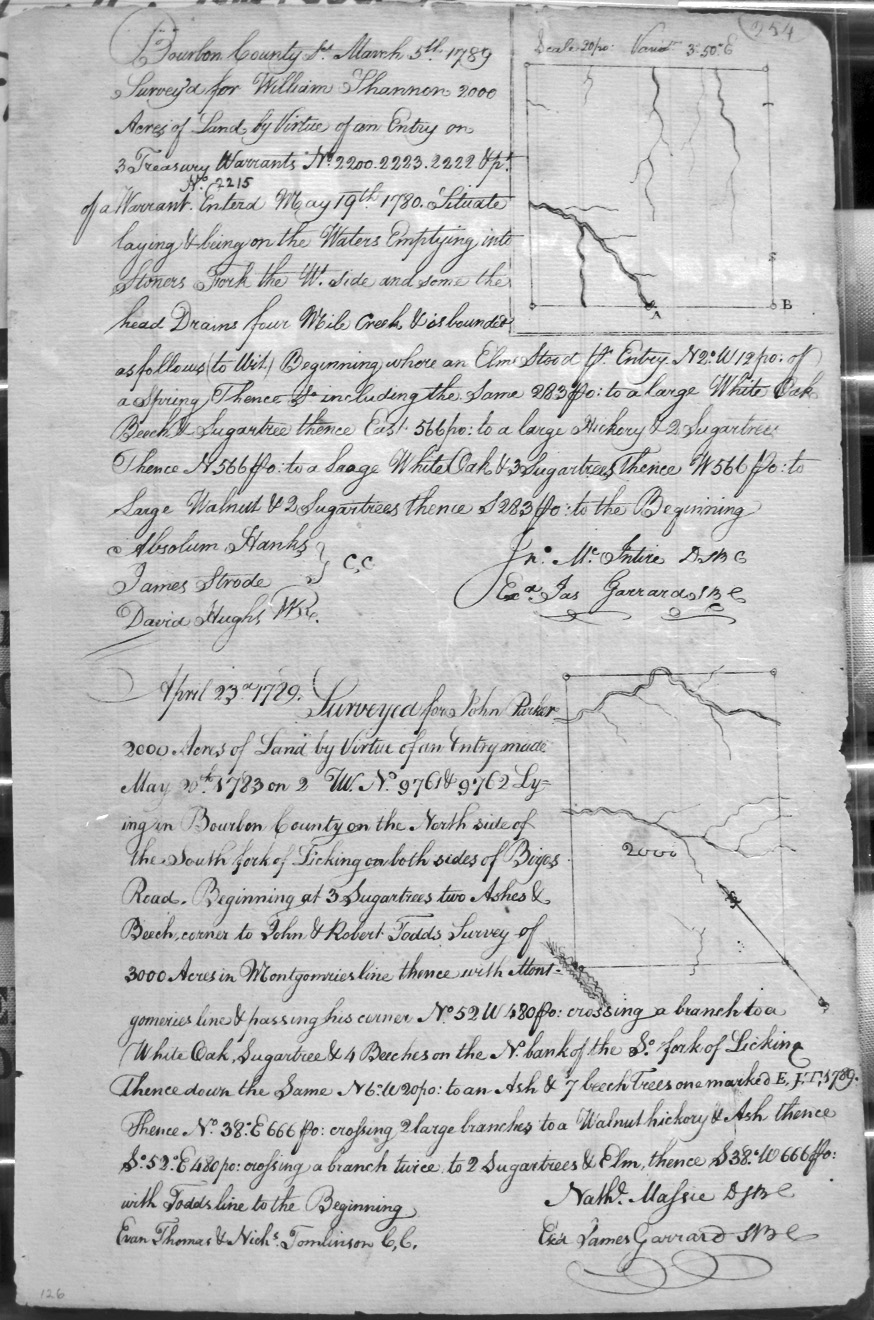
Todd, John and Robert Todd
23 Apr 1789 (?)
3,000 acres
On the Main forks of Licking, on the lines of Thomas Montgomery's 2,331 acre survey and ____'s 1,000 acres.
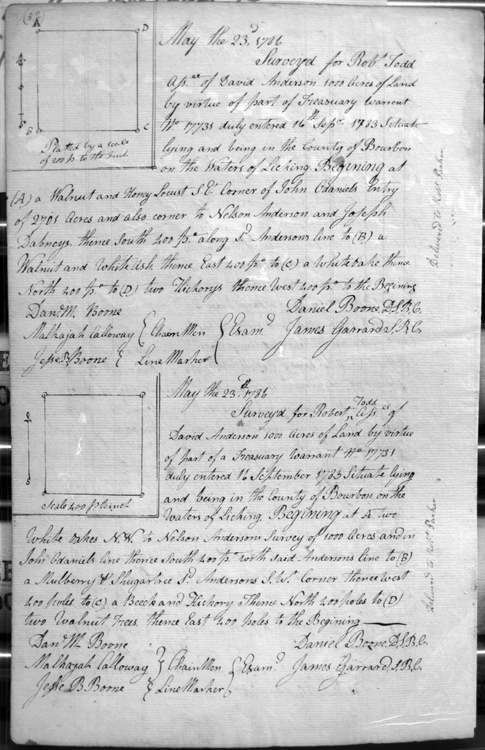
Todd, Robert
23 May 1786
1,000 acres
On the waters of Licking, on the lines of John O'daniels's 2,701 acre entry, and the lines of Nelson Anderson and Joseph Dabney.
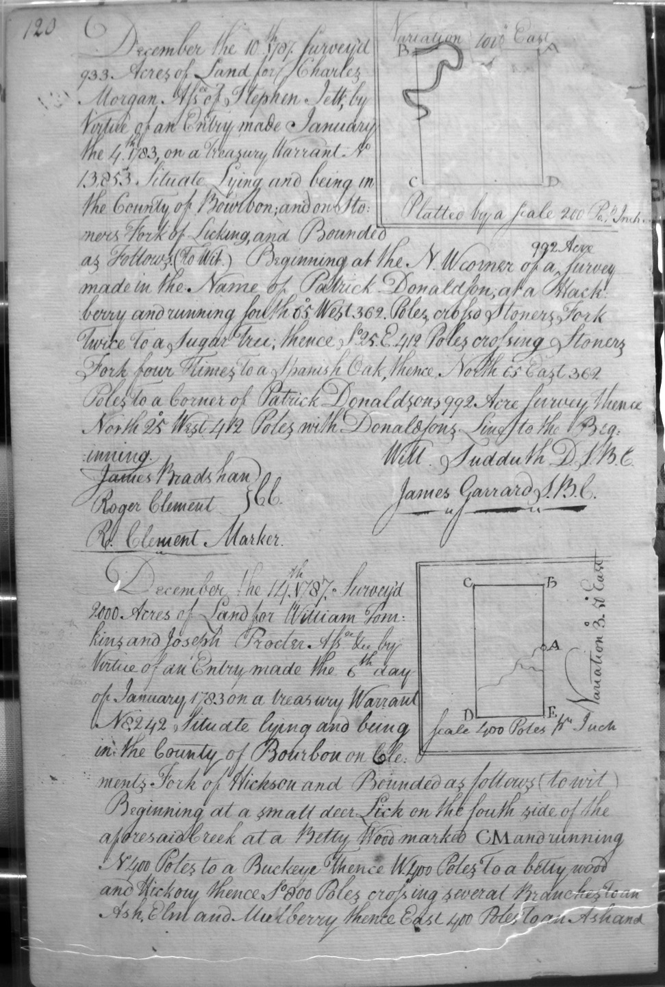
Tomkins, William & Joseph Procter
14 Dec 1787
2,000 acres
On Clement's fork of Hinkson, on a small deer lick on the south side of the creek.
Tomlinson, Joseph
13 Dec 1788
1,000 acres
On the waters of Slate creek to include two improvements on the branch, one for Ebenezer Corn and the other for Davis.
Train, Silas (heirs)
11 May 1789
400 acres
On a certificate of Settlement, corner to Hinkston's Preemption, with Moore's line, then with Huskins Settlement, Miller's Preemption, and the creek.
Trotter, George and John Fowlar
5 Jan 1787
3,375 acres
On the lines of Richard Graham's 138,320 acres, James Primm's 1,000 acre survey, George Lumsdon's 6.800 3/4 acres
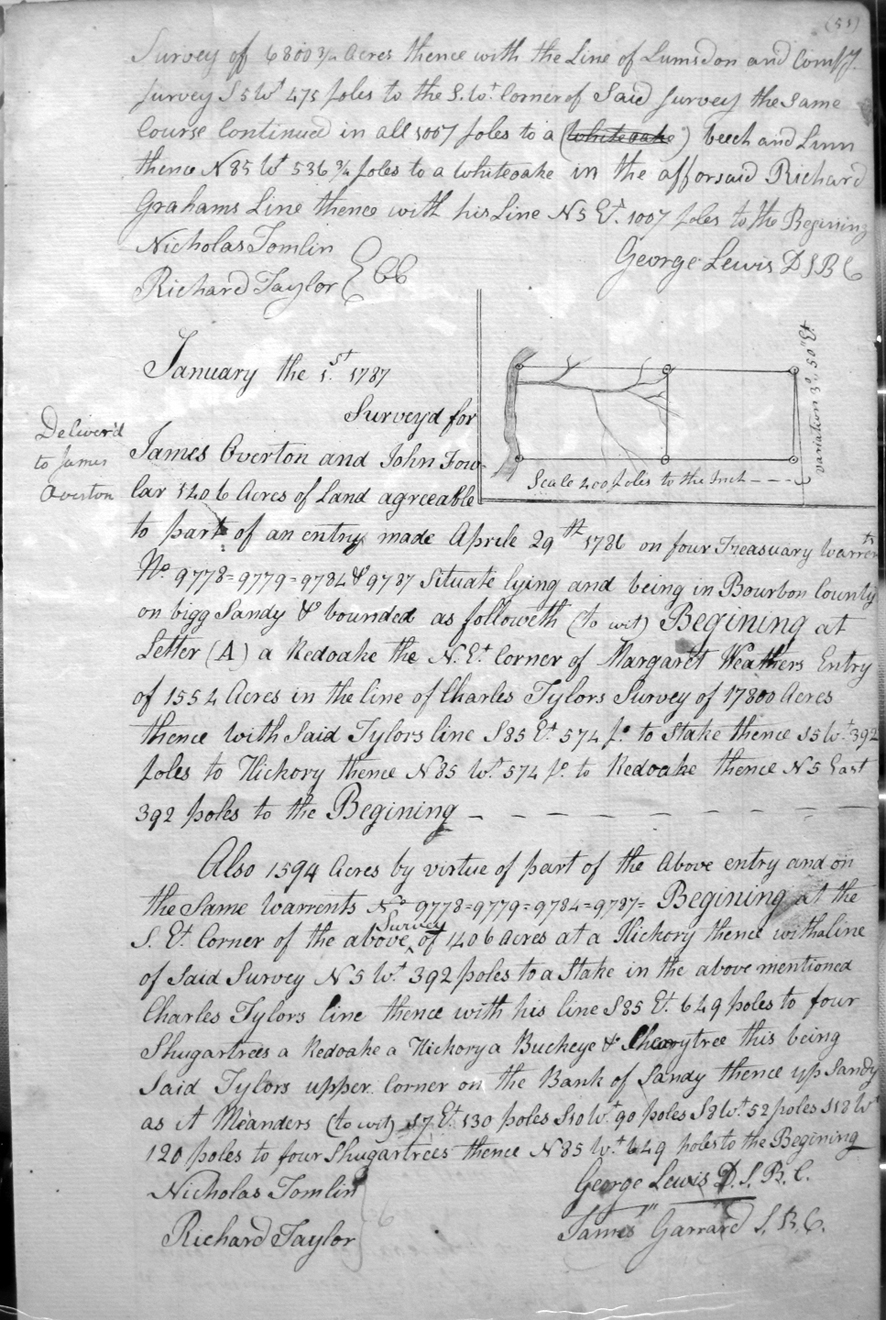
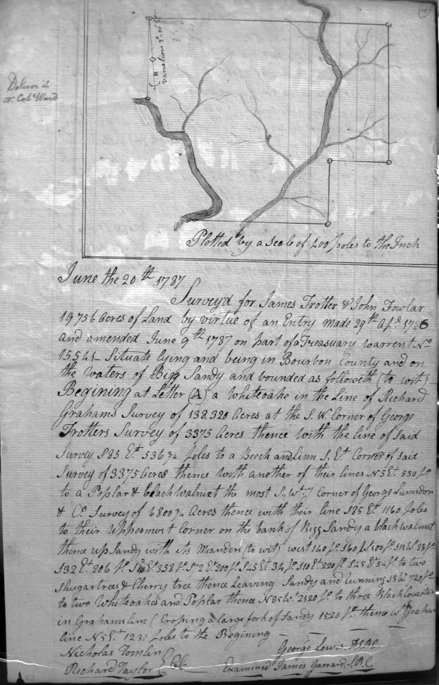
Trotter, James and John Fowlar
20 June 1787
19,736 acres
On the waters of Bigg Sandy and the lines of Richard Graham's 138,320 acre survey, George Trotter's 3,375 acre survey, George Lumsdon & Co.'s 6,800 3/4 acre survey, and the meanders of the Bigg Sandy.
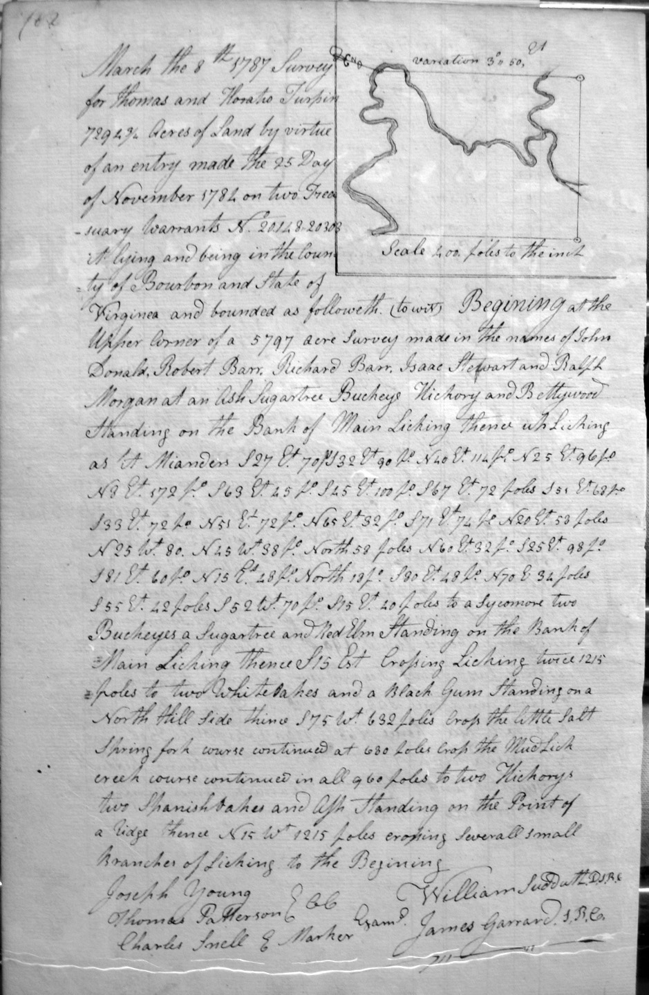
Turpin, Thomas & Horatio
8 Mar 1787
7,294 3/4 acres
Situate in Bourbon County and the State of Virginia, in John Donald, Robert Barr, etc., 5.797 acre survey, crossing Licking and mud Lick Creek,
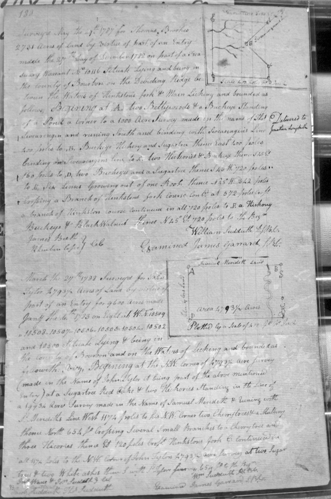
Tyler, John
27 Mar 1788
4,793 1/2 acres
On the waters of Licking and on the NW corner of an entry made in the name of John Tyler for 4,793 1/2 acres and being part of the above entry, standing in the line of Samuel Meredith's 19,934 acre survey.
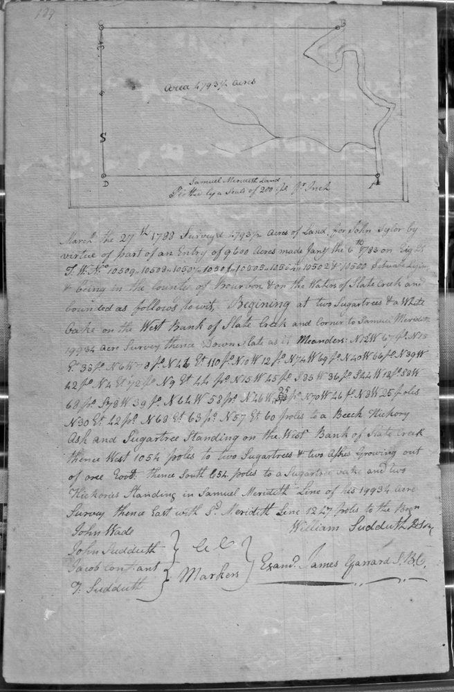
Tyler, John
27 Mar 1788
4,793 1/2 acres
On the waters of Slate Creek and in the line of Samuel Meredith's 19,934 acre survey and with the meanders of Slate Creek.
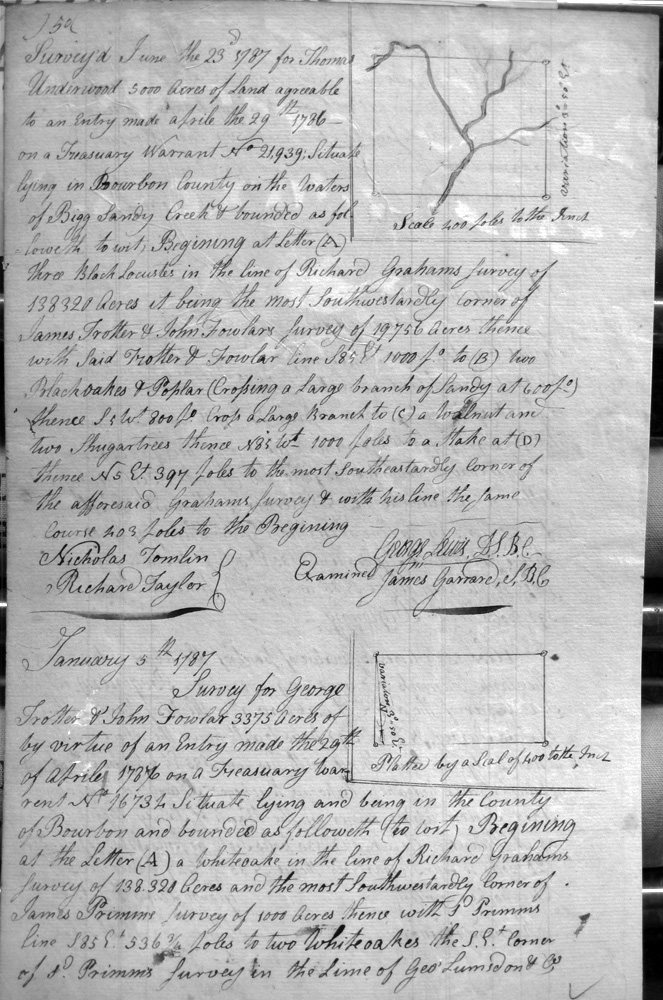
Underwood, Thomas
23 June 1787
5,000 acres
On the waters of Bigg Sandy Creek, on the lines of Richard Graham's 138,320 acre survey, and James Trotter and John Fowlar's 19,756 acre survey
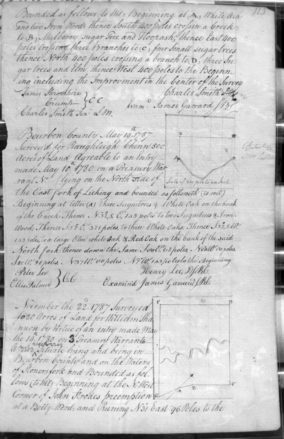
Virgin, John
12 Aug 1787
1,000 acres
On the waters of Huston's creek, a branch of Licking, including the Improvement in the center of the Survey.
Waits, Elizabeth, in trust for the Heir of Reuben Waits
20 Sep 1786
1,000 acres
North side of the Road leading from Lexington to the Mouth of Cooper's Run
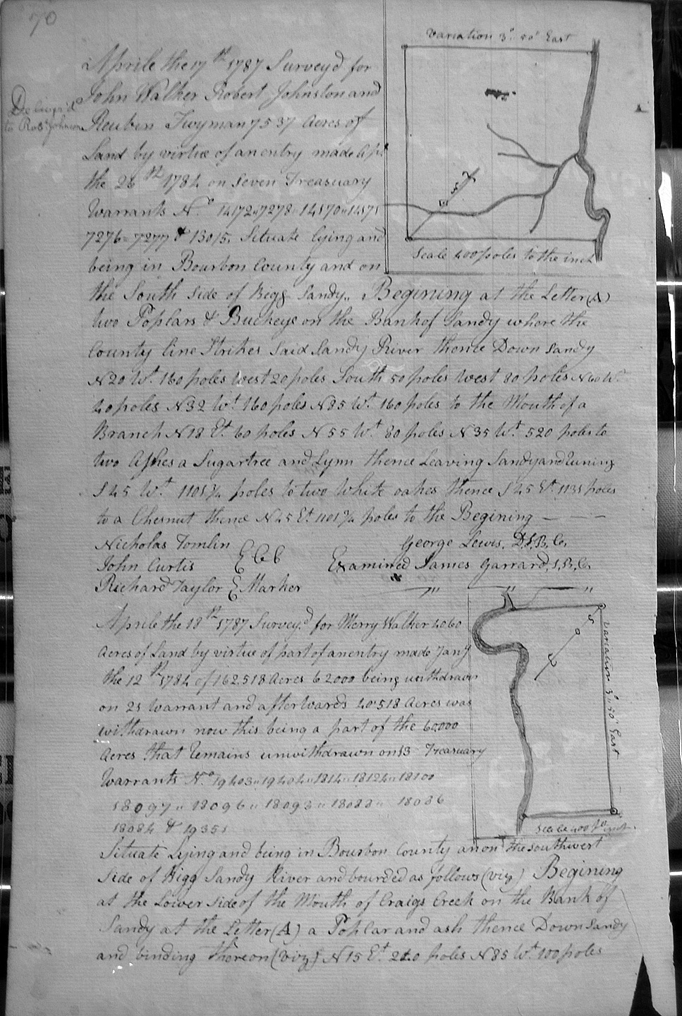
Walker, John, Robert Johnston and Reubin Twyman
17 Apr 1787
7,539 acres
On the south side of Bigg Sandy, on the lines of the Bigg Sandy where the county line strikes.
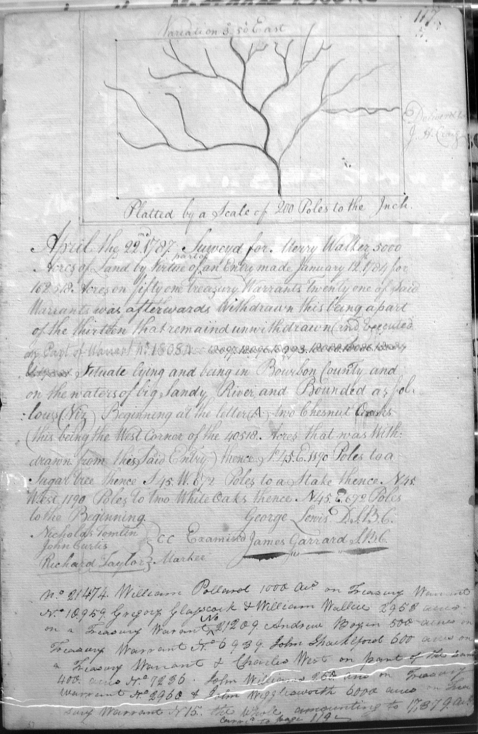
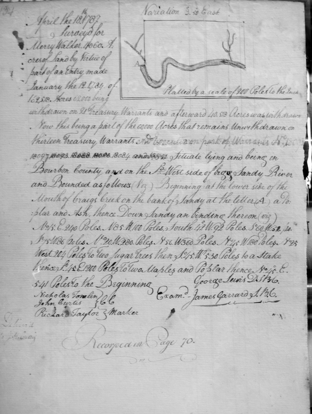
Walker, Merry
18 Apr 1787
4,060 acres
On the Southwest side of Bigg Sandy River, and on the lower side of the mouth of Craig's creek on the bank of Sandy.
Walker, Merry
25 April 1787
5,000 acres
On the waters of Bigg Sandy River on the East corner of J. Walker's 5,000 acres.
Walker, Merry
18 April 1787
5,940 acres
On the SW side of bigg Sandy River, at the lower corner of Walker's 4060 acre survey, to the mouth of Elkhorn, and crossing Elkhorn.
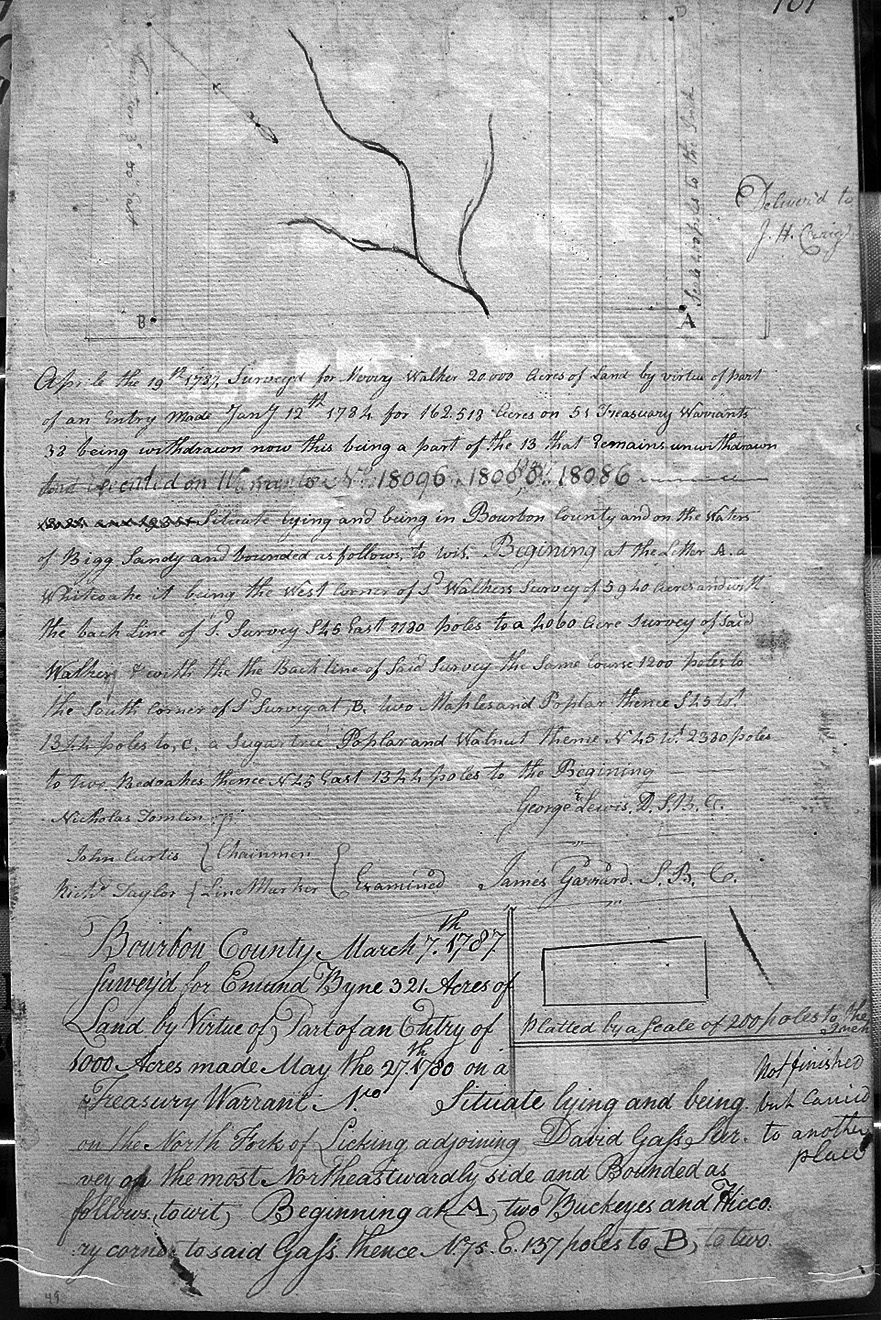
Walker, Merry
19 Apr 1787
20,000 acres
On the waters of Bigg Sandy and on the lines of Sd. Walkers 5,940 and 2060 acre surveys.
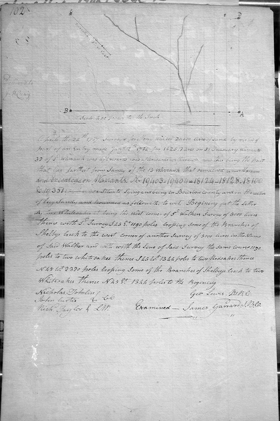
Walker, Merry
24 Apr 1787
20,000 acres
On the waters of Bigg Sandy and on the lines of Sd. Walkers 5,000 acre surveys, crossing Shelby's creek to another of said Walker's 5,000 acre survey..
Walker, Merry
22 Apr 1787
5,000 acres
On the waters of big Sandy River, and on the lines of 40,518 acres drawn from this Entry by Walker
Walker, Merry (Recopied in Page 70)
18 Apr 1787
4,060 acres
On the SoWest side of Bigg Sandy River, and on the lower side of the mouth of Craig's creek.
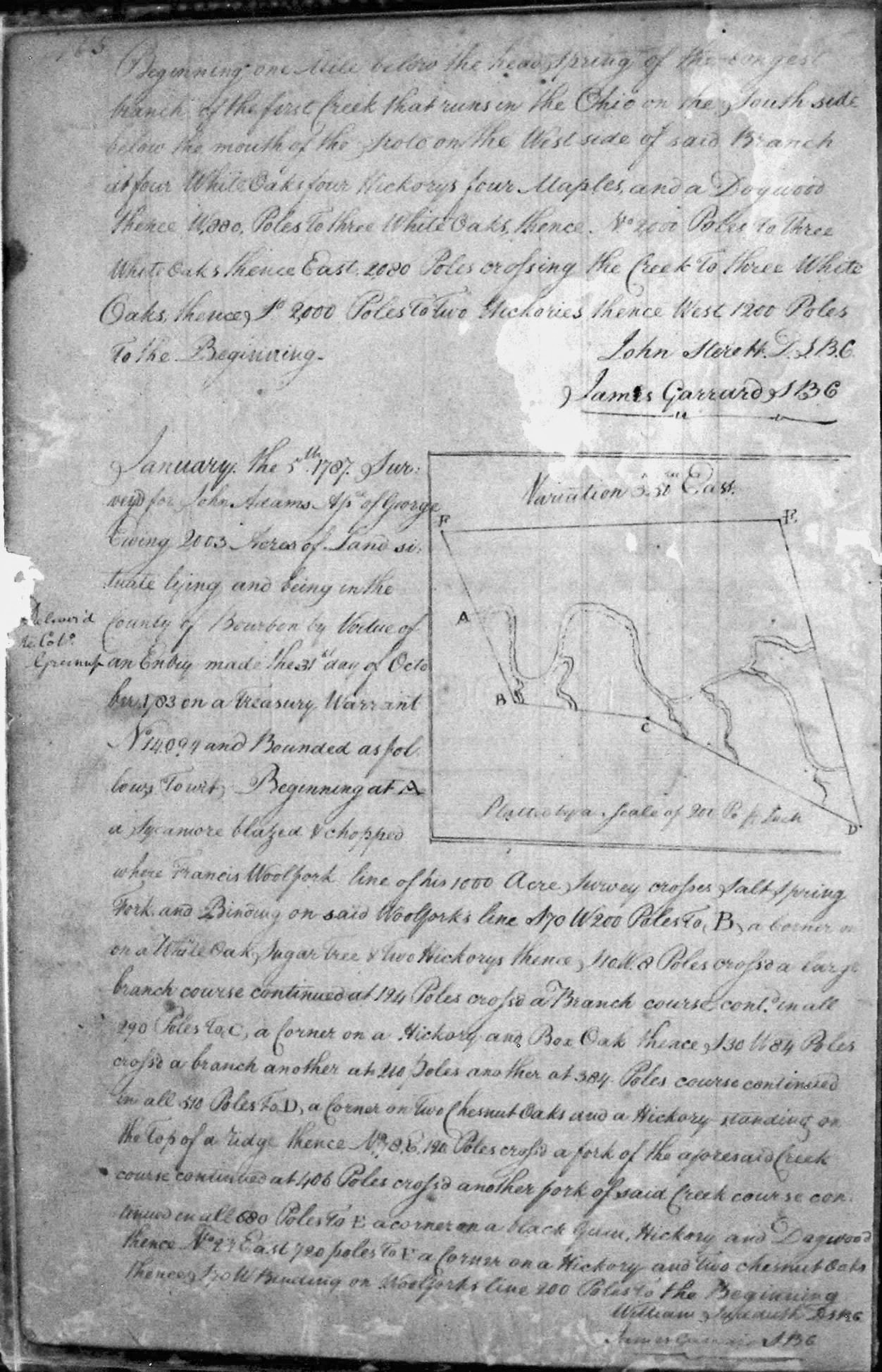
Walker, Merry
1 (?) Aug 1788
26,000 acres
In Bourbon County, beginning at the head spring of the long branch of the first creek that runs into the Ohio on the South side.
Walkins, Nicholas
25 Apr 1789
4,000 acres
On the Headwaters on the North fork of Licking, bounded by a 10,000 acre survey of Thomas Poindexter, and crossing two small branches.
Walton, Matthew
3 Apr 1789
609 1/4 or 6,091 1/4acres
On the waters of Bigg Sandy, on the lines of Richard Adams' 20,000 acre survey, Merry Walker's line, Shipp's line, and corner to said Walton.
Walton, Matthew
3 Apr 1789
609 1/4 or 6,091 1/4acres
On the waters of Bigg Sandy, on the lines of Richard Adams' 20,000 acre survey, sd. Walton's 609 1/4 acre survey, and Shipp's line.
Walton, Matthew
Page 280
5 Apr 1790
9,000 acres
On the waters of Red River at Matt Robertsons SE corner of his 20,000 acre survey.
Wamack, Allin
7 Apr 1788
5,000 acres
On each side of Little Sandy, on John Mason's 7,539 acre survey,
Weaglesworth, John & Richard Young
3 May 1787
16,000 acres
On the waters of the Bigg Sandy River, and on the lines of the south corner of Benjamin Robinson, Richard Young & John Robinson's 14,280 acre survey, and Merry Walker's 162,513 acre survey, and several small branches of Shelby's creek.
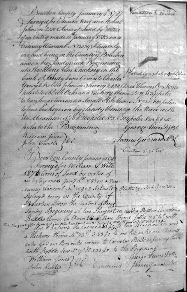
West, Edward & Robert Johnson
4 Jan 1787
2,100 acres
On big Sandy Creek, on the lines of Charles Yancey and Robert Johnson's 2428 acre survey
Wells, Raden
10 Mar 1789
1,000 acres
On the North fork of Licking, and West of his improvement at North fork of Licking, a hollow, and crossing the North fork.
Wells, William C.
25 Jan 1787
187 acres
On the waters of Bigg Sandy on the lines of Cornelius Ruddell's survey and Franklin
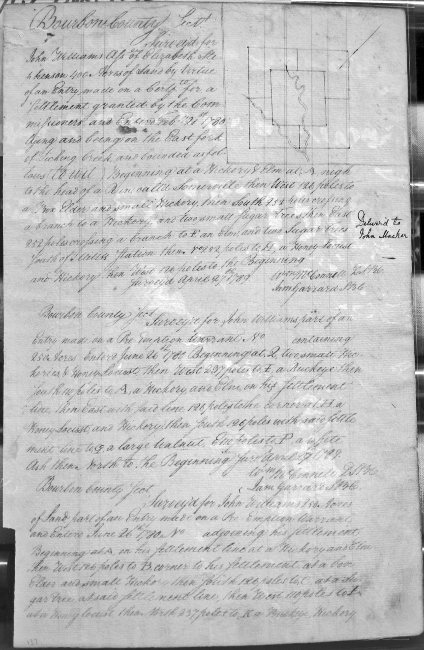
Williams, John, Assignee of Elizabeth Stephenson
27 Apr 1789
400 acres
On the East fork of Licking and bounded by the head of a Run called Sommerville, South of Mills (or Millers) Station,
Williams, John
29 Apr 1789
250 acres
On Williams settlement line.
Williams, John
27 Apr 1789
400 acres
Adjoining his settlement.
Williams, John
27 Apr 1789
250 acres
On Williams settlement line.
Williams, John
27 Apr 1789
250 (or 280) acres
On Williams settlement line.
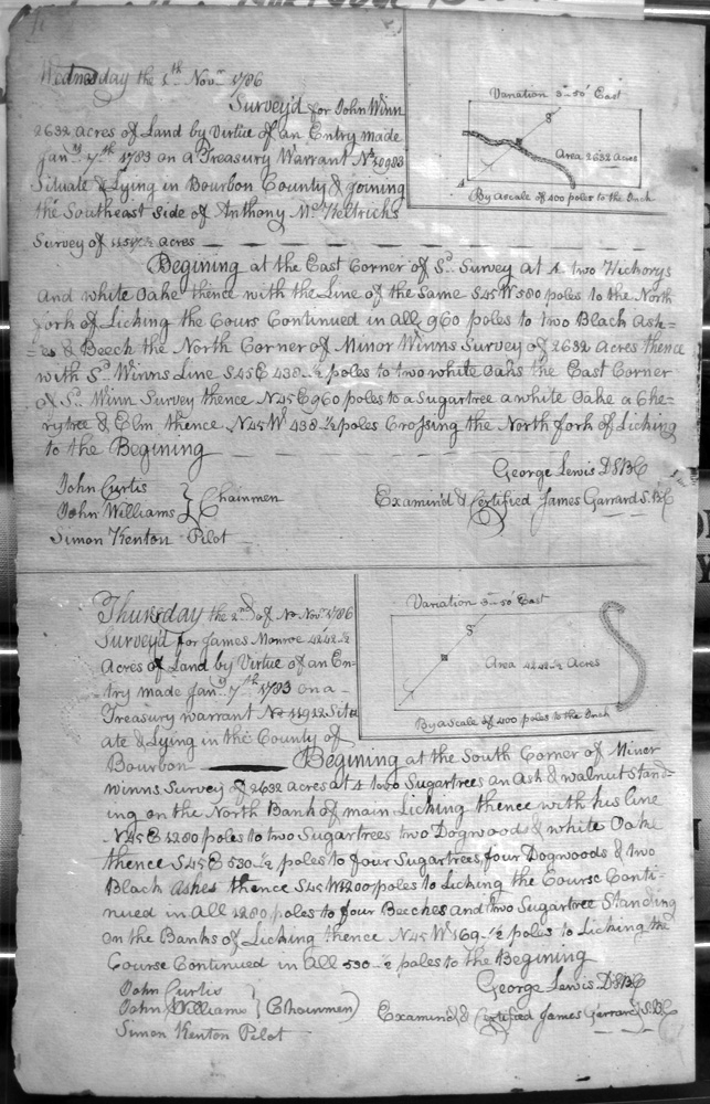
Winn, John
1 Nov 1786
2,688 acres
SE side of Anthony McKeltrich's survey, on main Licking; and Minor Winn's survey
Winn, Minor
1 Sep 1786
2632 acres
On the SE side of Anthony McKeltrich's survey, on Main Licking
Winslow, Beverly
20 May 1788
2,493 acres
On the Main branch of Licking adjoining the lower side of the 3,150 acre survey of Richard Young, Assignee of Jonathan Wilson that lies on the South side of the creek, cornering on Richard Young's two surveys of 3,150 each, and crossing the creek three times.
Winslow, Beverly
20 May 1788
2,076 acres
On the Main branch of Licking adjoining the lower side of the 3,150 acre survey of Richard Young, Assignee of Jonathan Wilson that lies on the North side of the creek, cornering on Richard Young's two surveys of 3,150 each, and crossing the creek three times.
Winslow, Beverly
20 __ 1788
424 acres
On the waters of Main Licking, adjoining the lines of Richard Young Assignee of Jonathan Wilson's 3,150 acres on the South side of Licking creek.
Woolridge, Edward
16 May 1788
5,985 1/3 acres
On the dividing waters of Licking and Bigg Sandy, on the northeasterly part of Samuel Hardy's 61,534 1/2 acre survey.
Yancey, Charles, & Robert Johnson
3 Jan 1787
2.428 acres
On big Sandy Creek, on the line of Cornelius Ruddell's survey
Young, Richard
6 May 1787
3,121 3/4 acres
On the waters of Bigg Sandy River, on the lines of Bodain's and Young's 5,000 acre survey, and John Weaglesworth and Richard Young's 16,000 acre survey.
Young, Richard & John Robinson
7 Apr 1787
12,280 acres
On the Bigg Sandy River, on the lines of Merry Walker's 162,513 (?) acre survey, crossing Shelby's creek, along the meanders of Bigg Sandy & the mouth of Shelby's creek.
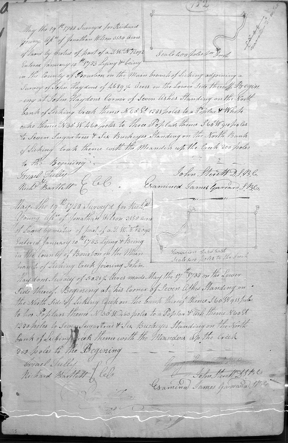
Young, Richard, Assignee of Jonathan Wilson
19 May 1788
3,150 acres
On the Main branch of Licking adjoining the lower side of John Haydon's 4,689 1/2 acre survey, and on the meanders of Licking.
Young, Richard, Assignee of Jonathan Wilson
19 May 1788
3,150 acres
On the Main branch of Licking adjoining the lower side of John Haydon's 5,021 acre survey, and on the North side of Licking creek and with the meanders up thereof.
Zumwalt (or Sumwalt), George
Page 281
22 July 1790
400 acres
On the waters of Greens Creek and McMillions branch, and bounded by an Elm in Parberry's line, with Henty Clays line and his corner with Christopher Zumwalt, and with Samuel Clays line. Surveyed by Charles Smith Jun. and Marker Christopher Zumwalt, and chain carriers Edmund and James Hord.


